
")
Current Snapshot
For all the latest updates visit: DisasterAWARE
pdcepac
1800x1080e
93a
meteosat9_ir_93A_202505221536_lat17.7-lon72.5
93A_tracks_latest
By PDC’s Senior Weather
Specialist Glenn James

The Pacific Disaster Center’s (PDC Global) Thursday, May 22, 2025, Tropical Cyclone Activity Report…for the Pacific Ocean, the Indian Ocean, and adjacent Seas
Current Tropical Cyclones:
There are no Tropical Cyclones
Northeast Pacific Ocean: There are no Tropical Cyclones
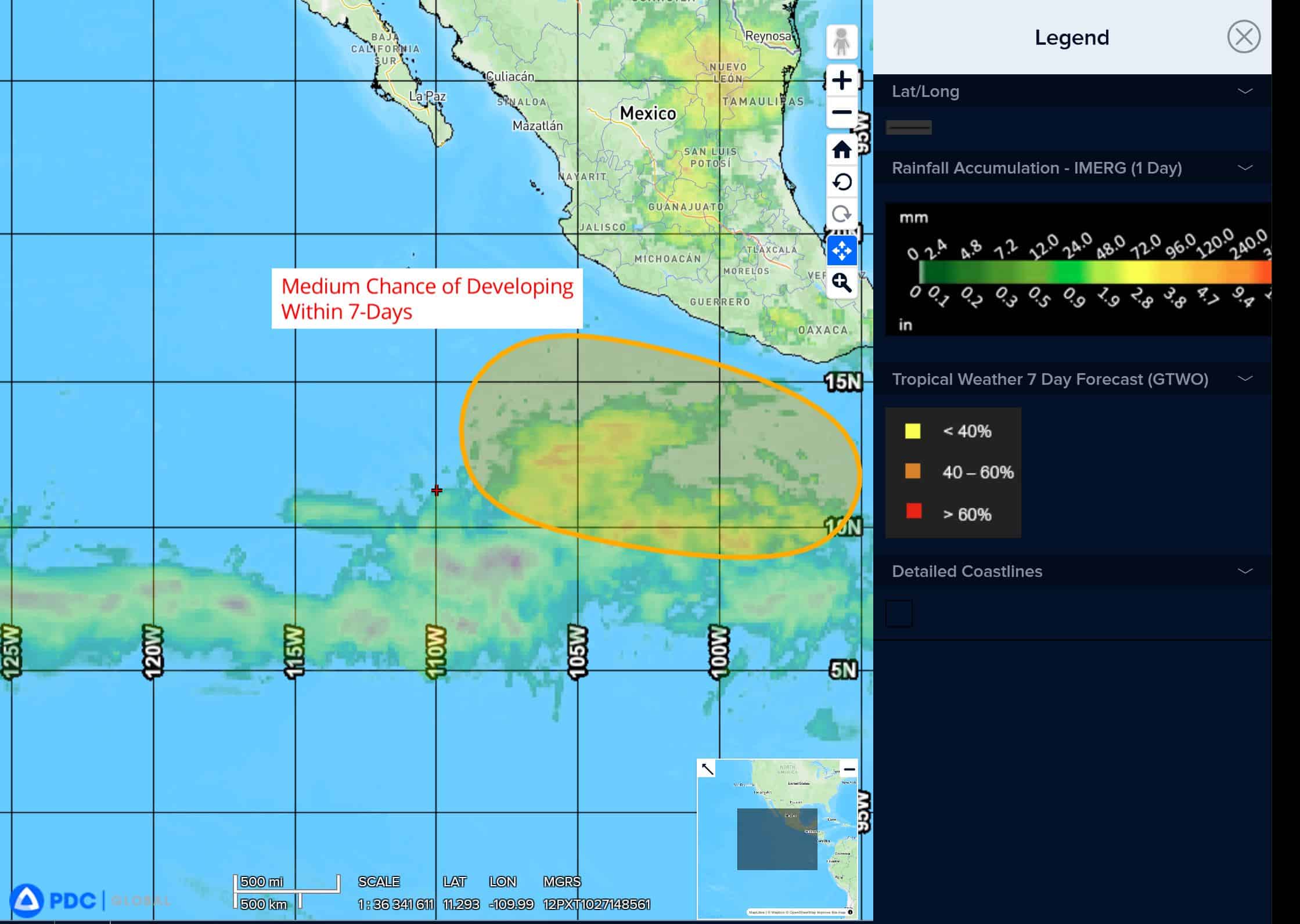
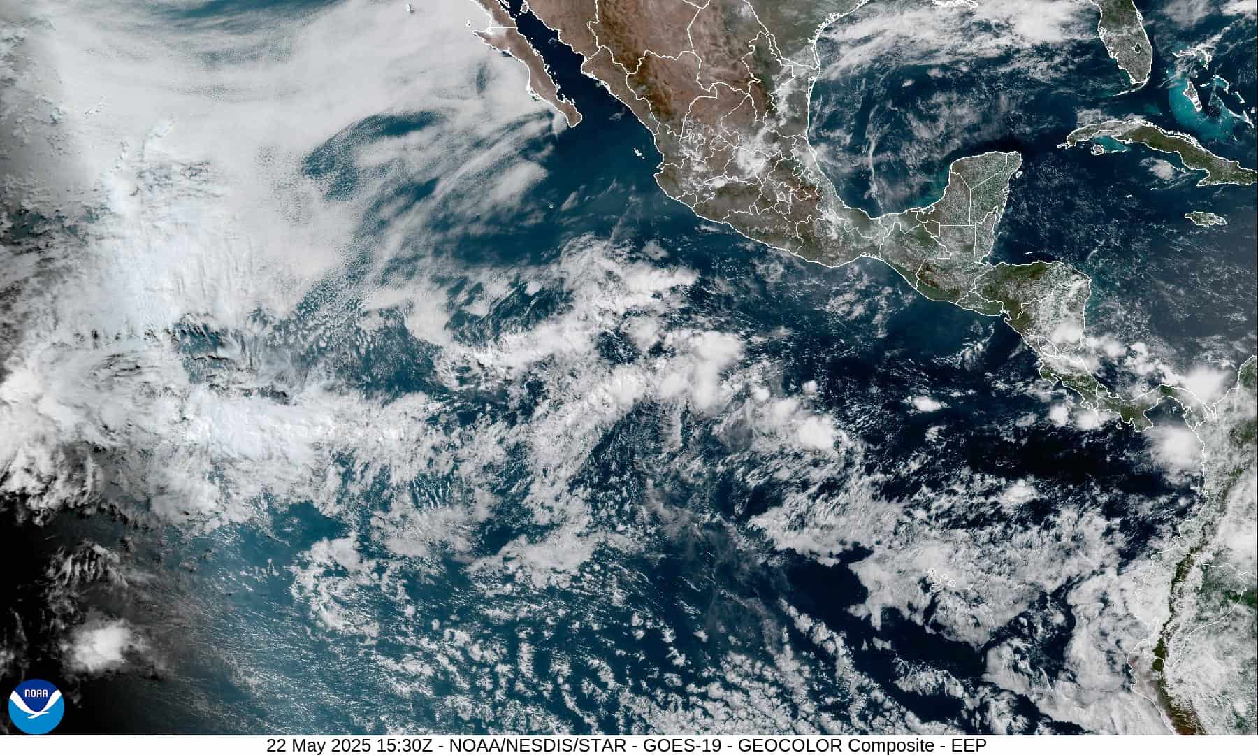
South of the Southern Coast of Mexico:
>>> An area of low pressure is likely to form early next week several hundred miles south of the southern coast of Mexico. Conditions appear favorable for development of this system, and a tropical depression could form around the middle of next week while moving westward to west-northwestward at 10 to 15 mph.
* Formation chance through 48 hours…low…near 0 percent
* Formation chance through 7 days…medium…50 percent
Central Pacific Ocean: There are no Tropical Cyclones
The 2024 central North Pacific hurricane season has ended. As such, the final routine Tropical Cyclone Activity Report for the 2024 season has been issued. Routine issuance of this section of the PDC product will resume on June 1, 2025. During the off-season, Special Tropical Weather Outlooks will be issued as conditions warrant by the CPHC.
Western Pacific, Indian Ocean, and adjacent Seas: There are no Tropical Cyclones
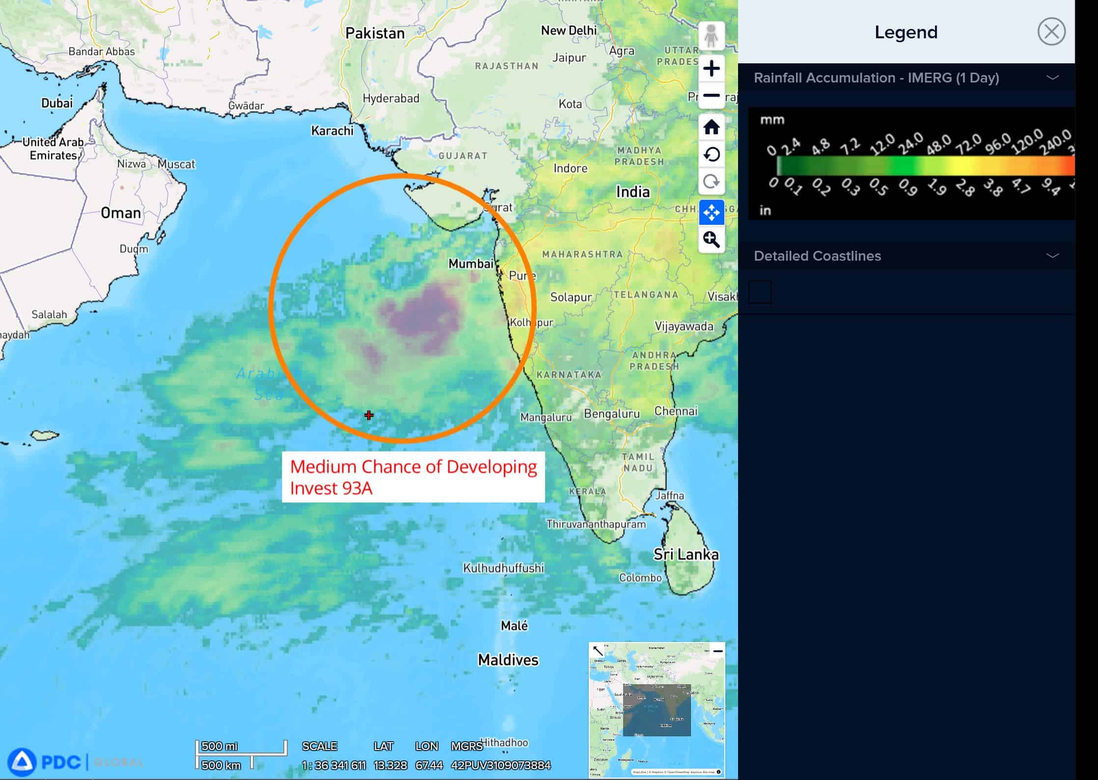
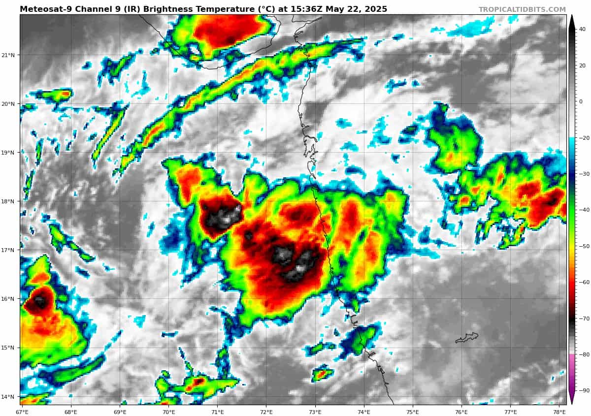
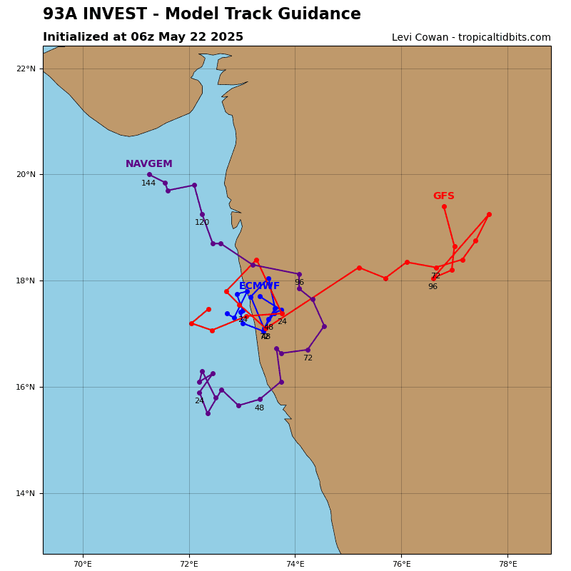
>>> There’s an area of disturbed weather being referred to as Invest 93A, that is located approximately 75 NM south-southeast of Mumbai, India
Animated enhanced infrared satellite imagery and a microwave pass reveals an area of disorganized flaring convection in the southern semicircle of a poorly defined llcc.
Environmental analysis reveals favorable conditions for development with low to moderate (15-20 knots) vertical wind shear, moderate dual-channel outflow aloft, and very warm sea surface temperatures.
Global deterministic have backed off development with this run compared to the last run, as the model package has shifted the track of the system closer to, or even moving it inland. The GEFS and ECEPS ensembles are also depicting a general shift eastward, with increasing members indicating a landfall in the near-term, with the potential for the system to return over water in the medium-range. With the model guidance moving the system closer to shore or inland, the likelihood of the system intensifying in the short-term is lowering but still remains a possibility.
Maximum sustained surface winds are estimated at 23 to 27 knots.
The potential for the development of a significant tropical cyclone within the next 24 hours remains medium.