

")
Tropical Cyclone 02A (Biparjoy)
Thursday, June 15, 2023
Current Snapshot
For all the latest updates visit: DisasterAWARE

epac
1800×1080

pdcbiparjoy

02A_151200.sair

02A_tracks_latest
By PDC’s Senior Weather
Specialist Glenn James

The Pacific Disaster Center’s (PDC Global) Thursday, June 15, 2023, Tropical Cyclone Activity Report…for the Pacific Ocean, the Indian Ocean, and adjacent Seas
Current Tropical Cyclones:
Tropical Cyclone 02A (Biparjoy)…is located approximately 125 NM southeast of Karachi, Pakistan – Final Warning
Northeast Pacific Ocean:
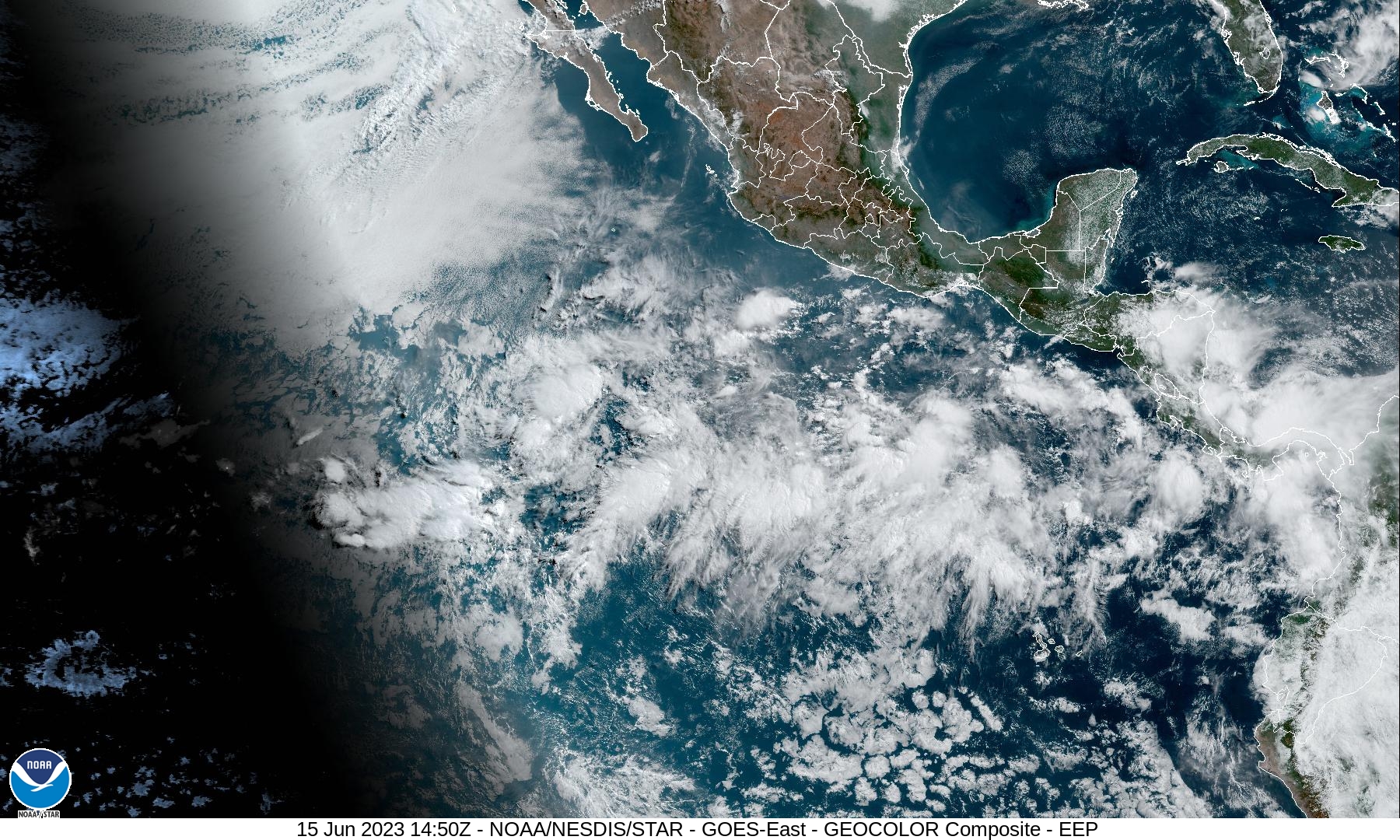
Central East Pacific:
An area of disorganized showers and thunderstorms is located several hundred miles south of the southern tip of Baja California. This activity remains poorly organized, and development is becoming increasingly unlikely as environmental conditions are expected to become unfavorable by this weekend while the system moves generally west-northwestward at 10 to 15 mph.
* Formation chance through 48 hours…low…10 percent
* Formation chance through 7 days…low…10 percent
Eastern East Pacific:
An area of low pressure could form by this weekend several hundred miles south of the southern coast of Mexico. Conditions appear favorable for some development of this system thereafter while it moves westward to west-northwestward at around 10 mph.
* Formation chance through 48 hours…low…near 0 percent
* Formation chance through 7 days…low…30 percent
Central Pacific Ocean:
There are no tropical cyclones…nor any areas of disturbed weather under investigation by the Central Pacific Hurricane Center (CPHC)
Tropical cyclone formation is not expected during the next 7-days.
Arabian Sea
Tropical Cyclone 02A (Biparjoy) – Final Warning
According to the JTWC Warning number 39, sustained winds are 55 knots…with gusts to near 70 knots
As the sun sets on 02A both literally and figuratively, animated multi-spectral satellite imagery depicts fragmented deep convective banding and low level cloud lines struggling to overcome persistent shear and increasing land interaction. A color composite microwave image indicates a large and elongated circulation with disorganized convection limited to the southern semicircle. This image further indicates a slightly sharper northeasterly turn over the past several hours.
Surface observation from Naliya, India indicates 23 knot southeasterly winds (perpendicular to the coast), which indicates the system is off shore of this location and closing. To further drive the point home, animated radar imagery also indicates a broad circulation tracking towards the city of Nailiya.
Over the past six hours, 02A has turned northeastward more aggressively than anticipated and therefore within the next six hours or so the system is forecast to make landfall near the town of Naliya, India.
With a forecast intensity near 55 knots, 02A will be pushed inland by the ridge over southern India and the building ridge over the Strait of Hormuz. As is usually the case, making landfall is game over. The system will rapidly weaken and deteriorate through 24 hours, eventually dissipating by 36 hours.
