

")
Tropical Cyclone 01B (Mocha)
Thursday, May 11, 2023
Current Snapshot
For all the latest updates visit: DisasterAWARE

mocha

01B_120000sair
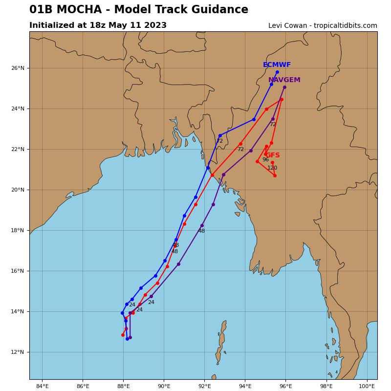
01B_tracks_latest
By PDC’s Senior Weather
Specialist Glenn James

Current Tropical Cyclones:
Tropical Cyclone 01B (Mocha)…is located approximately 582 NM south-southwest of Cox’s Bazar, Bangladesh
North Indian Ocean
According to JTWC Warning number 5, sustained winds were 65 knots, with gusts to 80 knots.
Animated enhanced infrared satellite imagery depicts a gradually improving convective signature associated with tropical cyclone 01B (Mocha). Deep convection is flaring around and over the low-level circulation center with a ragged eye structure occasionally appearing.
The environment is favorable with moderate vertical wind shear (10 to 15 knot), good radial outflow restricted only to the east, and warm sea surface temperatures.
Tropical cyclone Mocha is currently tracking toward the north and will soon begin to turn toward the northeast as it is steered by a deep-layer subtropical ridge to the east. As it does so, the environment will become increasingly favorable for continued intensification.
With low vertical wind shear, warm sea surface temperatures, and good outflow, rapid intensification is likely to occur. Peak intensity in the official forecast has been raised to 110 knots by 60 hours, but the actual peak intensity of tropical cyclone Mocha will likely occur between 60 and 72 hours before landfall, so the peak intensity may need to be raised further in future warning cycles as the 60 hour point approaches the coast.
Landfall is expected prior to 72 hours near the border of Bangladesh and Myanmar. After landfall, rapid dissipation of the system is expected as it interacts with the rugged terrain of Myanmar.
