

")
Tropical Cyclone 01B (Mocha) / Tropical Cyclone 19S (Fabien)
Sunday, May 14, 2023
Current Snapshot
For all the latest updates visit: DisasterAWARE
mocha
01B_141200sair

01B_tracks_latest

pdcfabien
19S_150000sair

19S_tracks_latest
By PDC’s Senior Weather
Specialist Glenn James

Current Tropical Cyclones:
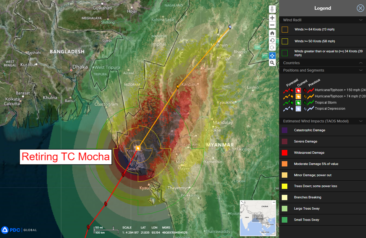
Tropical Cyclone 01B (Mocha)…is located approximately 114 NM south-southeast of Cox’s Bazar – Final Warning
Tropical Cyclone 19S (Fabien)…is located approximately 427 NM east-northeast of Diego Garcia
Bay of Bengal
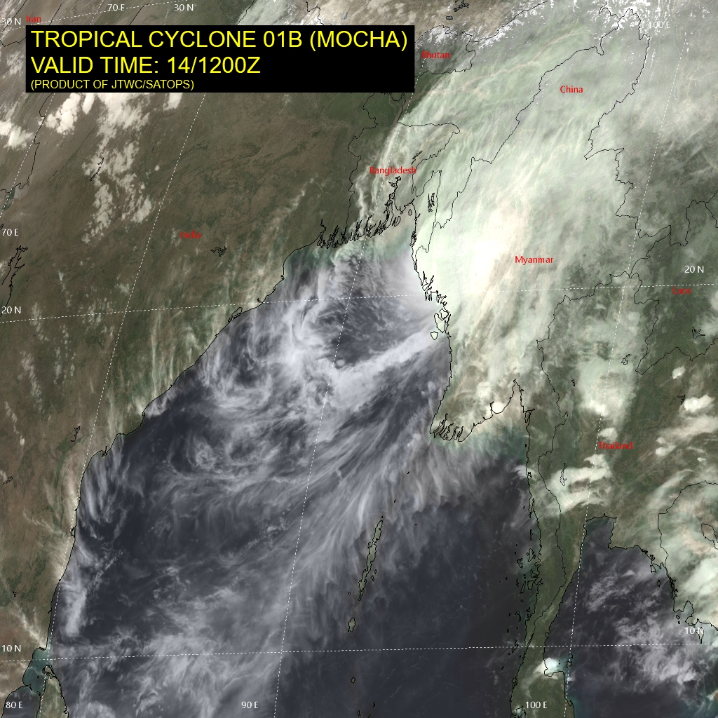
Tropical Cyclone 01B (Mocha) – Final Warning
According to the JTWC Warning number 15, sustained winds were 105 knots, with gusts to 130 knots.
TC 01B (Mocha) made landfall along the coast of northwest Myanmar, just north of Sittwe, and has now moved slowly inland. a timely microwave image showed a weak microwave eye feature and lent high confidence to the initial position.
The system is forecast to continue tracking towards the northeast over the next 24 hours while rapidly weakening due to increasing vertical wind shear and terrain interaction. The system is forecast to dissipate as a tropical cyclone within the next 24 hours over far northern Myanmar.
South Indian Ocean
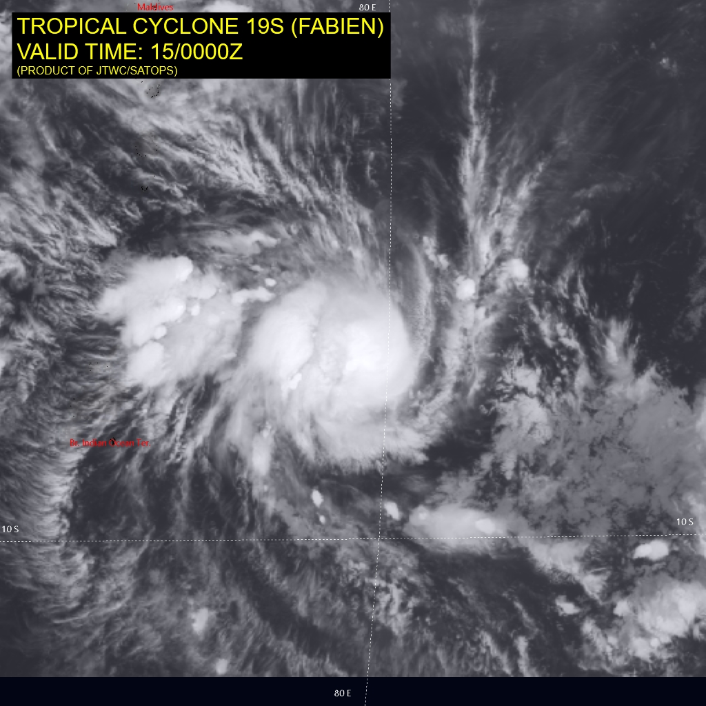
Tropical Cyclone 19S (Fabien)
According to the JTWC Warning number 4, sustained winds were 75 knots, with gusts to 90 knots.
Animated enhanced infrared satellite imagery depicts a rapidly consolidating and intensifying system, with broad outer bands wrapping into a small, developing central dense overcast. A microwave image shows a well-defined band of deep convection wrapping up the western side of the core of the system, and a developing microwave eye feature.
Analysis reveals a favorable environment, with low (5-10 knot) vertical wind shear, good radial outflow aloft and warm sea surface temperatures. The system is currently tracking west-southwest along the northern side of a deep-layer subtropical ridge to the south.
Through the next 48 hours,TC 19S (Fabien) is forecast to continue tracking towards the west-southwest along the northern side of a ridge which extends east-west along the 15th latitude to the south. The passage of an upper-level mid-latitude trough by 72 hours will break the steering ridge and create an opportunity for the system to turn more poleward.
The forecast calls for a peak of 100 knots by 48 hours. After this point, upper-level outflow is expected to weaken slightly, accompanied by moderately increased shear and some mid-level dry air entrainment, which will lead to a slow weaken trend through the remainder of the forecast period.
