

")
Tropical Cyclone 19S (Fabien)
Monday, May 15, 2023
Current Snapshot
For all the latest updates visit: DisasterAWARE

pdcfabien
19S_150600sair

19S_tracks_latest
By PDC’s Senior Weather
Specialist Glenn James

Current Tropical Cyclones:
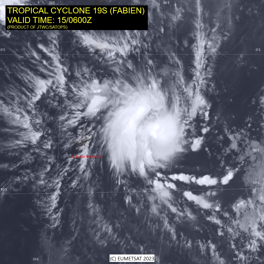
Tropical Cyclone 19S (Fabien)…is located approximately 221 NM east-northeast of Diego Garcia
South Indian Ocean
Tropical Cyclone 19S (Fabien)
According to the JTWC Warning number 8, sustained winds were 90 knots, with gusts to 110 knots.
Animated multi-spectral satellite imagery depicts a small central dense overcast feature, with a well-defined feeder band wrapping into the low level circulation center from the west side.
Environmental conditions are generally favorable. Outflow is strong towards the west and more moderate to poleward. The moderate easterly shear however is slowing the pace of core consolidation and thus inhibiting the rate of intensification for now. The system is tracking generally west-southwestward along the northern side of a deep steering ridge to the south.
TC 19S (Fabien) is forecast to continue tracking towards the west to southwest along the northern side of a deep ridge through the majority of the forecast period. Over the next 36 hours a deep upper-level trough will move in from the west, eroding and ultimately breaking the steering ridge.
However, as the trough pushes by to the south it is expected to weaken and fill, leaving TC 19S trapped in a weak steering pattern between a developing near equatorial ridge to the northeast which extends a ridge poleward to the east of TC 19S, and strong ridge centered to the southwest over northern Madagascar.
In response to the change in the steering environment, TC 19S will slow down sharply, and become nearly quasi-stationary to the southeast of Diego Garcia through 120 hours. A generalized slow drift towards the southwest is anticipated, but a meandering, or looping track cannot be discounted as the steering pattern will be very weak.
With the warm waters and moist atmosphere providing ample energy, it is anticipated TC Fabien will rapidly intensify over the next 24-36 hours, reaching a peak of 110 knots by 36 hours. As the system slows down and becomes quasi-stationary, upwelling induced sea surface temperature cooling, accompanied by a reduction in upper-level outflow, will lead to a slow weakening trend through the remainder of the forecast period.
