

")
Tropical Cyclone 19S (Fabien) / Tropical Cyclone 02W (Mawar)
Saturday, May 20, 2023
Current Snapshot
For all the latest updates visit: DisasterAWARE

pdcepac

pdcclouds

pdcfabien
19S_200600sair
19S_tracks_latest

pdcmawar

hh

02W_tracks_latest
By PDC’s Senior Weather
Specialist Glenn James

Current Tropical Cyclones:
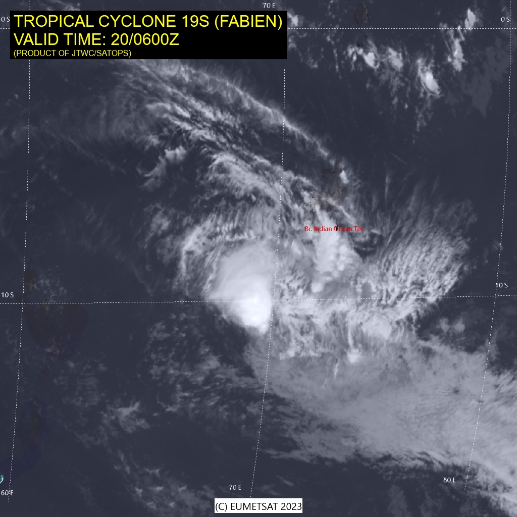
Tropical Cyclone 19S (Fabien)…is located approximately 270 NM southwest of Diego Garcia
Tropical Cyclone 02W (Mawar)…is located approximately 22 NM southeast of Puluwat
Northeast Pacific Ocean:
There are no tropical cyclones…nor any areas of disturbed weather under investigation by the National Hurricane Center (NHC)
Tropical cyclone formation is not expected during the next 7 days.
South Indian Ocean
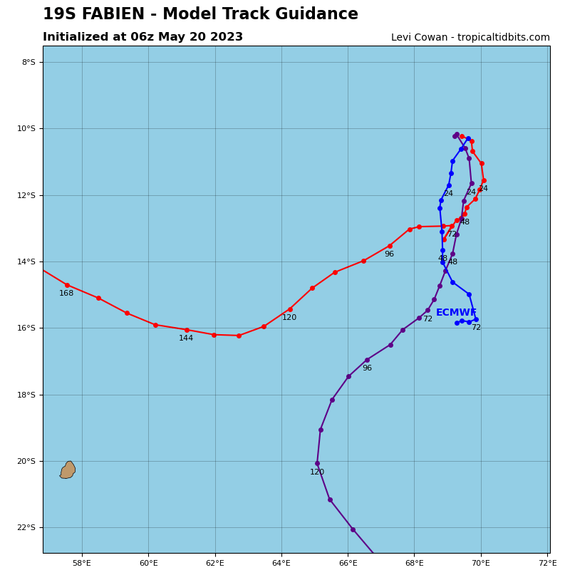
Tropical Cyclone 19S (Fabien)
According to the JTWC Warning number 25, sustained winds were 40 knots, with gusts to 50 knots.
Animated multi-spectral satellite imagery depicts an elongated circulation with an asymmetric convective cover fully obscuring the low level circulation center beneath.
Having recently reached its apogee, TC 19S (Fabien) is forecast to make a poleward shift over the next 12 hours. During this time, as vertical wind shear remains low and outflow remains generally favorable, the system is forecast to maintain its intensity.
By 24 hours, now tracking generally southward in a poor steering environment, vertical wind shear and vertical tilting increases and upper level outflow weakens resulting in gradual weakening.
By 72 hours, a building ridge just east of the system forces Fabien westward until its eventual dissipation by 96 hours.
Western Pacific Ocean
Tropical Cyclone 02W (Mawar)
According to the JTWC Warning number 5, sustained winds were 50 knots, with gusts to 65 knots.
Animated enhanced infrared satellite imagery depicts a tightly wrapping circulation with a forming cdo (central dense overcast) feature and transverse banding in the northern periphery. A microwave image, though not the highest resolution, does display that a primary deep convective band is consolidating and wrapping into the low level circulation center from the north and west.
TS 02W (Mawar) has continued to consolidate over the past six hours and is forecast to continue tracking generally north-northwestward under the steering influence of the ridge to the east and ridge to the northwest.
Currently in a favorable environment characterized by moderate vertical wind shear which is more than compensated by warm sea surface temperatures and strong outflow aloft. Over the next 24 hours, 02W has a significant potential to rapidly intensify as poleward outflow continues building and core convection consolidates.
After 24 hours, 02W will continue tracking north-northwestward and gradually intensify until reaching 90 knots by 72 hours. As the system passes poleward and east of Guam, the ridge to the east is forecast to reorient and build further poleward and eastward.
This shift will have two primary impacts on 02W, it will begin to guide the system west-northwestward through the forecast period, as well as negatively impact the robust poleward outflow channel. This large reduction in poleward outflow coupled with cooling sea surface temperatures will begin to level out the intensification trend. By 120 hours, now clear of Guam, 02W will continue tracking west-northwestward at a peak intensity near 100 knots.
