

")
Tropical Cyclone 01W (Sanvu)
Thursday, April 20, 2023
Current Snapshot
For all the latest updates visit: DisasterAWARE

pdcsanvu

jtwc
bbbbbb
By PDC’s Senior Weather
Specialist Glenn James

Current Tropical Cyclones:
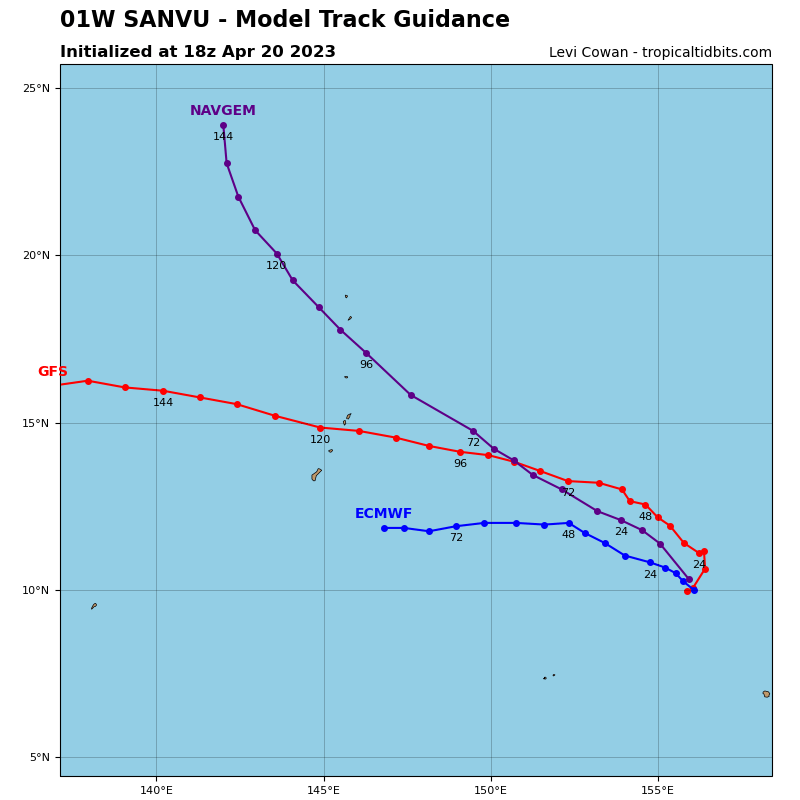
Tropical Cyclone 01W (Sanvu)…is located approximately 700 NM east-southeast of Andersen AFB, Guam
Southwest Pacific Ocean
Tropical Cyclone 01W (Sanvu)
According to the JTWC Warning number 7, sustained winds were 45 knots, with gusts to 55 knots.
Animated satellite imagery and water vapor imagery both confirm that tropical storm Sanvu (01W) has peaked and begun what is expected to be its very slow and gradual dissipation over water. the system has slowed as it tracked away from its previous steering influence of the near equatorial ridge, and has yet to come under the influence of its next steering force, the subtropical ridge. The intensity of 45 knots is held steady from the previous forecast but all subjective and objective measures are showing the first confirmations of declining in values.
The evidence that tropical storm Sanvu has begun its decline is mounting. The system is just now crossing the 10th latitude and will soon feel the stretch of increasing vertical wind shear and dry air entrainment. Dry air is wrapping into the southwest quadrant and its effects are already becoming apparent in animated visual imagery.
Vertical wind shear will increase to over 20 knots north of the 11th latitude, and there is a sharply increasing vertical wind shear gradient poleward of that. Combined with a lack of deep moisture in the column that is showing in both total precipitable water loops and mid-level moisture models, TS 01W has too much environmental hostility to overcome to make it to the Marianas. The next 12 hours will provide critical confirmation to the downtrend.
