

")
Invest 92W
Tuesday, April 18, 2023
Current Snapshot
For all the latest updates visit: DisasterAWARE

uuu

kkk
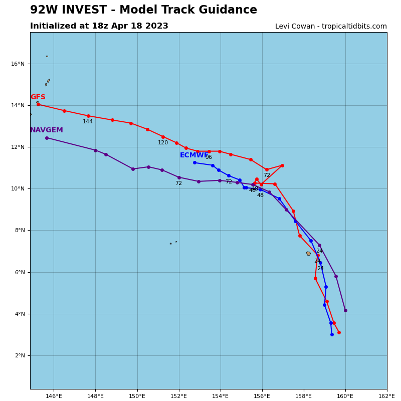
92W_tracks_latest
By PDC’s Senior Weather
Specialist Glenn James

Current Tropical Cyclones:
There are no tropical cyclones at the time of this writing
>>> There’s an area of disturbed weather being referred to as Invest 92W…which is located approximately 206 NM south-southeast of Pohnpei.
Animated multi-spectral satellite imagery and a microwave image depict curved deep convective banding wrapping into a well-defined and consolidated low level circulation center.
Upper level analysis shows that 92W is in a favorable environment with low (05-10 knot) vertical wind shear, good
divergence aloft, and warm sea surface temperatures.
Global models indicate a north-northwestward to northwestward track over the next two days but are split on development with ECMWF and GFS developing a tropical depression in the next one to two days, and the NAVGEM indicating weaker development. .
Maximum sustained surface winds are estimated at 20 to 25 knots.
The potential for transition into a significant tropical cyclone within the next 24 hours is upgraded to high.
