

")
Invest 90W / Invest 98S
Friday, April 7, 2023
Current Snapshot
For all the latest updates visit: DisasterAWARE
90s

nrl90w

90W_tracks_latest (1)

nrl98s
98S_tracks_latest
By PDC’s Senior Weather
Specialist Glenn James

Current Tropical Cyclones:
There are no tropical cyclones
Northwest Pacific Ocean
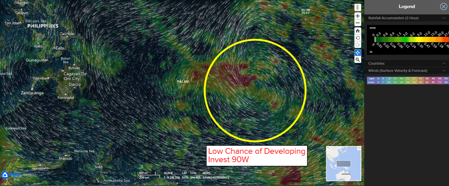
>>> There’s an area of disturbed weather being referred to as Invest 90W…which is located approximately 246 NM south-southeast of Yap.
Animated multi-spectral satellite imagery depicts persistent flaring convection over the still disorganized and broad low level circulation (llc). A scatterometer bullseye revealed the eastern side of 90W to have a consistent wind field of 10-15 knot flowing into the llc with larger swath of 20 knots and some convection induced 25 knot areas on the northern side.
Environmental analysis reveals an unfavorable environment with very weak outflow, low to moderate (15-20 knot) vertical wind shear, offset by favorably warm sea surface temperatures.
Global models are in agreement that 90W will continue on a north, then northwestward track towards the Philippines over the next few days. A secondary area of low-level vorticity is present to the north of 90W, and global model fields are in disagreement on how much this area, which is moving westward, will influence the consolidation of 90W over the next couple of days. Additionally, a moderate cold surge event will begin to influence and potentially disrupt the system after 36 hours.
Global models disagree on the timing and pace of consolidation and intensification, with the GFS being the most aggressive, while the ECMWF is more sluggish.
Maximum sustained surface winds are estimated at 12 to 18 knots.
The potential for the development of a significant tropical cyclone within the next 24 hours remains low.
South Indian Ocean
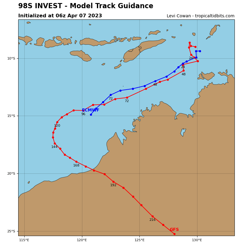
>>> There’s a second area of disturbed weather being referred to as Invest 98S…which is located approximately 189 NM north-northwest of Darwin, Australia.
Enhanced infrared satellite imagery shows a consolidating system with deep convection sheared southwestward of a partly exposed low level circulation.
Environmental analysis reveals marginally favorable conditions for intensification with strong (30 knot) vertical wind shear offset by warm sea surface temperatures and strong poleward outflow.
Models are in general agreement that 98S will continue on a southwestward track into an area of lower vertical wind shear and intensify.
Maximum sustained surface winds are estimated at 30 to 34 knots.
The potential for the development of a significant tropical cyclone within the next 24 hours is upgraded to high.
