

")
Tropical Cyclone 18S (Ilsa) / Invest 90W
Tuesday, April 11, 2023
Current Snapshot
For all the latest updates visit: DisasterAWARE

pdcilsa
18S_111800sair

18S_tracks_latest

pdclow
himawari9_ir_90W_202304112310_lat13.2-lon124.6

90W_tracks_latest
By PDC’s Senior Weather
Specialist Glenn James

Current Tropical Cyclones:
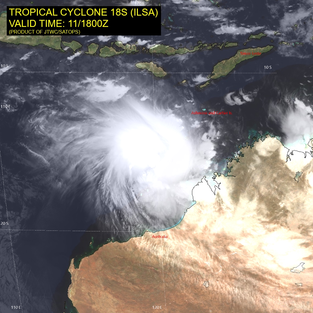
Tropical Cyclone 18S (Ilsa)…is located approximately 187 NM northwest of Broome, Australia
South Indian Ocean
Tropical Cyclone 18S (Ilsa)
According to JTWC Warning number 14, sustained winds were 80 knots, with gusts to 100 knots.
Animated enhanced infrared satellite imagery depicts a large central dense overcast fully obscuring the low level circulation center (llcc) beneath. A microwave image reveals the previously offset llcc and upper level circulation center (ulcc) have become much closer to vertically stacked. A deep convective band is evident to the south of the llcc, while the copious amounts of dry air to the west attempt to entrain the system from the north.
TC 18S (Ilsa) is forecast to continue tracking southwestward under the steering influence of the ridge to the east. Through 36 hours, the environment around 18S will continue to shift from favorable to highly favorable, characterized by warm sea surface temperatures, low vertical wind shear and improving outflow aloft.
As the system approaches the ridge axis near 36 hours, the system is forecast to be near 115 knots. As 18S begins to turn poleward and eventually south-southeastward, sea surface temperature values combined with robust outflow aloft will fuel Ilsa to a peak intensity near 120 knots and possibly higher before weakening as the system approaches land.
After 48 hours, Ilsa will make landfall near the center point of Eighty Mile Beach and proceed inland, quickly weakening through 72 hours and eventually dissipating near 96 hours.
Northwest Pacific Ocean
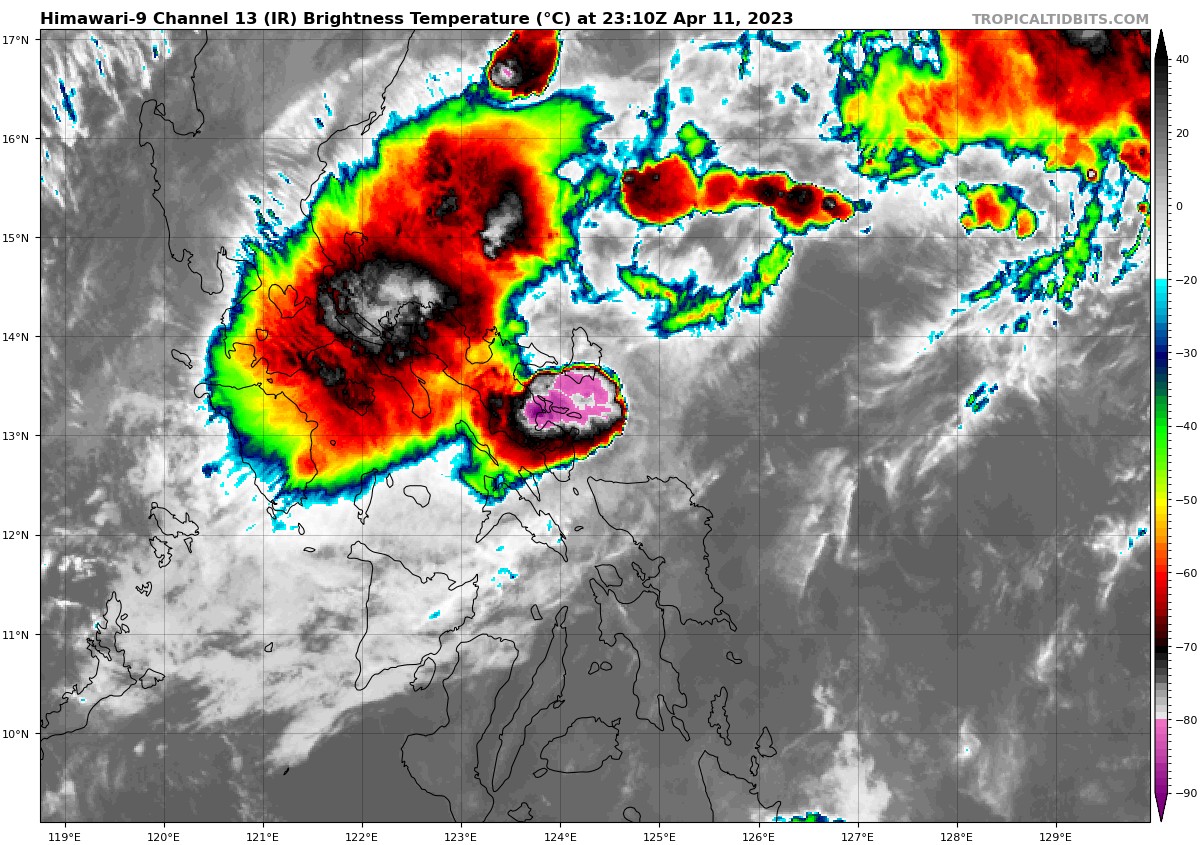
>>> There’s an area of disturbed weather being referred to as Invest 90W…which is located approximately 50 NM east of Legazpi, Philippines.
Animated enhanced infrared satellite imagery and a microwave image depict a partially exposed low level circulation center (llcc) with deep convection displaced to the northwest.
Despite having good poleward outflow, 90W is in an unfavorable environment due to land interaction, low to moderate (10-15 knot) vertical wind shear, and warm sea surface temperatures.
Global models agree that invest 90W will track west-northwestward and eventually dissipate over the course of the next 24-48 hours, due to an increase in vertical wind shear, land interaction and copious amounts of dry air entrainment being introduced from the northeast.
Maximum sustained surface winds are estimated at 17 to 23 knots.
The potential for the development of a significant tropical cyclone within the next 24 hours is downgraded to low.
