

")
Invest 93W
Tuesday, May 2, 2023
Current Snapshot
For all the latest updates visit: DisasterAWARE

pdc93w
nrl
93W_tracks_latest
By PDC’s Senior Weather
Specialist Glenn James

Current Tropical Cyclones:
There are no tropical cyclones
Northwest Pacific Ocean
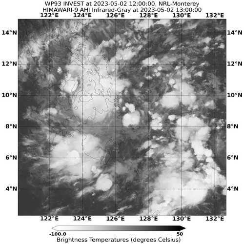
>>> There’s an area of disturbed weather being referred to as Invest 93W, which is located approximately 135 NM east-northeast of Davao, Philippines.
Animated multi-spectral satellite imagery, including a Himawari satellite image, depict broad, disorganized low level turning with flaring convection.
Environmental analysis indicates generally good poleward outflow aloft with favorable upper-level divergence, low (5-10 knot) vertical wind shear and warm sea surface temperatures.
Global models are in good agreement that 93W will track generally west-northwestward over the next 24-48 hours. Although the environment is favorable, the weak low-level structure and passage over land will likely limit development in the near-term.
Maximum sustained surface winds are estimated at 15 to 20 knots.
The potential for the development of a significant tropical cyclone within the next 24 hours remains medium.
