

")
Invest 93W
Thursday, May 4, 2023
Current Snapshot
For all the latest updates visit: DisasterAWARE

93
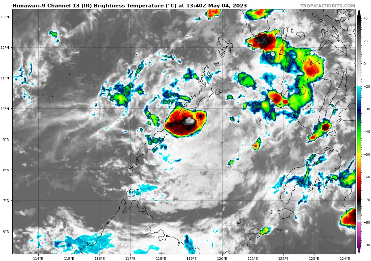
himawari9_ir_93W_202305041340_lat9.5-lon119.1
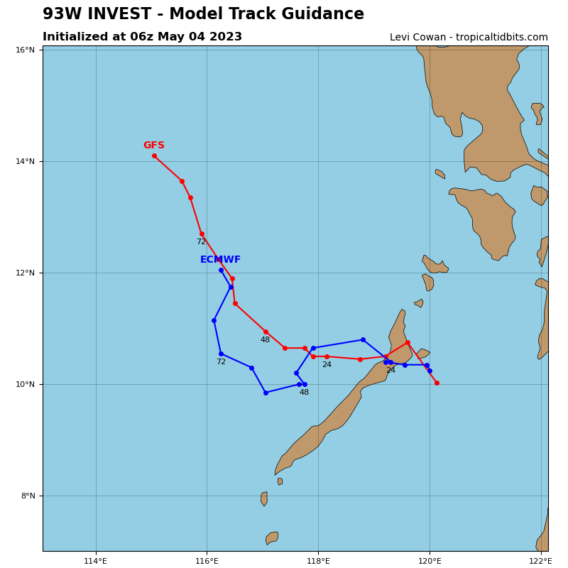
93W_tracks_latest (1)
By PDC’s Senior Weather
Specialist Glenn James

Current Tropical Cyclones:
There are no tropical cyclones
Northwest Pacific Ocean
>>> There’s an area of disturbed weather being referred to as Invest 93W, which is located approximately 75 NM east of Puerto Princesa, Philippines.
Animated satellite imagery depicts flaring convection wrapping around a broad and disorganized low level circulation. Additionally, a broad circulation with 15-20 knot winds near the center and a swath of 20-25 knot winds to the north of the center, likely enhanced by funneling of low-level flow through the Philippine Islands.
93W’s environment has become increasingly favorable, characterized by moderate upper-level divergence, warm sea surface temperatures and low (5-15 knot) vertical wind shear.
Global models are in agreement that 93W will track generally west-northwestward over the next 24-72 hours. Although the environment is favorable overall, the weak low-level structure and interaction with land will likely continue to hinder development in the near-term.
Maximum sustained surface winds are estimated at 18 to 23 knots.
The potential for the development of a significant tropical cyclone within the next 24 hours remains medium.
