

")
Tropical Cyclone 17E (Norma) / Tropical Cyclone 16W (Sanba) / Tropical Cyclone 05A / Invest 91E / Invest 90P / Invest 92B
Friday, October 20, 2023
Current Snapshot
For all the latest updates visit: DisasterAWARE

1800x1080cc

1800x1080ccc

pdcnorma1

17E_tracks_latestnorma
pdc91e

pdcepac7

pdcsanba

16W_201200sair

tsanba

pdc05A

jtwc05

05A_tracks_latest

pdc90P

tsat90p

90P_tracks_latest

pdc92b

tsat92b
92B_tracks_latest
By PDC’s Senior Weather
Specialist Glenn James

The Pacific Disaster Center’s (PDC Global) Friday, October 20, 2023, Tropical Cyclone Activity Report…for the Pacific Ocean, the Indian Ocean, and adjacent Seas
Current Tropical Cyclones:
Tropical Cyclone 17E (Norma)…is located approximately 245 miles south of Cabo San Lucas, Mexico
Tropical Cyclone 16W (Sanba)…is located approximately 190 NM east-southeast of Hanoi, Vietnam
Tropical Cyclone 05A …is located approximately 613 NM southeast of Salalah, Oman
Northeast Pacific Ocean:
Tropical Cyclone Norma…
HEAVY RAINS AND FLASH FLOODING EXPECTED IN SOUTHERN BAJA CALIFORNIA SUR DURING THE NEXT FEW DAYS…TROPICAL STORM WATCH ISSUED FOR A PORTION OF THE WEST COAST OF MEXICO
According to the NHC advisory number 12
Norma is moving toward the north-northwest near 8 mph (13 km/h). A north-northwestward to northward motion is forecast through Saturday, followed by a turn toward the northeast on Sunday. On the forecast track, Norma is expected to approach the southern portion of Baja California Sur tonight and move near or over the area on Saturday.
Norma is forecast to move toward the west coast of mainland Mexico on Sunday and Sunday night. Maximum sustained winds have decreased to near 110 mph (175 km/h) with higher gusts. Gradual weakening is expected during the next few days, but Norma is forecast to be a hurricane when it moves near or over the southern portion of Baja California Sur.
Hurricane-force winds extend outward up to 35 miles (55 km) from the center and tropical-storm-force winds extend outward up to 175 miles (280 km).
HAZARDS AFFECTING LAND
WIND: Hurricane conditions are expected within the hurricane warning area in Baja California Sur on Saturday, with tropical storm conditions beginning late tonight. Tropical storm conditions are expected in the tropical storm warning areas in Baja California Sur on Saturday. Tropical storm conditions are possible in Las Islas Marias today and tonight, and in the watch area along the west coast of Mexico by Sunday.
RAINFALL: Norma is likely to produce rainfall totals of 5 to 10 inches with local maxima of 15 inches across the far southern portion of Baja California Sur through Sunday and across portions of Sinaloa through Monday. These rains will likely produce flash and urban flooding, along with possible mudslides in areas of higher terrain.
STORM SURGE: A storm surge could produce coastal flooding in areas of onshore winds within the hurricane warning area. Near the coast, the surge will be accompanied by large and destructive waves.
SURF: Swells generated by Norma are affecting portions of the coast of southwestern and west-central Mexico and Baja California Sur. These swells will spread northward along the coast of western Mexico and the Baja California peninsula this weekend.
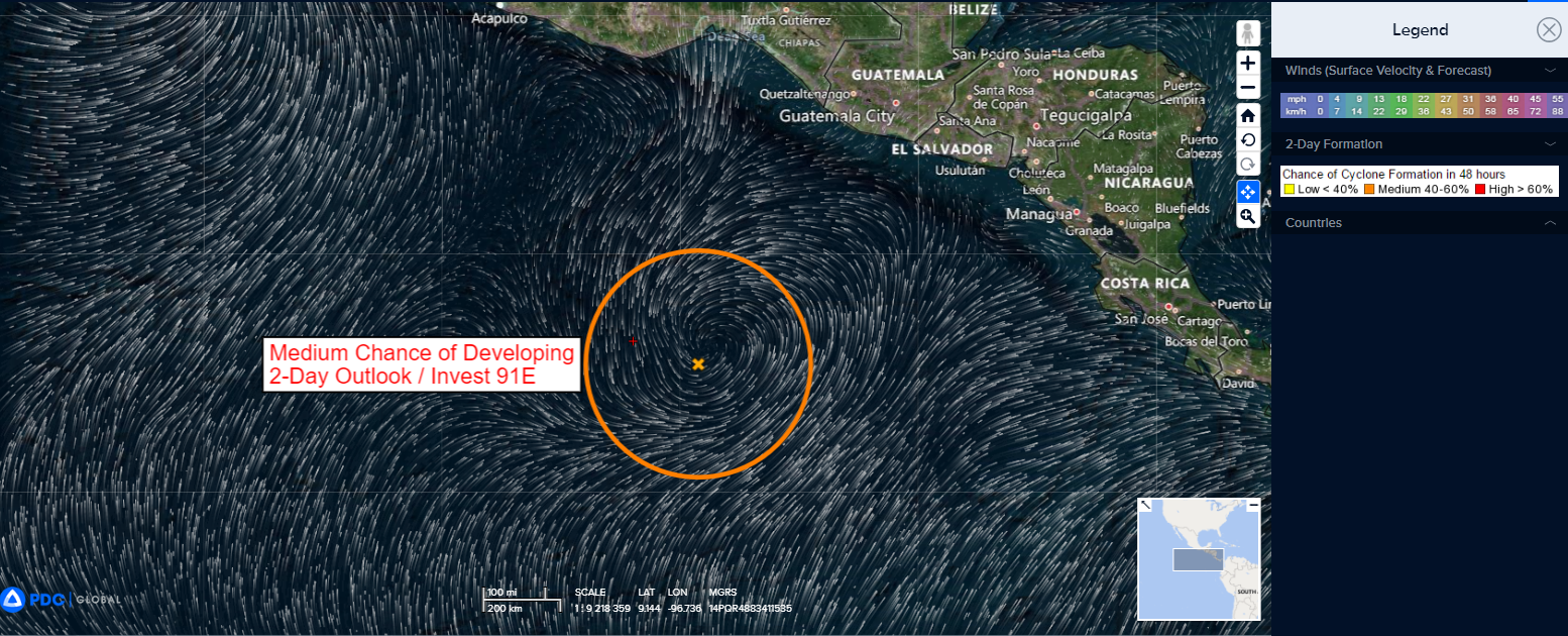
Invest 91E
A broad area of low pressure located several hundred miles south of the Gulf of Tehuantepec continues to produce large area of showers and thunderstorms, mainly over the western part of the circulation.
Upper-level winds are forecast to become more conducive for development later this weekend, and a tropical depression will likely form by early next week. The system is forecast to meander during the next couple of days and then drift generally northward late this weekend and into early next week.
* Formation chance through 48 hours…medium…50 percent
* Formation chance through 7 days…high…80 percent
Central North Pacific:
There are no tropical cyclones, nor any areas of disturbed weather under investigation by the CPHC at the time of this writing.
Western Pacific, Indian Ocean and adjacent Seas:
Western Pacific
Tropical Cyclone 16W (Sanbu)
According to the JTWC warning number 13…
The system had sustained winds of 30 knots, with gusts to 40 knots
Animated satellite imagery shows tropical depression 16W (Sanba) having persisted in a marginal environment over the past six hours. Though the low level circulation center is completely obscured, mid level clouds are observed rotating cyclonically absent of any deep convection.
Marginal sea surface temperatures, moderate to high vertical wind shear (20-25 knots), and dry air (relative humidity less than 50 percent) continue to weaken TD 16W.
TD 16W is forecast to gradually weaken over the next 24 hours. Complete dissipation is anticipated prior to 24 hours. moderate to high vertical wind shear, marginal sea temperatures, and low relative humidity will slowly diminish what is left of the low-level vortex.
Arabian Sea
Tropical Cyclone 05A
According to the JTWC warning number 1…
The system had sustained winds of 35 knots, with gusts to 45 knots
Animated multi-spectral satellite imagery (msi) depicts tropical cyclone 05A having greatly consolidated over the past six hours. Formative bands of deep convection are observed spiraling radially from the low level circulation center (llcc). Flaring convection with overshooting tops has persisted directly over the llcc, Evidencing the systems core has aligned and found a prominent exhaust for convergence at the surface.
Environmental conditions are very favorable for development, with very warm sea surface temperatures and very low vertical wind shear (5-10 knots). The initial position is placed with medium confidence based on enhanced infrared image.
TC 05A is forecast to track west-northwestward through 36 hours and then gradually turn to a northwestward track by 48 hours and maintain through 120 hours. Rapid intensification is imminent, as the aforementioned very favorable environmental conditions allude to.
The peak intensity will likely be realized near 60 hours. Thereafter (60 to 72 hours), dry air entrainment is expected to begin impeding the moist core necessary for intensification and sustainment. A rapid weakening trend, as increasing amounts of very dry air advect into structure, is expected from 72 to 120 hours.
Southwestern Pacific
>>> There’s an area of disturbed weather being referred to as Invest 90P…which is located approximately 655 NM east-northeast of Honiara, Solomon Islands
Animated multi-spectral satellite imagery depicts an area of deep convection in the southwestern quadrant of a gradually consolidating low level circulation center (llcc).
Environmental analysis reveals favorable conditions for intensification with low to moderate (15-20 ) vertical wind shear, warm sea surface temperatures, and an upper-level point source to the north providing good outflow.
Global models are in agreement that 90P will continue to gradually develop as it tracks southwestward toward the Solomon Islands.
Maximum sustained surface winds are estimated at 18 to 23 knots.
The potential for the development of a significant tropical cyclone within the next 24 hours remains low.
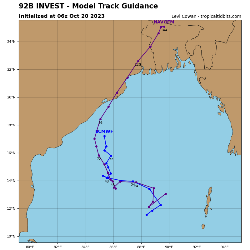
North Indian Ocean
>>> There’s an area of disturbed weather being referred to as Invest 92B…which is located approximately 267 NM west-northwest of Port Blair
Enhanced infrared satellite imagery depicts a low-level circulation partially obscured by formative bands of deep convection.
Environmental analysis indicates favorable conditions for development characterized by low (5-10 knot) vertical wind shear, and warm sea surface temperatures offset by poor outflow aloft.
Global models agree that invest 92B will gradually develop as it remains quasi-stationary over the next 24-36 hours before meandering northward.
Maximum sustained surface winds are estimated at 10 to 15 knots.
The potential for the development of a significant tropical cyclone within the next 24 hours is low.
