

")
Invest 95E / Invest 96W
Monday, September 18, 2023
Current Snapshot
For all the latest updates visit: DisasterAWARE

1800×1080

1800×10801

pdc7777

tsat95e
95E_tracks_latest
pdc96w

tsat96w
96W_geps_latest
By PDC’s Senior Weather
Specialist Glenn James

The Pacific Disaster Center’s (PDC Global) Monday, September 18, 2023, Tropical Cyclone Activity Report…for the Pacific Ocean, the Indian Ocean, and adjacent Seas
Current Tropical Cyclones:
There are no active Tropical Cyclones at the time of this writing
Northeast Pacific Ocean:
Central East Pacific…
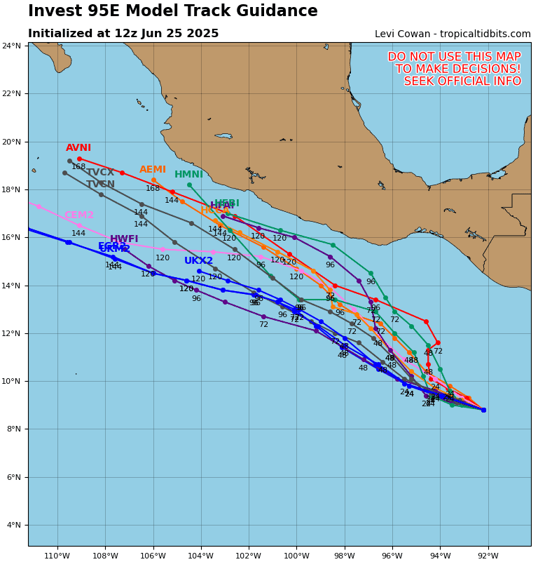
Invest 95E
Showers and thunderstorms have increased near an area of low pressure located several hundred miles southwest of the southern tip of the Baja California peninsula.
Environmental conditions appear to be conducive for further development, and this low is expected to become a tropical depression on Tuesday. This system is forecast to move slowly west-northwestward for the next day or so and then turn northward by late Wednesday over the western portion of the basin.
* Formation chance through 48 hours…high…90 percent
* Formation chance through 7 days…high…90 percent
Central North Pacific:
There are no tropical cyclones…nor any areas of disturbed weather under investigation by the CPHC
No tropical cyclones are expected during the next 7 days.
Western Pacific, Indian Ocean and adjacent Seas:
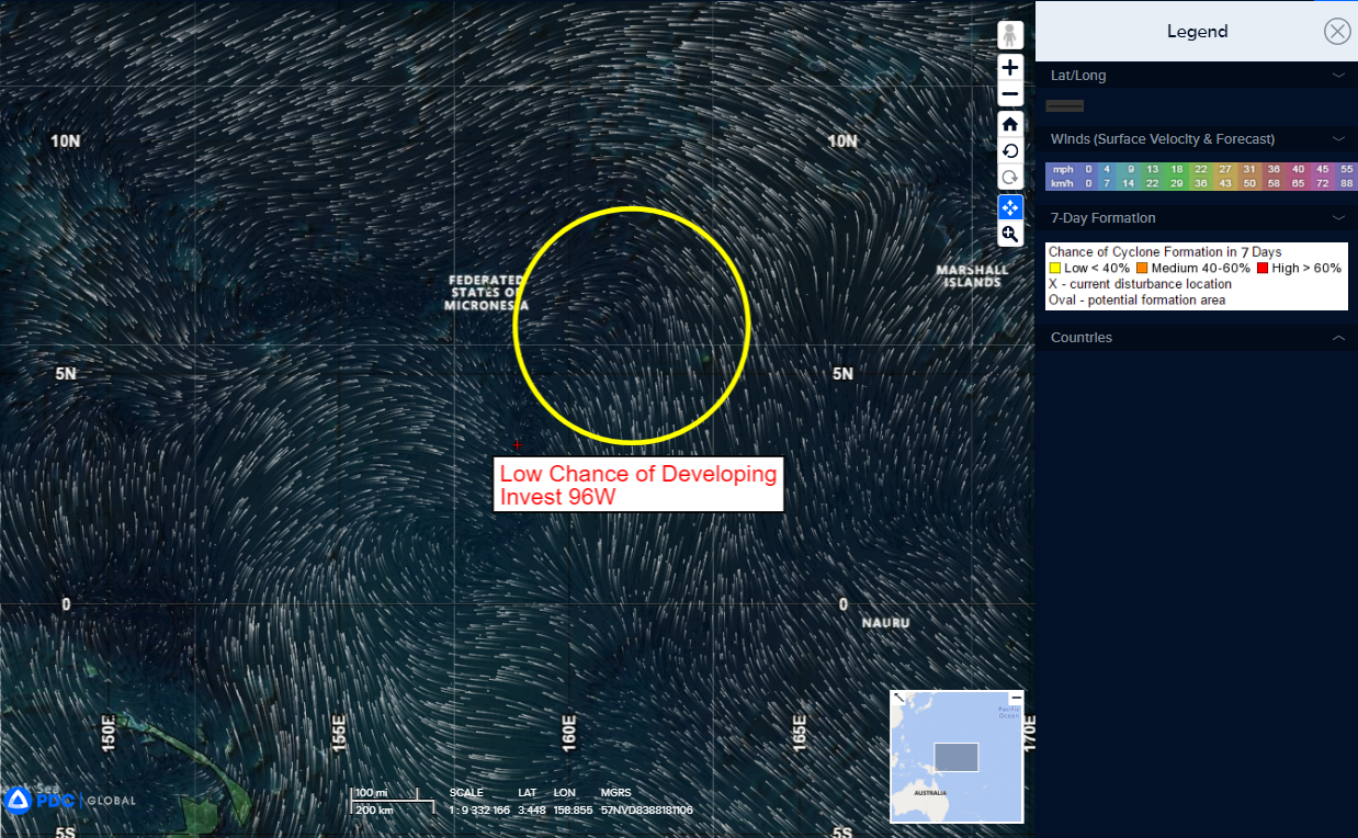
>>> There’s an area of disturbed weather being referred to as Invest 96W…which is located approximately 286 NM east-southeast of Pohnpei
Animated multi-spectral satellite imagery and a microwave pass reveal a broad and disorganized region of convection with no clear low level circulation center. Another pass revealed a small region of 10-15 knot southerly winds wrapping up the east side of a convective cluster, but no westerlies south of the convection as of yet.
Environmental analysis indicates that 96W is in a favorable environment for development due to warm sea surface temperatures, low (10-15 knot) vertical wind shear, and fair poleward outflow.
Models are in agreement of the development on the invest, but disagree on the timeline, with the GFS being the most proactive in forming around 48 hours, while others anticipate formation around 72-96 hours out, as the system tracks north-northwest.
Maximum sustained surface winds are estimated at 13 to 17 knots.
The potential for the development of a significant tropical cyclone within the next 24 hours is low.
