

")
Tropical Cyclone 03E (Calvin) / Tropical Cyclone 04W (Talim) / Invest 98W
Monday, July 17, 2023
Current Snapshot
For all the latest updates visit: DisasterAWARE
1800×1080

1800×10801

pdc7

pdccalvin

goes18_ir_03E_202307171445_lat16.7-lon-140.5

144356_earliest_reasonable_toa_34

03E_tracks_latest

pdctalim

04W_171200sair

04W_tracks_latest

pdc98w

98W_tracks_latest
By PDC’s Senior Weather
Specialist Glenn James

The Pacific Disaster Center’s (PDC Global) Monday, July 17, 2023, Tropical Cyclone Activity Report…for the Pacific Ocean, the Indian Ocean, and adjacent Seas
Current Tropical Cyclones:
Tropical Cyclone 03E (Calvin)…is located about 710 miles east of Hilo, Hawaii
Tropical Cyclone 04W (Talim)…is located approximately 171 NM east-northeast Of Hanoi, Vietnam – Final Warning
Central Pacific Ocean:
Tropical Cyclone 03E (Calvin)
TROPICAL STORM CALVIN MOVING WESTWARD TOWARD THE BIG ISLAND…TROPICAL STORM WARNING ISSUED FOR HAWAII COUNTY
According to the CPHC advisory number 26
Calvin is moving toward the west near 22 mph (35 km/h) and this motion is expected to continue over the next several days. On the forecast track, tropical storm conditions are expected over Hawaii County starting Tuesday night.
Maximum sustained winds are near 45 mph (75 km/h) with higher gusts. Some additional weakening is forecast during the next few days.
Tropical-storm-force winds extend outward up to 105 miles (165 km) from the center.
HAZARDS AFFECTING LAND
RAINFALL: From Tuesday night into Thursday, storm total rainfall amounts of 4-8 inches are possible along windward areas of the Big Island of Hawaii, with lower amounts (1-4 inches) expected elsewhere in the state. This rainfall could lead to localized flash flooding and mudslides.
SURF: Swells generated by Calvin are expected to begin reaching the main Hawaiian Islands during the next couple of days. These swells are likely to cause life-threatening surf.
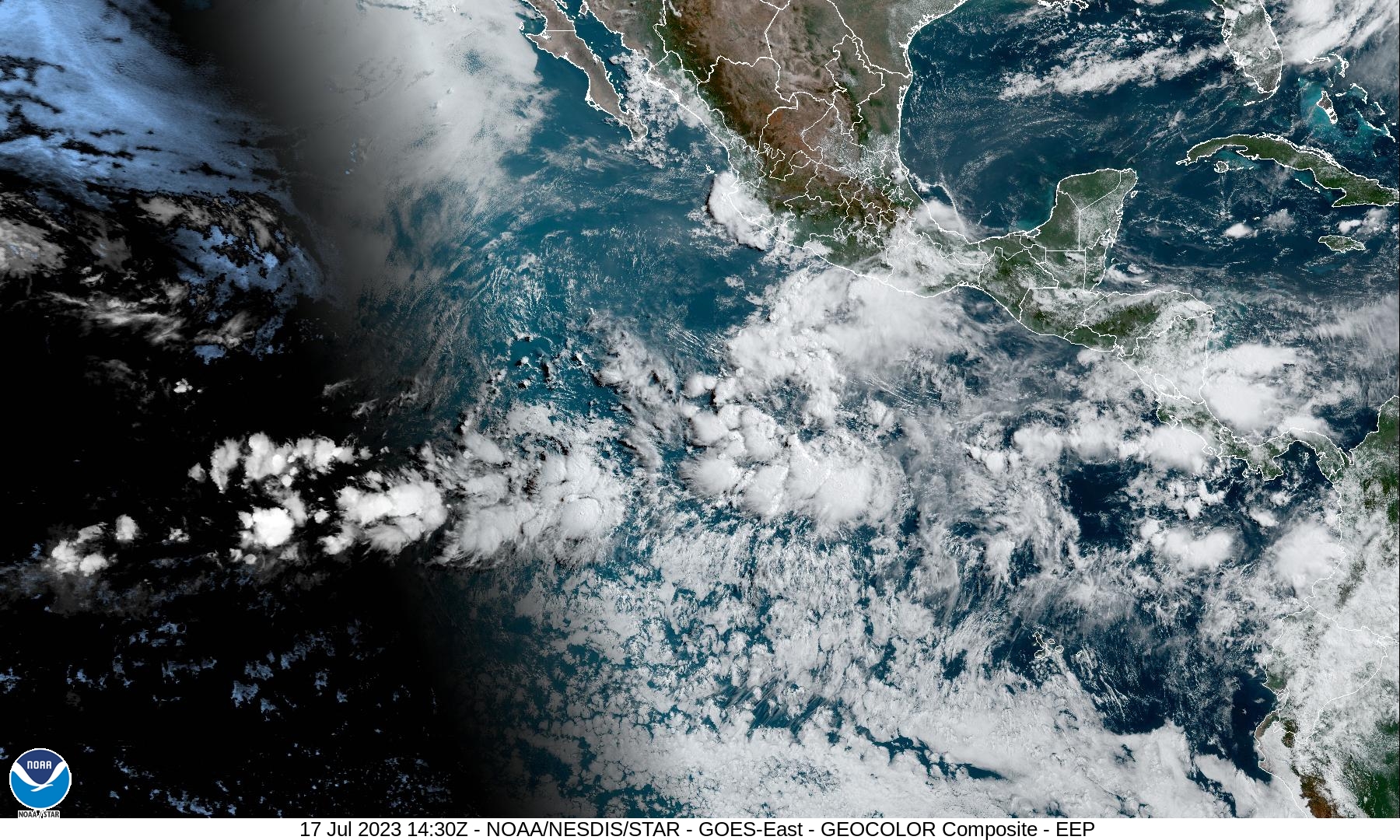
South of Southwestern Mexico:
An area of disturbed weather located a few hundred miles south of
the coast of southwestern Mexico is associated with a tropical wave.
Development of this system, if any, should be slow to occur as it
moves generally west-northwestward over the central portion of the
eastern Pacific basin.
* Formation chance through 48 hours…low…near 0 percent
* Formation chance through 7 days…low…20 percent
Western Pacific, Indian Ocean and adjacent Seas:
Western Pacific…
Tropical Cyclone 04W (Talim) – Final Warning
According to the JTWC warning number 15…sustained winds are 60 knots with gusts to 75 knots
Typhoon 04W has gradually deteriorated over the past six hours and made landfall near the eastern base of the Leizhou Peninsula.
Animated satellite imagery depicts slow decay of the outermost convective banding and obscuration of the low level circulation center (llcc). Animated weather radar shows evidence of a ragged eye persisting despite the greater northern semicircle propagating westward over land. An infrared image positioned deep convection in the southern periphery and relatively shallowed convection poleward of the llcc due to the influence of land induced friction.
Typhoon 04W is forecast to track west- northwestward through 36 hours under the steering influence of deep-layer easterly flow to the north. Land interaction and dry air entrainment along the northern periphery will gradually cause 04W to dissipate by 36 hours.
>>> There’s an area of disturbed weather being referred to as Invest 98W…which is located approximately 164 NM east of Palau.
Animated multi-spectral satellite imagery reveals a broad low level circulation (llc) partially obscured by deep broad convection along the southern semi-circle.
Environmental analysis reveals marginally favorable conditions characterized by moderate equatorward outflow aloft offset by low to moderate (15-20 knot) vertical wind shear. Sea surface temperatures remain warm.
Global models are in agreement that Invest 98W will steadily develop as it remains quasi-stationary before propagating northward around 48 hours.
Maximum sustained surface winds are estimated at 15 to 20 knots.
The potential for the development of a significant tropical cyclone within the next 24 hours remains medium.
