

")
Tropical Cyclone 08W (Damrey) / Tropical Cyclone 09W (Saola) / Invest 91E / Invest 92E / Invest 93W
Friday, August 25, 2023
Current Snapshot
For all the latest updates visit: DisasterAWARE

1800×10806

1800×10807

pdcepac2

pdcepac7

91E_tracks_latest
92E_tracks_latest

pdcdamrey

jtwcdamrey

08W_tracks_latestdamrey

pdcsaola

jtwcsaolasat

09W_tracks_latestsaola
By PDC’s Senior Weather
Specialist Glenn James

The Pacific Disaster Center’s (PDC Global) Friday, August 25, 2023, Tropical Cyclone Activity Report…for the Pacific Ocean, the Indian Ocean, and adjacent Seas
Current Tropical Cyclones:
Tropical Cyclone 08W (Damrey)…is located approximately 993 NM southeast of Yokosuka, Japan
Tropical Cyclone 09W (Saola)…is located approximately 267 NM northeast of Manila, Philippes
Northeast Pacific Ocean:
>>> South of Southwestern Mexico…
Invest 91L
A trough of low pressure located a few hundred miles south of the southwestern coast of Mexico continues to produce disorganized shower and thunderstorm activity.
Environmental conditions appear only marginally conducive for development of this system while it meanders offshore the southwestern coast of Mexico during the next few days. Interests along the southwestern coast of Mexico should continue to monitor the progress of this system.
* Formation chance through 48 hours…low…20 percent
* Formation chance through 7 days…low…30 percent
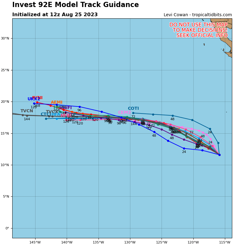
>>> Central East Pacific…
Invest 92L
Showers and thunderstorms are gradually becoming better organized in association with an elongated low pressure area located about 800 miles south-southwest of the southern tip of the Baja California Peninsula.
Environmental conditions are conducive for additional development, and a tropical depression is expected to form during the next day or two while the system moves west-northwestward or northwestward at 10 to 15 mph over the central portion of the tropical eastern Pacific.
* Formation chance through 48 hours…high…90 percent
* Formation chance through 7 days…high…90 percent
>>> Central North Pacific…
The National Hurricane Center in Miami, Florida is monitoring an area of low pressure (Invest 92L) located about 2600 miles east of the main Hawaiian Islands.
Showers and thunderstorms are gradually becoming better organized in association with a low pressure system. Environmental conditions are expected to become more favorable for additional development of this system during the next day or so.
A tropical depression is likely to form during the next couple of days while it moves west-northwestward at 10 to 15 mph.
This system could move into the Central Pacific Hurricane Center area of responsibility during the middle of next week.
Elsewhere, no tropical cyclones are expected during the next 7 days.
Western Pacific, Indian Ocean and adjacent Seas:
Western Pacific…
Tropical Cyclone 08W (Damrey)
According to the JTWC Warning number 13…
Sustained winds were 50 knots…with gusts to near 65 knots
Animated enhanced infrared satellite imagery depicts a tropical storm strength circulation appearing to be stretched longitudinally as the upper level outflow to the north continues to crank. The western periphery of the circulation remains mostly exposed due to the subsidence and dry air being provided by the tropical upper tropospheric trough to the system northwest.
TS 08W (Damrey) is forecast to continue tracking generally northward under the steering influence of the ridge centered to the southeast. By 12 hours the system will shift steering to a subtropical ridge (str) to the north and track speeds will gradually increase. by tau 48, 08w will approach the axis of the str and turn due north, as the system continues further into the subtropics, it will initiate extratropical transition (ett) by 72 hours and will complete ett by 96 hours.
In terms of intensity, over the next 12 hours, as 08W will move east of the aforementioned tutt cell, which is already providing a tremendous poleward outflow channel, which will continue to fuel the systems intensification to an estimate of 65 knots by 48 hours, despite moderate shear values. GFS in particular indicates that the tutt cell to the northwest combined with an upper level anticyclone to the northeast will provide in excess of 95 knots of southeasterly flow.
This fortuitous setup could fuel 08W far beyond the anticipated peak intensity of 65 knots, though the exact placement of all three atmospheric bodies during this period will determine the exact placement of the llcc in relationto the jet max, and thus shear will drive the ultimate intensity. The system will gradually weaken beyond 72 hours as it begins ett, but is still anticipated to become a storm force extratropical low by the end of the forecast period.
Tropical Cyclone 09W (Saola)
According to the JTWC Warning number 10…
Sustained winds were 100 knots…with gusts to near 125 knots
Animated enhanced infrared satellite imagery depicts a large central dense overcast, fully obscuring the low level circulation center (llcc) beneath. A much needed a synthetic aperture radar pass revealed a significantly improved circulation, both in size and intensity of the wind field in every quadrant. there is a band of 86-90 knot winds that nearly encircles the core of the system with two small patches of 95-100 knot winds in the eastern and northern quadrants. A microwave image reveals a robust microwave eye with deep convection still struggling to wrap the northwestern quadrant of the circulation.
Current undergoing rapid intensification (ri), typhoon 09W (Saola) is forecast to increase equatorward track speed over the coming hours, under the steering influence of the str to the west. over the next 36 hours, 09W will proceed generally equatorward until its forward progress is halted by a nearequatorial ridge (ner) to the systems south. By 48 hours, 09W will execute a graceful eastward and eventually northward course change.
Potential interaction with a very large tropical cyclone north of Guam, if it actually develops, will have a sizeable impact on the exact extended track forecast of 09W. If the new system does develop, then the track will likely push through the Luzon Strait. If it does not develop or is weaker than several deterministic models indicate, this would lead to a track further towards the north.
In terms of intensity, 09W is forecast to quickly intensify to 115 knots by 36 hours, as the system executes the hairpin northward turn, there is potential for cooler water to be upwelled beneath the system, resulting in a somewhat flattened intensity trend. This stagnation however, is quickly resolved as poleward track movement is once again achieved. The system is forecast to reach a peak intensity at the end of the current forecast period in the neighborhood of 130 knots and possibly higher.
>>> There’s an area of disturbed weather being referred to as Invest 93W…which is located approximately 180 NM west-northwest of Guam
Animated enhanced infrared satellite imagery and a microwave pass depict a broad and highly disorganized low level circulation with intense convective bursts associated with strong (20-25 knots), convergent monsoonal westerlies.
Environmental analysis reveals favorable conditions with a point source over the system with good outflow aloft. additionally, warm sea surface temperatures and low (10-15 knot) vertical wind shear are conducive for development.
Global models indicate 93W will track slowly eastward with steady development over the next 48 hours.The system will likely stall over or to the west of the Northern Marianas with strong monsoonal flow persisting over the region.
Maximum sustained surface winds are estimated at 15 to 20 knots.
The potential for the development of a significant tropical cyclone within the next 24 hours is low.
