

")
Tropical Cyclone 11E (Jova) / Invest 90W / Invest 91W
Saturday, September 9, 2023
Current Snapshot
For all the latest updates visit: DisasterAWARE

1800×10802

1800×10803

pdcjova

tsatjova

144828_earliest_reasonable_toa_34jova

11E_tracks_latestjova

pdcwpac
tsat90w

90W_tracks_latest
tsat91

91W_tracks_latest
By PDC’s Senior Weather
Specialist Glenn James

The Pacific Disaster Center’s (PDC Global) Saturday, September 9, 2023, Tropical Cyclone Activity Report…for the Pacific Ocean, the Indian Ocean, and adjacent Seas
Current Tropical Cyclones:
Tropical Cyclone 11E (Jova)…is located approximately 1030 NM west of the southern tip of Baja California
Northeast Pacific Ocean:
Tropical Cyclone 11E Jova
JOVA CONTINUES TO WEAKEN…DANGEROUS BEACH CONDITIONS ALONG THE COASTS OF CALIFORNIA AND
MEXICO ARE OCCURRING
According to the NHC Advisory number 21…
Jova is moving toward the northwest near 9 mph (15 km/h). A northwestward motion at a slightly slower forward speed is expected for the next day or so. Jova is forecast to slow down further and turn toward the west-southwest by late Sunday.
Maximum sustained winds have decreased to near 50 mph (85 km/h) with
higher gusts. Additional weakening is likely, and Jova is expected to become a remnant low by late Sunday or early Monday.
Tropical-storm-force winds extend outward up to 90 miles (150 km) from the center.
Central North Pacific…
There are no tropical cyclones, nor any areas of disturbed weather under investigation by the CPHC.
Western Pacific, Indian Ocean and adjacent Seas:
Western Pacific…
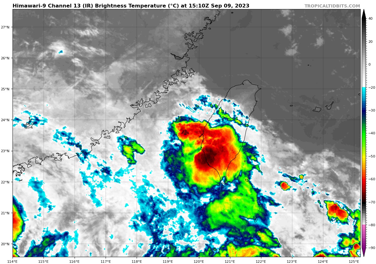
>>> There’s an area of disturbed weather being referred to as Invest 91W…which is located approximately 197 NM southwest of Taipei, Taiwan
Animated enhanced infrared satellite imagery and a microwave image reveal an elongated circulation along a low level troughing area oriented south-southwest to north-northeast.
Analysis shows that the Invest is in a marginally favorable environment for development defined by robust equatorward outflow aloft and very warm sea surface temperatures offset by high (25-30 knot) vertical wind shear.
Global numerical models are in fair agreement that Invest 91W will track northeastward through the Taiwan Strait over the next 24-48 hours.
Maximum sustained surface winds are estimated at 15 to 20 knots.
The potential for the development of a significant tropical cyclone within the next 24 hours remains low.
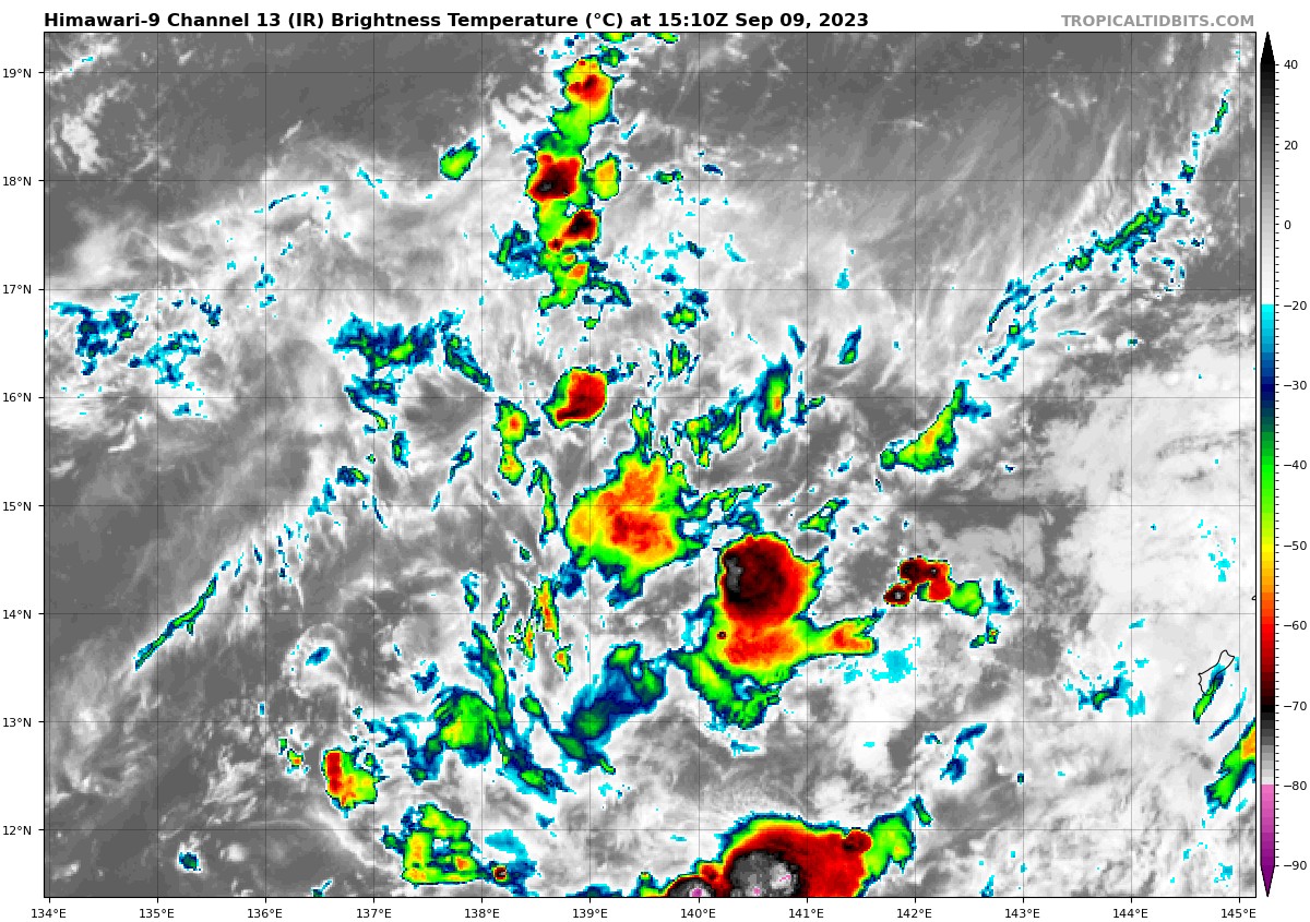
>>> There’s a second area of disturbed weather being referred to as Invest 90W…which is located approximately 282 NM west-northwest of Guam
Animated enhanced infrared satellite imagery depicts centralized flaring convection with discrete, shallow bands wrapping into a broad low-level circulation.
Environmental analysis shows the invest is in a favorable environment for development defined by good poleward outflow aloft, low (5-10 knot)
vertical wind shear, and warm surface temperatures.
Global models are in agreement that Invest 90W will gradually intensify as it travels northeastward over the next 48-72 hours.
Maximum sustained surface winds are estimated at 15 to 20 knots.
The potential for the development of a significant tropical cyclone within the next 24 hours remains low.
