

")
Invest 92W / Invest 93W
Monday, September 11, 2023
Current Snapshot
For all the latest updates visit: DisasterAWARE
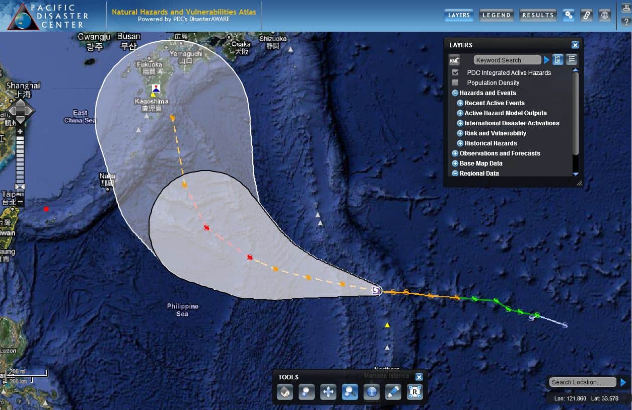
2011-07-14-atlas-08W
Pacific Disaster Center’s Natural Hazards and Vulnerabilities Atlas (https://wwwwww.pdc.org/atlas)
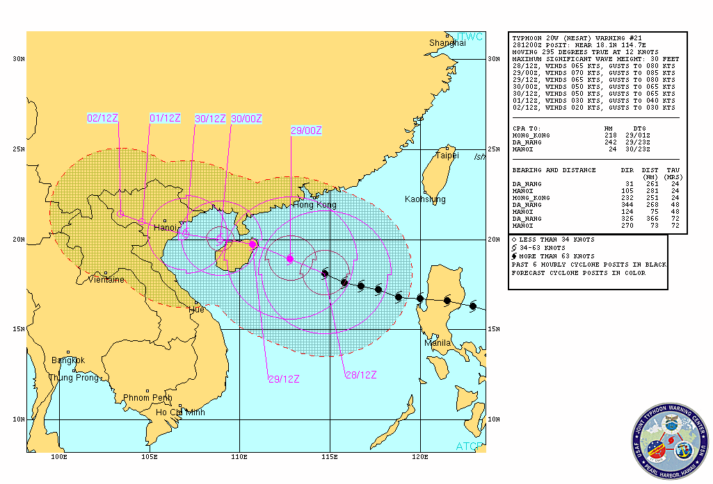
Nesat
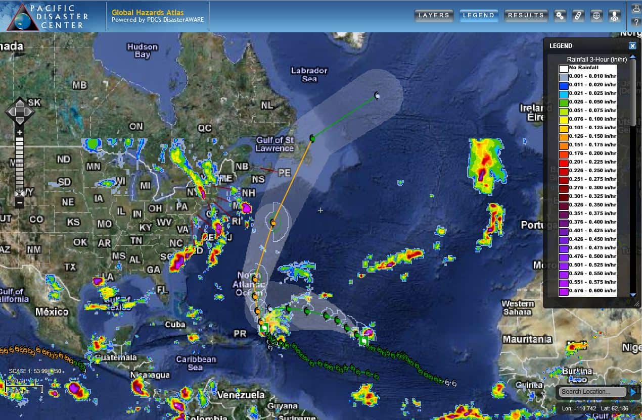
Ophelia / Phillipe
Atlantic
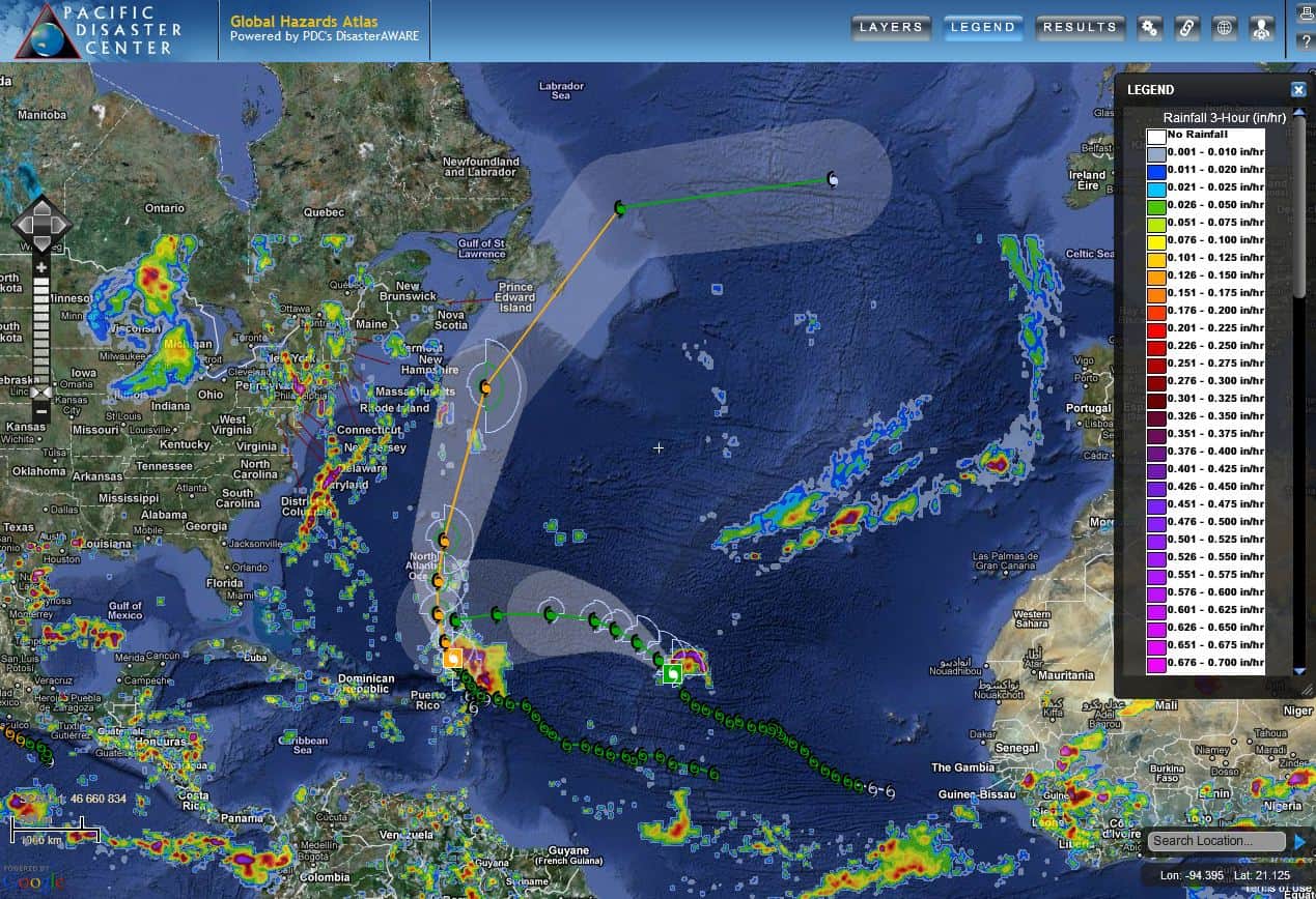
PDC Atlas
PDC Atlas showing tropical cyclones Philippe and Ophelia – track maps, TRMM rainfall, storm winds…all in the Atlantic Ocean Basin
PDC Atlas
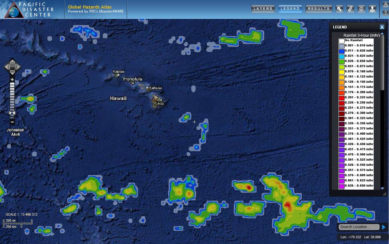
PDC Atlas showing the Hawaiian Islands, with TRMM rainfall
By PDC’s Senior Weather
Specialist Glenn James

The Pacific Disaster Center’s (PDC Global) Monday, September 11, 2023, Tropical Cyclone Activity Report…for the Pacific Ocean, the Indian Ocean, and adjacent Seas
Current Tropical Cyclones:
There are no Tropical Cyclones at the time of this writing
Northeast Pacific Ocean:
Western east Pacific
A disorganized area of showers and thunderstorms located well to the southwest of the southern tip of the Baja California peninsula is associated with a tropical wave.
Environmental conditions appear conducive for some gradual development of this system, and a tropical depression could form during the latter part of this week or this weekend while it moves generally west-northwestward across the western portion of the eastern Pacific basin.
* Formation chance through 48 hours…low…20 percent
* Formation chance through 7 days…medium…40 percent
Central North Pacific…
There are no tropical cyclones, nor any areas of disturbed weather under investigation by the CPHC.
Western Pacific, Indian Ocean and adjacent Seas:
Western Pacific…
>>> There’s an area of disturbed weather being referred to as Invest 92W…which is located approximately 211 NM south-southeast of Kadena AB, Okinawa
Animated multi-spectral satellite imagery depicts an exposed low level circulation center (llcc), with flaring convection.
Environmental analysis indicates that 92W is in a marginally favorable environment for development with weak outflow aloft and dry air entrainment offset by low (10-15 knot) vertical wind shear and warm sea surface temperatures. Additionally, a deep upper-level trough directly over the system is expected to deepen and suppress development.
Global models show that 92W will drift slowly southward over the next 48 hours with no significant development.
Maximum sustained surface winds are estimated at 15 to 20 knots.
The potential for the development of a significant tropical cyclone within the next 24 hours is downgraded to low.
>>> There’s an area of disturbed weather being referred to as Invest 93W…which is located approximately 573 NM east-southeast of Iwo To, Japan
Animated multi-spectral satellite imagery depicts a partially exposed llcc with the deepest convection displaced to the southeast.
Environmental environmental analysis indicates that 93W is in marginally favorable conditions for development with low (10-15 knot) vertical wind shear and warm sea surface temperatures, but is offset by a deep upper-level trough in the area that is suppressing potential development.
Global models have the circulation drifting poleward with little development over the next 24 hours.
Maximum sustained surface winds are estimated at 14 to 19 knots.
The potential for the development of a significant tropical cyclone within the next 24 hours is upgraded to low.
