

")
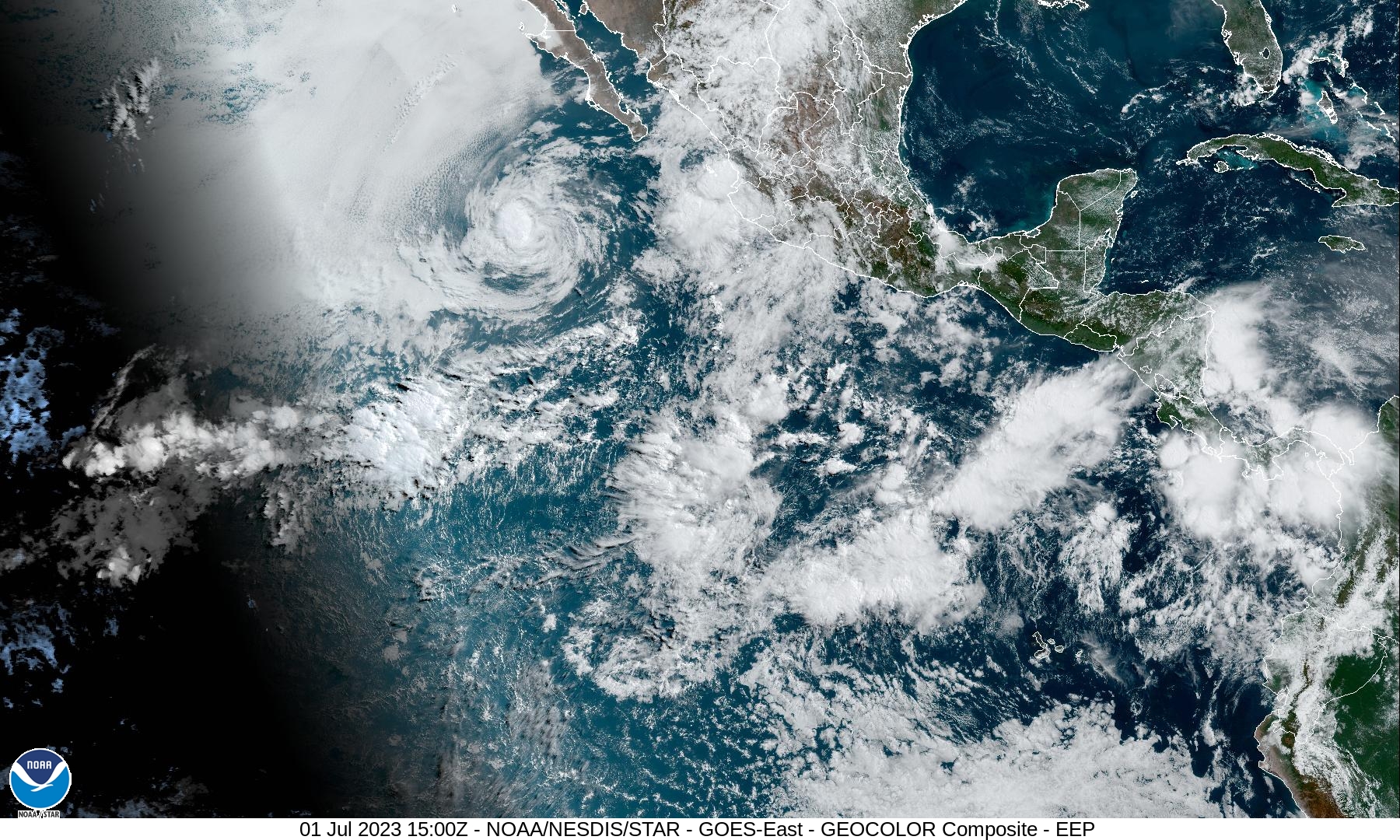
Tropical Cyclone Adrian / Tropical Cyclone 02E (Beatriz)
Saturday, July 1, 2023
Current Snapshot
For all the latest updates visit: DisasterAWARE
epacsat

pdcadrian

tsatadrian

144237_earliest_reasonable_toa_34

01E_tracks_latest

pdcbeatriz

tsatbeat

144640_earliest_reasonable_toa_34

02E_tracks_latest
By PDC’s Senior Weather
Specialist Glenn James

The Pacific Disaster Center’s (PDC Global) Saturday, July 1, 2023, Tropical Cyclone Activity Report…for the Pacific Ocean, the Indian Ocean, and adjacent Seas
Current Tropical Cyclones:
Tropical Cyclone 01E (Adrian)…is located about 440 miles southwest of the southern tip of Baja, California
Remnants of Tropical Cyclone 02E (Beatriz)…is located about 55 miles south-southeast of Las Islas Marias, Mexico – Last Advisory
Northeast Pacific Ocean:
Tropical Cyclone Adrian
ADRIAN PASSING JUST NORTH OF CLARION ISLAND…FORECAST TO BECOME A REMNANT LOW ON SUNDAY
According to the NHC advisory number 17…
Adrian is moving toward the west-northwest near 7 mph (11 km/h). This general motion is expected to continue with a gradual turn toward the west during the next couple of days.
Maximum sustained winds have decreased to near 60 mph (95 km/h) with higher gusts. Continued weakening is expected during the next couple of days, and Adrian is forecast to become a remnant low on Sunday and dissipate early next week.
Tropical-storm-force winds extend outward up to 60 miles (95 km) from the center. A Mexican Navy automated weather station on Clarion Island recently reported a sustained wind of 41 mph (66 km/h) and a gust of 55 mph (89 km/h).
HAZARDS AFFECTING LAND
None
Remnants of Tropical Cyclone 02E (Beatriz) – Last Advisory
BEATRIZ DISSIPATES OFF THE WEST-CENTRAL COAST OF MEXICO
According to the NHC advisory number 12…
The remnants are moving toward the northwest near 12 mph (19 km/h), but are expected to slow down and meander over the mouth of the Gulf of California during the next few days.
Maximum sustained winds have decreased to near 30 mph (45 km/h) with higher gusts.
HAZARDS AFFECTING LAND
RAINFALL: Through Monday, storm total rainfall of 3 to 5 inches, with maximum amounts of 8 inches, is expected across portions of southern and western Mexico from Colima northwest to Sinaloa and Durango in association with the remnants of Beatriz. This rainfall could lead to localized flash flooding and mudslides.
SURF: Swells generated by Beatriz are expected to diminish along the southwestern coast of Mexico during the next day or so. These swells could cause life-threatening surf and rip current conditions.
Central Pacific Ocean:
There are no tropical cyclones…nor any areas of disturbed weather under investigation by the Central Pacific Hurricane Center (CPHC)
Tropical cyclone formation is not expected during the next 7-days.
Western Pacific, Indian Ocean and adjacent Seas:
There are no tropical cyclones…nor any areas of disturbed weather under investigation by the Joint Typhoon Warning Center (JTWC)
