

")
Tropical Cyclone Tammy
Saturday, October 21, 2023
Current Snapshot
For all the latest updates visit: DisasterAWARE
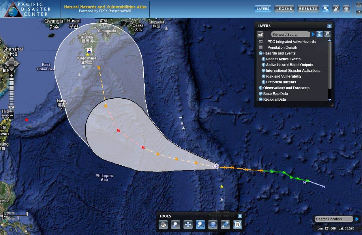
2011-07-14-atlas-08W
Pacific Disaster Center’s Natural Hazards and Vulnerabilities Atlas (https://wwwwww.pdc.org/atlas)
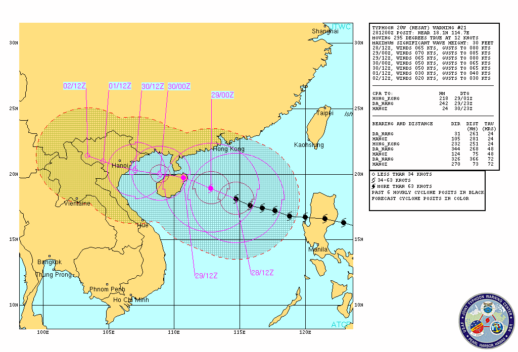
Nesat
Ophelia / Phillipe
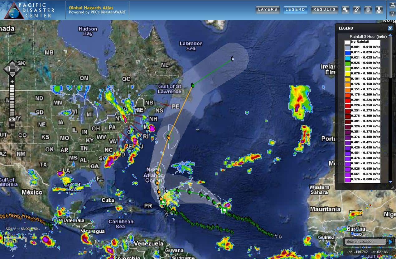
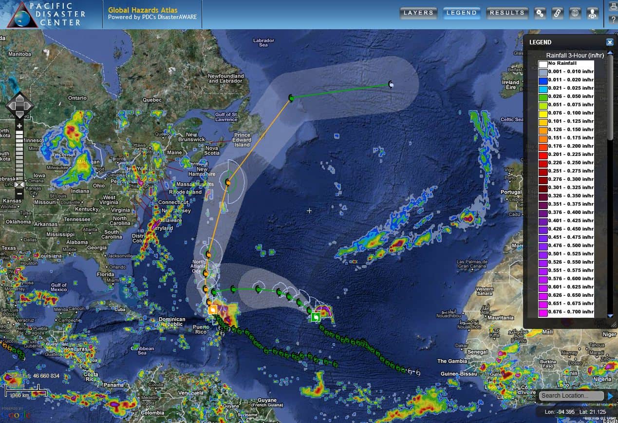
Atlantic
PDC Atlas
PDC Atlas showing tropical cyclones Philippe and Ophelia – track maps, TRMM rainfall, storm winds…all in the Atlantic Ocean Basin
PDC Atlas
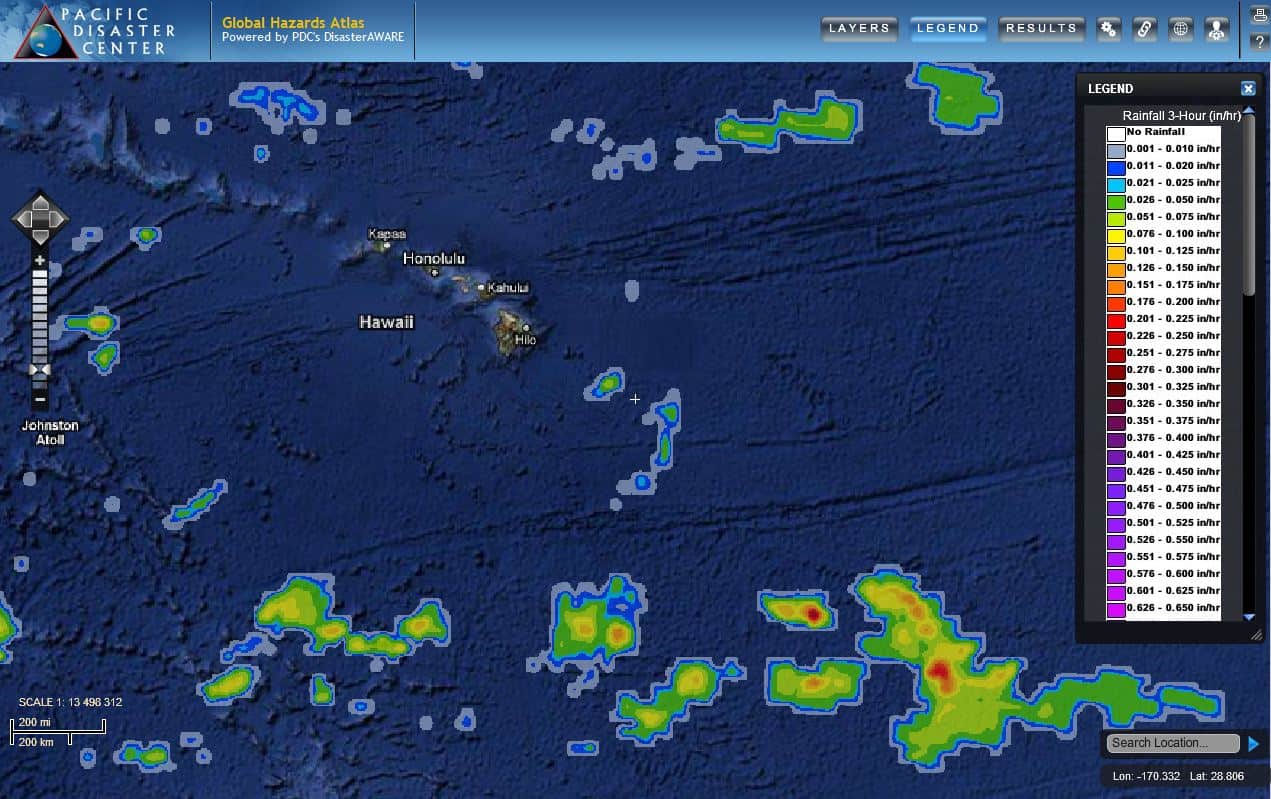
PDC Atlas showing the Hawaiian Islands, with TRMM rainfall
By PDC’s Senior Weather
Specialist Glenn James

The Pacific Disaster Center’s (PDC Global) Saturday, October 21, 2023, Tropical Cyclone Activity Report…for the Atlantic Ocean, the Caribbean Sea, and the Gulf of Mexico
CURRENT TROPICAL CYCLONES:
Tropical Cyclone Tammy…is located about 15 miles east-southeast of Barbuda
Atlantic Ocean
Tropical Cyclone Tammy
TAMMY VERY NEAR BARBUDA…STRONG WINDS AND HEAVY RAINS CONTINUE OVER PORTIONS OF THE LEEWARD ISLANDS
According to the NHC advisory number 14A
Tammy is moving toward the north-northwest near 10 mph (17 km/h) and this general motion is expected through Sunday, followed by a turn toward the north on Monday. On the forecast track, the center of Tammy will move near or over portions of the Leeward Islands tonight, and then move north of the northern Leeward Islands by Sunday afternoon.
Maximum sustained winds are near 85 mph (140 km/h) with higher gusts. Slow strengthening is possible during the next few days. Hurricane-force winds extend outward up to 25 miles (35 km) from the center and tropical-storm-force winds extend outward up to 125 miles (205 km).
HAZARDS AFFECTING LAND
WIND:
Hurricane conditions are expected over portions of the northern Leeward Islands tonight. Tropical storm conditions are expected within the tropical storm warning areas through tonight. Tropical storm conditions are possible in the British Virgin Islands tonight and Sunday.
RAINFALL: Tammy is expected to produce the following storm total rainfall:
Leeward Islands: 4 to 8 inches with maximum amounts of 12 inches
Martinique and Dominica: Additional 2 to 4 inches with maximum amounts of 6 inches
British and U.S. Virgin Islands into eastern Puerto Rico: 1 to 2 inches with maximum amounts of 4 inches
These rains may produce isolated flash and urban flooding, along with isolated mudslides in areas of higher terrain.
STORM SURGE: Storm surge could raise water levels by as much as 1 to 3 feet above normal tide levels near where the center of Tammy moves across the Leeward Islands. Near the coast, the surge will be accompanied by large and dangerous waves.
SURF: Swells generated by Tammy will continue to affect portions of the Lesser Antilles during the next few days. These swells are likely to cause life-threatening surf and rip current conditions.
>>> Southwestern Caribbean Sea…
An area of low pressure could form this weekend over the southwestern Caribbean Sea. Some slow development of this system will be possible before it moves inland over Central America by the early to middle portion of next week.
* Formation chance through 48 hours…low…20 percent
* Formation chance through 7 days…low…20 percent
