

")
Tropical Cyclone 15L (Nigel) / Potential Tropical Cyclone 16L
Thursday, September 21, 2023
Current Snapshot
For all the latest updates visit: DisasterAWARE

5

55

nigel

tsatnigel

143811_earliest_reasonable_toa_34negel

15L_tracks_latestnigel

pdc16L
1000×1000

1000×10001

tsat16

152519_earliest_reasonable_toa_3416

16L_tracks_latest

7
By PDC’s Senior Weather
Specialist Glenn James

The Pacific Disaster Center’s (PDC Global) Thursday, September 21, 2023, Tropical Cyclone Activity Report…for the Atlantic Ocean, the Caribbean Sea, and the Gulf of Mexico
CURRENT TROPICAL CYCLONES:
Tropical Cyclone 15L (Nigel)…is located about 700 miles northwest of the Azores
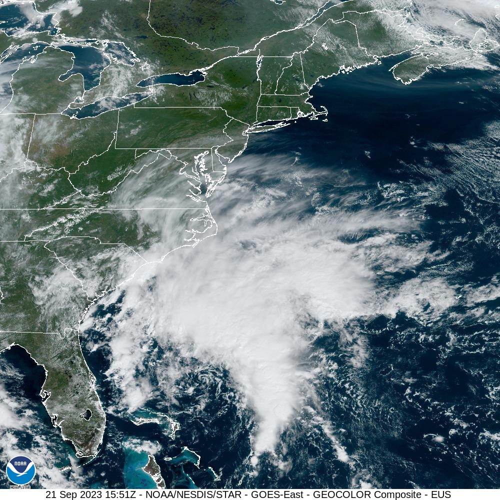
Potential Tropical Cyclone 16L…is located about 380 miles south of Cape Hatteras, North Carolina
Atlantic Ocean
Tropical Cyclone 15L (Nigel)
NIGEL SOON TO BE EXTRATROPICAL
According to the NHC advisory number 27…
Nigel is moving toward the east-northeast near 37 mph (59 km/h), and this general motion is expected to continue for the next day or so. A slower northward or north-northwestward motion is expected this weekend.
Maximum sustained winds have decreased to near 75 mph (120 km/h) with higher gusts. Weakening is forecast during the next couple of days, and Nigel is forecast to become a post-tropical cyclone tonight or early Friday.
Hurricane-force winds extend outward up to 70 miles (110 km) from the center and tropical-storm-force winds extend outward up to 230 miles (370 km).
Potential Tropical Cyclone 16L
TROPICAL STORM CONDITIONS EXPECTED TO REACH THE NORTH CAROLINA COAST LATER TODAY
According to the NHC advisory number 3A…
The low is moving toward the north-northeast near 3 mph (6 km/h). A faster northward or north-northwestward motion is expected later this morning through Sunday.
On the forecast track, the center of the low will approach the coast of North Carolina through tonight, and then move across eastern North Carolina, southeastern Virginia, and the Delmarva Peninsula Saturday and Sunday.
Maximum sustained winds are near 40 mph (65 km/h) with higher gusts.
Additional strengthening is forecast during the next day or so, and the low is expected to become a tropical storm before it reaches the coast of North Carolina.
Regardless of whether it becomes a tropical storm, the system is expected to bring tropical-storm conditions to portions of the southeast and mid-Atlantic coasts.
* Formation chance through 48 hours…high…70 percent
* Formation chance through 7 days…high…70 percent
HAZARDS AFFECTING LAND
STORM SURGE: The combination of a dangerous storm surge and the tide will cause normally dry areas near the coast to be flooded by rising waters moving inland from the shoreline. The water could reach the following heights above ground somewhere in the indicated areas if the peak surge occurs at the time of high tide…
Neuse and Bay Rivers…3-5 ft
Pamlico and Pungo Rivers…3-5 ft
Chesapeake Bay south of Colonial Beach…2-4 ft
Surf City NC, NC to Chincoteague, VA…2-4 ft
Albemarle Sound…2-4 ft
South Santee River, SC to Surf City NC, NC…1-3 ft
Chincoteague, VA to Manasquan Inlet, NJ…1-3 ft
Upper Chesapeake Bay…1-3 ft
Delaware Bay…1-3 ft
The deepest water will occur along the immediate coast near and to the north of the landfall location, where the surge will be accompanied by dangerous waves. Surge-related flooding depends on the relative timing of the surge and the tidal cycle, and can vary greatly over short distances.
WIND: Tropical storm conditions are expected to first reach the coast within the warning area in North Carolina on Friday, and spread northward Friday night and Saturday.
RAINFALL: The system is forecast to produce 3 to 5 inches of rainfall, with localized amounts of 7 inches, across eastern North Carolina into southeast Virginia Friday into Saturday. Across remaining portions of the Mid-Atlantic into southern New England, 2 to 4 inches of rainfall are forecast from late Friday into Sunday. This rainfall may produce isolated urban and small stream flooding impacts.
SURF: Swells generated by this system will be affecting much of the east coast of the United States through this weekend. These swells are likely to cause life-threatening surf and rip current conditions.
TORNADOES: A few tornadoes are possible beginning Friday night through Saturday for portions of the Mid-Atlantic Coast.
>>> Eastern Tropical Atlantic…
Showers and thunderstorms continue to show signs of organization in association with a broad area of low pressure located about 500 miles west-southwest of the Cabo Verde Islands.
Environmental conditions are forecast to be conducive for gradual development of this system, and a tropical depression is likely to form this weekend or early next week while the system moves generally westward at 10 to 15 mph across the eastern and central tropical Atlantic.
* Formation chance through 48 hours…medium…60 percent
* Formation chance through 7 days…high…80 percent
