

")
Tropical Cyclone 17L (Philippe) / Invest 91L
Tuesday, September 26, 2023
Current Snapshot
For all the latest updates visit: DisasterAWARE

1

2

pdcphilippe

tsatphilippe

143346_earliest_reasonable_toa_34philippe
17L_tracks_latest

pdc2

7

tsat91

91L_tracks_latest
By PDC’s Senior Weather
Specialist Glenn James

The Pacific Disaster Center’s (PDC Global) Tuesday, September 26, 2023, Tropical Cyclone Activity Report…for the Atlantic Ocean, the Caribbean Sea, and the Gulf of Mexico
CURRENT TROPICAL CYCLONES:
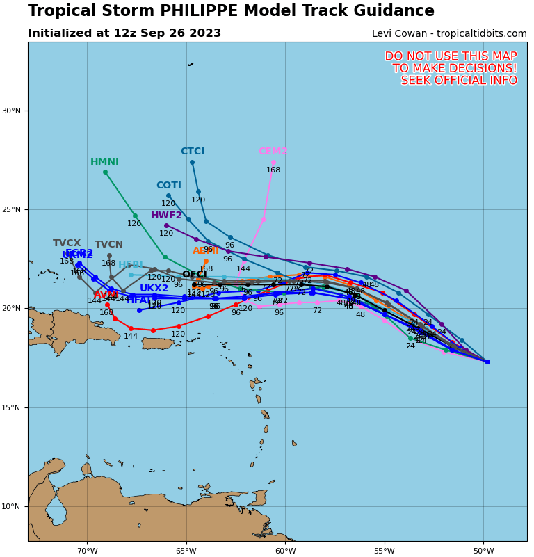
Tropical Cyclone 17L (Philippe)…is located about 730 miles east of the Northern Leeward Islands
Atlantic Ocean
Tropical Cyclone 17L (Philippe)
PHILIPPE EXPECTED TO SLOWLY WEAKEN OVER THE NEXT SEVERAL DAYS
According to the NHC advisory number 15…
Philippe is moving toward the west near 12 mph (19 km/h) and a westward to west-northwestward motion is expected during the next few days.
Satellite wind data indicates that maximum sustained winds remain near 45 mph (75 km/h) with higher gusts. Gradual weakening is forecast over the next several days.
Tropical-storm-force winds extend outward up to 230 miles (370 km) from the center.
>>> Central Tropical Atlantic…
Invest 91L
Showers and thunderstorms continue to show signs of organization in association with an area of low pressure located roughly halfway between the Cabo Verde Islands and the Lesser Antilles.
Environmental conditions are forecast to be conducive for development, and a tropical depression or storm is expected to form in the next day or so while the system moves west-northwestward across the central tropical Atlantic.
* Formation chance through 48 hours…high…90 percent
* Formation chance through 7 days…high…90 percent
