

")
Tropical Storm Don / Invest 95L
Saturday, July 22, 2023
Current Snapshot
For all the latest updates visit: DisasterAWARE

1800×1080

e

don

goes16_ir_05L_202307221415_lat38.5-lon-49.9

144644_earliest_reasonable_toa_34

05L_tracks_latest

95L2

95L7

goes16_ir_95L_202307221415_lat12.1-lon-41.7
95L_tracks_latest
By PDC’s Senior Weather
Specialist Glenn James

The Pacific Disaster Center’s (PDC Global) Saturday, July 22, 2023, Tropical Cyclone Activity Report…for the Atlantic Ocean, the Caribbean Sea, and the Gulf of Mexico
CURRENT TROPICAL CYCLONES:
Tropical Storm Don…is located about 545 miles south-southeast of Cape Race, Newfoundland
Tropical Storm Don
DON A LITTLE STRONGER
According to the NHC advisory number 34…
Don is moving toward the north near 13 mph (20 km/h), and this motion should continue today. A northeastward turn is expected later tonight or early Sunday, and a northeastward motion should continue into Monday.
Maximum sustained winds have increased to near 65 mph (100 km/h) with higher gusts. Some slight additional strengthening is possible today. Weakening should begin tonight and Don is forecast to become a post-tropical cyclone Sunday night.
Tropical-storm-force winds extend outward up to 60 miles (95 km) from the center.
Central Tropical Atlantic:
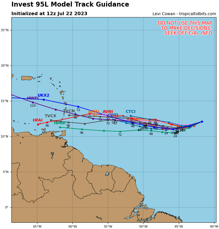
Invest 95L
Shower activity associated with a small area of low pressure located roughly midway between the Cabo Verde Islands and the Lesser Antilles continues to show signs of organization.
Although environmental conditions are only marginally conducive, some additional gradual development is anticipated and this system will likely become a tropical depression by early next week while it moves westward across the tropical Atlantic.
Interests in the Lesser Antilles should monitor the progress of this system.
* Formation chance through 48 hours…medium…50 percent
* Formation chance through 7 days…high…70 percent
