

")
Invest 98L / Invest 99L
Thursday, August 17, 2023
Current Snapshot
For all the latest updates visit: DisasterAWARE

1800×1080

1800×10801

pdcatl2

pdcatl7

99sat

99L_tracks_latest

sat98

98L_tracks_latest
1000×1000

1000×10002

pdcgom7
By PDC’s Senior Weather
Specialist Glenn James

The Pacific Disaster Center’s (PDC Global) Thursday, August 17, 2023, Tropical Cyclone Activity Report…for the Atlantic Ocean, the Caribbean Sea, and the Gulf of Mexico
CURRENT TROPICAL CYCLONES:
There are no active tropical cyclones at the time of this writing
>>> Central Tropical Atlantic…
Invest 99L
Disorganized showers and thunderstorms continue in association with an elongated trough of low pressure about 1000 miles west-southwest of the Cabo Verde Islands.
Environmental conditions appear conducive for gradual development of this system, and a tropical depression could form during the next several days while it moves west-northwestward at 10 to 15 mph across the central tropical Atlantic.
* Formation chance through 48 hours…medium…40 percent
* Formation chance through 7 days…medium…60 percent
>>> Eastern Tropical Atlantic…
Invest 98L
A broad area of low pressure associated with a tropical wave is producing a large area of disorganized showers and thunderstorms near and to the southwest of the Cabo Verde Islands.
Further development of this low is possible while it moves toward the west-northwest or northwest at around 10 mph across the eastern tropical Atlantic, and a tropical depression could form over the weekend before environmental conditions become unfavorable for development early next week.
* Formation chance through 48 hours…medium…40 percent
* Formation chance through 7 days…medium…60 percent
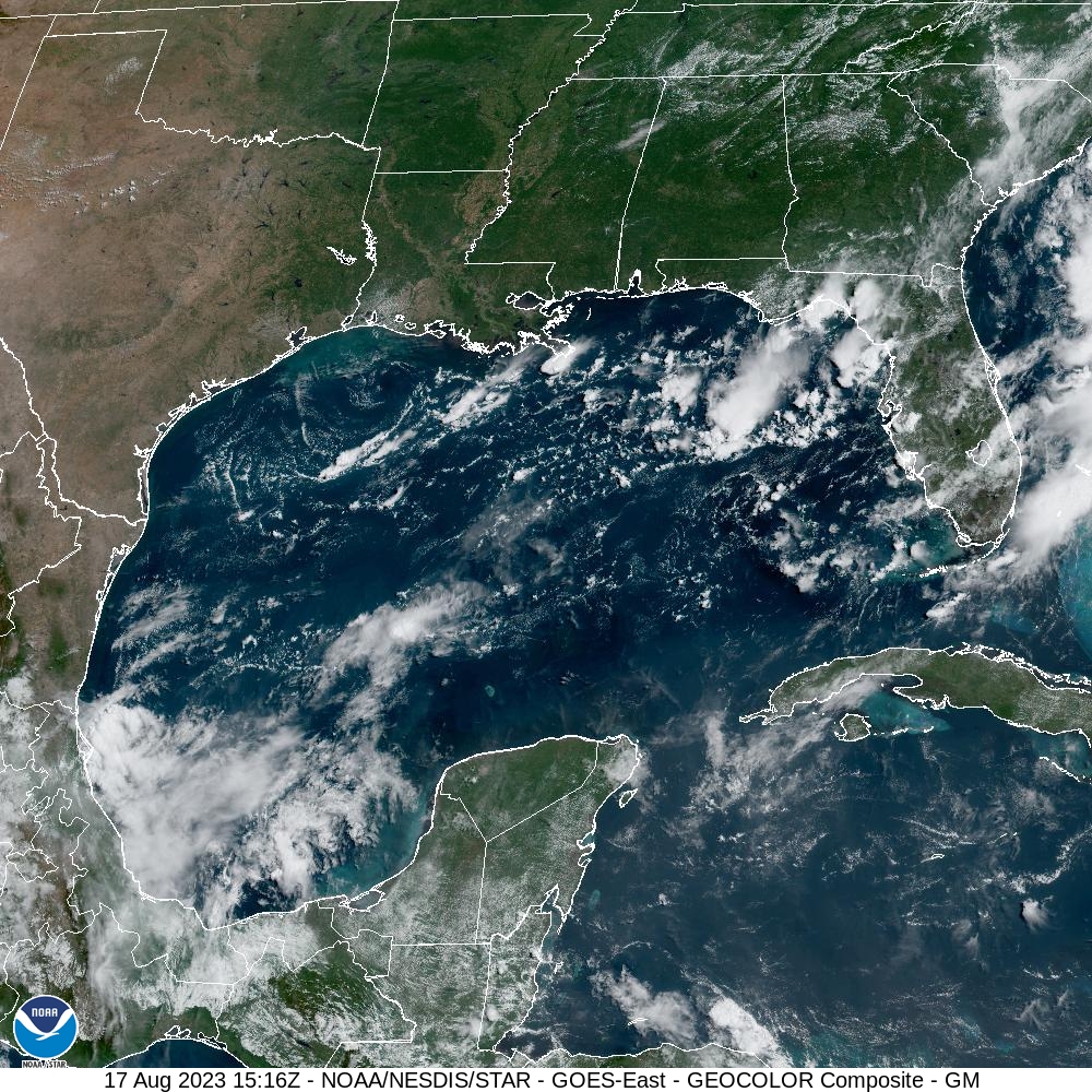
>>> Western Gulf of Mexico…
A broad area of low pressure could form in the central or western Gulf of Mexico by the beginning of next week.
Some slow development of this system is possible thereafter as it moves westward and approaches the western Gulf of Mexico coastline by the middle of next week.
* Formation chance through 48 hours…low…near 0 percent
* Formation chance through 7 days…low…30 percent
