

")
Invest 91W / Invest 92W
Friday, December 15, 2023
Current Snapshot
For all the latest updates visit: DisasterAWARE
10
pdcwpac2
himawari9_ir_91W_202312151520_lat5.8-lon137.5
91W_tracks_latest
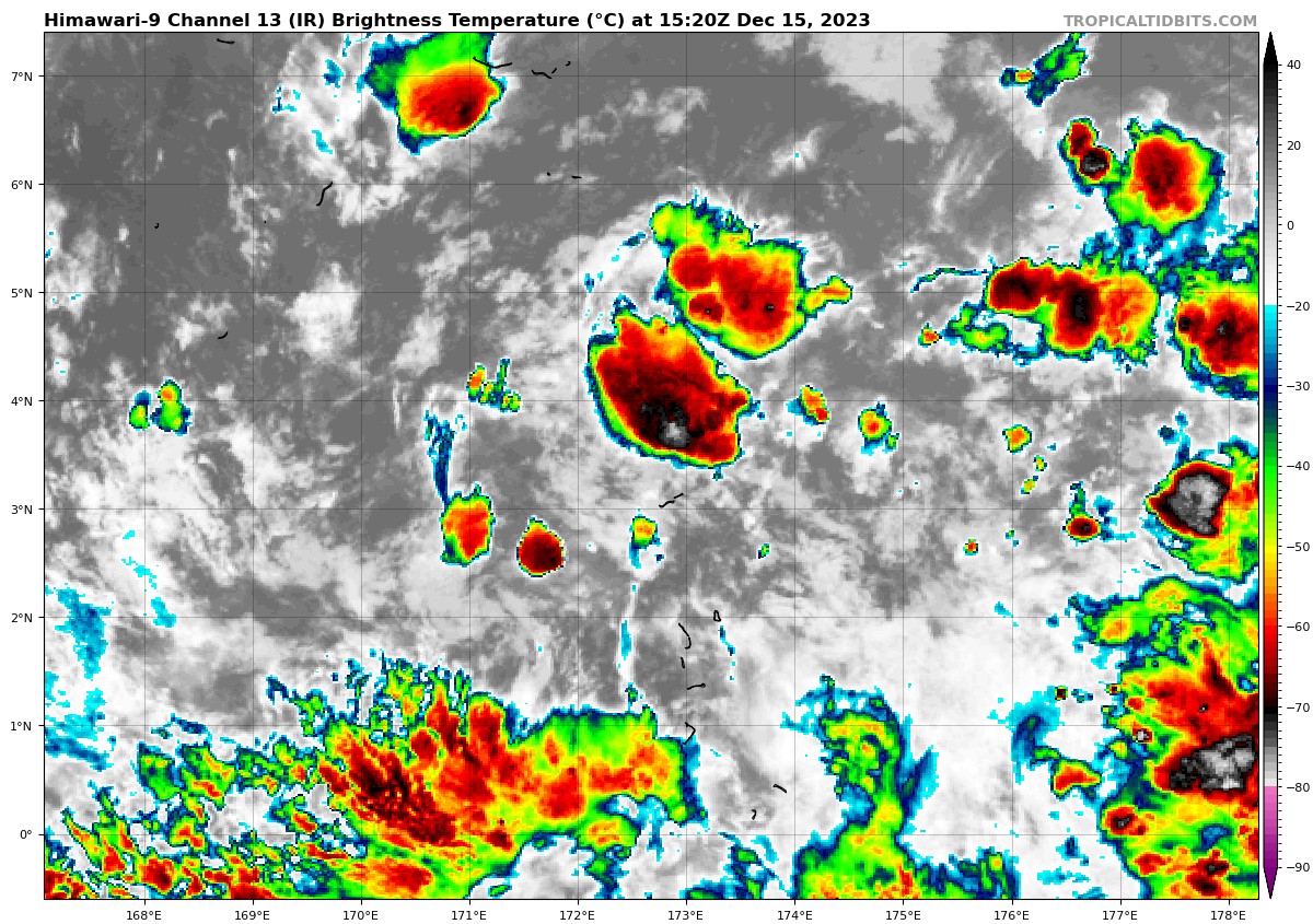
himawari9_ir_92W_202312151520_lat3.2-lon172.2
92W_tracks_latest
By PDC’s Senior Weather
Specialist Glenn James

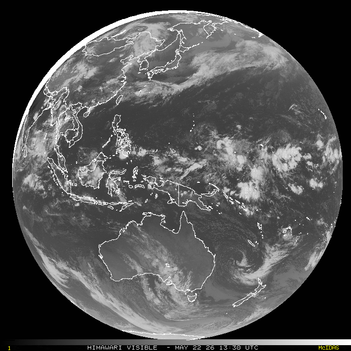
The Pacific Disaster Center’s (PDC Global) Friday, December 15, 2023, Tropical Cyclone Activity Report…for the Pacific Ocean, the Indian Ocean, and adjacent Seas
Current Tropical Cyclones:
There are no active tropical cyclones at the time of this writing
Northeast Pacific Ocean:
The North Pacific hurricane season officially ended on November 30, 2023. Routine issuance of the Tropical Weather Outlook will resume on May 15, 2024. During the off-season, Special Tropical Weather Outlooks will be issued as conditions warrant.
The eastern Pacific basin hurricane season was above normal, with 17 named storms, of which 10 were hurricanes and eight of those major hurricanes.
From August 16 to 21, Tropical Storm Hilary brought widespread heavy rainfall and flooding to Southern California, with some areas receiving up to 600% of their normal August rainfall. Hilary resulted in the first ever issuance of Tropical Storm Watches and Warnings for the Southern California coastline by NOAA’s National Hurricane Center. In addition, the Center distributed key hazard focused messages for Hilary in Spanish through the agency’s new language translation project.
Hurricane Otis made landfall near Acapulco, Mexico, on October 25 as a category-5 hurricane, with sustained winds of 165 mph. Otis holds the record as the strongest landfalling hurricane in the eastern Pacific, after undergoing rapid intensification in which wind speeds increased by 115 mph in 24 hours.
Central North Pacific:
The central North Pacific hurricane season officially ended on November 30, 2023. Routine issuance of the Tropical Weather Outlook will resume on June 1, 2024. During the off-season, Special Tropical Weather Outlooks will be issued as conditions warrant.
The central Pacific basin had a near-normal season with four tropical systems traversing the basin.
Hurricane Dora, a category-4 storm, passed south of Hawaii in early August, marking the first major hurricane in the central Pacific basin since 2020. The strong gradient between a high pressure system to the north and Dora to the south was a contributing factor to the wind-driven, fast-moving wildfires in Hawaii.
Western Pacific, Indian Ocean and adjacent Seas:
Northwest Pacific Ocean…
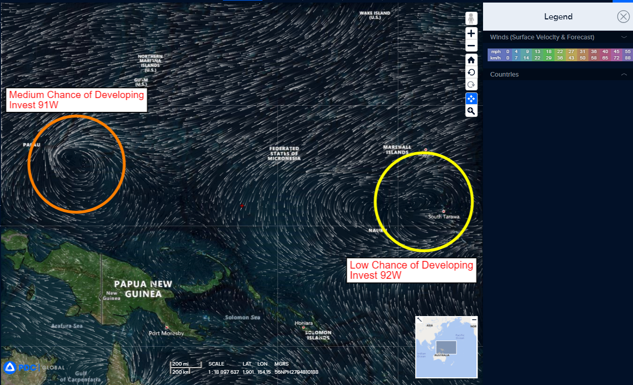
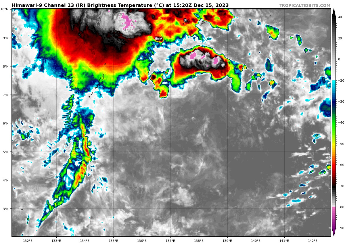
An area of disturbed weather, being referred to as Invest 91W, is now under investigation by the JTWC…it’s located approximately 319 NM east-southeast of Palau.
Animated multi-spectral satellite imagery highlights the overall broad nature of 91W and its low level circulation barely peaking out of the southeastern periphery of robust convection.
Environmental analysis reveals marginally favorable conditions for development with very warm sea surface temperatures, and low to moderate (15-20 knot) vertical wind shear offset by moderate westward outflow aloft.
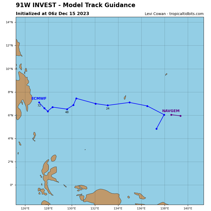
Global deterministic models, specifically GFS and NAVGEM, depict 91W to consolidate steadily while tracking northwestward towards the southern Philippine Archipelago and reaching warning threshold (25 knot intensity) prior to landfall. Intensity guidance consensus shows a steady build up to tropical depression strength over the course of the next 48 hours.
Maximum sustained surface winds are estimated at 18 to 23 knots.
The potential for the development of a significant tropical cyclone within the next 24 hours remains medium.
A second area of disturbed weather, being referred to as Invest 92W, is now under investigation by the JTWC…it’s located approximately 427 NM southeast of Kwajalein.
Animated enhanced infrared satellite imagery and a scatterometer partial pass depict a broad, poorly organized, low level circulation with flaring convection along the southern periphery.
Environmental analysis reveals favorable conditions for development with warm sea surface temperatures, low (05-10 knot) vertical wind shear, and good poleward outflow aloft.
Global numerical models agree 92W will slowly consolidate, staying quasi-stationary over the next 72 hours.
Maximum sustained surface winds are estimated at 13 to 17 knots.
The potential for the development of a significant tropical cyclone within the next 24 hours is low.
