

")
Remnants of 18W / Invest 94P
Wednesday, December 20, 2023
Current Snapshot
For all the latest updates visit: DisasterAWARE
10
pdc18w

pdc94P
By PDC’s Senior Weather
Specialist Glenn James

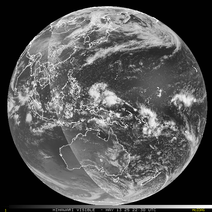
The Pacific Disaster Center’s (PDC Global) Wednesday, December 20, 2023, Tropical Cyclone Activity Report…for the Pacific Ocean, the Indian Ocean, and adjacent Seas
Current Tropical Cyclones:
There are no tropical cyclones at the time of this writing
Northeast Pacific Ocean:
The North Pacific hurricane season officially ended on November 30, 2023. Routine issuance of the Tropical Weather Outlook will resume on May 15, 2024. During the off-season, Special Tropical Weather Outlooks will be issued as conditions warrant.
The eastern Pacific basin hurricane season was above normal, with 17 named storms, of which 10 were hurricanes and eight of those major hurricanes.
From August 16 to 21, Tropical Storm Hilary brought widespread heavy rainfall and flooding to Southern California, with some areas receiving up to 600% of their normal August rainfall. Hilary resulted in the first ever issuance of Tropical Storm Watches and Warnings for the Southern California coastline by NOAA’s National Hurricane Center. In addition, the Center distributed key hazard focused messages for Hilary in Spanish through the agency’s new language translation project.
Hurricane Otis made landfall near Acapulco, Mexico, on October 25 as a category-5 hurricane, with sustained winds of 165 mph. Otis holds the record as the strongest landfalling hurricane in the eastern Pacific, after undergoing rapid intensification in which wind speeds increased by 115 mph in 24 hours.
Central North Pacific:
The central North Pacific hurricane season officially ended on November 30, 2023. Routine issuance of the Tropical Weather Outlook will resume on June 1, 2024. During the off-season, Special Tropical Weather Outlooks will be issued as conditions warrant.
The central Pacific basin had a near-normal season with four tropical systems traversing the basin.
Hurricane Dora, a category-4 storm, passed south of Hawaii in early August, marking the first major hurricane in the central Pacific basin since 2020. The strong gradient between a high pressure system to the north and Dora to the south was a contributing factor to the wind-driven, fast-moving wildfires in Hawaii.
Western Pacific, Indian Ocean and adjacent Seas:
Northwest Pacific Ocean…
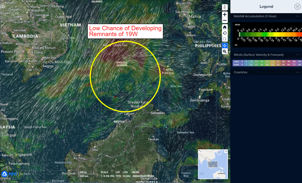
An area of disturbed weather, being referred to as the remnants of 18W, is under investigation by the JTWC…which is located approximately 510 NM southeast of Da Nang, Vietnam.
Enhanced infrared (eir) satellite imagery and a microwave imagery depict a highly asymmetric area of circulation hugging the eastern edge of a robust northeast cold surge pushing southwest along the coast of Vietnam. The eir shows an area of intense convective activity with some indications of mid-level rotation, which has persisted over the past six hours, but is now beginning to weaken.
Exposed low-level cloud lines to the west and south, as well as surface
observations from across the region mark the outlines of the relatively broad low level circulation center (llcc). The microwave image noted above shows a broad arc of cyclonically curved convection across the northern hemisphere and an exposed low emissivity region to the south, generally marking the position of the llcc.
The wind field remains highly asymmetric, with gale force winds streaming down the far western edge of the circulation, while on the eastern side the winds remain predominantly less than 15 knots.
Environmental analysis indicates marginal conditions for development with generally favorable shear, outflow and sea surface temperature conditions being offset by the asymmetric nature of the circulation and the presence of relatively stable air, associated with the cold surge entrenched across the western half of the system.
Global model fields suggest the system will shortly begin diving southwestward, riding the eastern side of the surge flow. Both the GFS and ECMWF models show some of the surge flow starting to wrap into the circulation as it passes the southern tip of Vietnam, which bears close scrutiny as the terrain induced cyclonic flow enhancement could result in a rapid increase in cyclonic vorticity in and around the llcc as the circulation approaches the southern Malay Peninsula.
Maximum sustained surface winds are estimated at 18 to 22 knots.
The potential for the development of a significant tropical cyclone within the next 24 hours is upgraded to low.
Southwest Pacific Ocean…
A second area of disturbed weather, being referred to as Invest 94P, is under investigation by the JTWC…which is located approximately 183 NM east of east of Weipa, Australia
Animated multi-spectral satellite imagery depicts flaring, disorganized convection scattered over an elongated area of low-level rotation. Low-level troughing extends from the northeast to the southwest, through the llcc that defines 94P.
Environmental analysis indicates favorable conditions for intensification with low (10-15 knot) vertical wind shear, good upper-level outflow, and warm sea surface temperatures.
Global models are in agreement that 94P will likely continue to develop as it curves equatorward and eastward over the next three days.
Maximum sustained surface winds are estimated at 20 to 25 knots.
The potential for the development of a significant tropical cyclone within the next 24 hours is low.
