

")
Tropical Cyclone 08B (Michaung) / Tropical Cyclone 03P (Jasper)
Tuesday, December 5, 2023
Current Snapshot
For all the latest updates visit: DisasterAWARE
10

meteosat9_ir_08B_202312051521_lat16.3-lon79.9

08B_tracks_latest

pdcjasper
By PDC’s Senior Weather
Specialist Glenn James

The Pacific Disaster Center’s (PDC Global) Tuesday, December 5, 2023, Tropical Cyclone Activity Report…for the Pacific Ocean, the Indian Ocean, and adjacent Seas
Current Tropical Cyclones:
Tropical cyclone 08B (Michaung)…is located approximately 74 NM north of Chennai, India – Final Warning
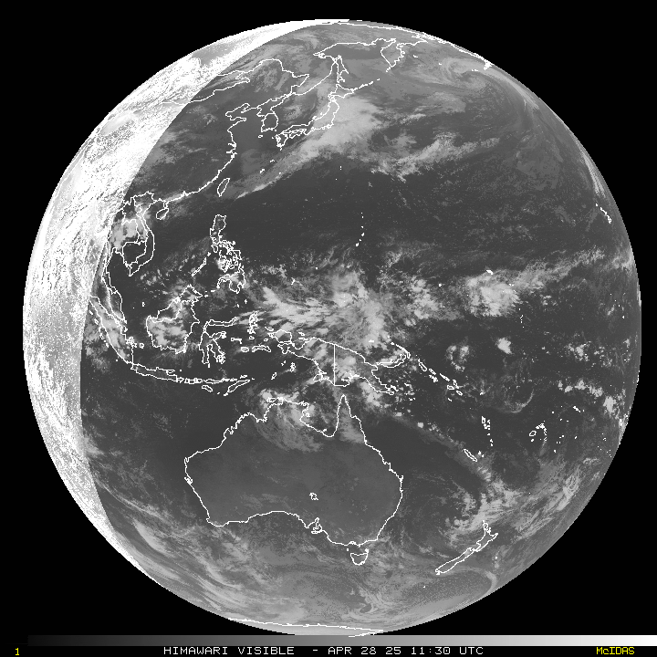
Tropical cyclone 03P (Jasper)…is located approximately 149 NM west of Honiara, Solomon Islands
Northeast Pacific Ocean:
The North Pacific hurricane season officially ended on November 30, 2023. Routine issuance of the Tropical Weather Outlook will resume on May 15, 2024. During the off-season, Special Tropical Weather Outlooks will be issued as conditions warrant.
The eastern Pacific basin hurricane season was above normal, with 17 named storms, of which 10 were hurricanes and eight of those major hurricanes.
From August 16 to 21, Tropical Storm Hilary brought widespread heavy rainfall and flooding to Southern California, with some areas receiving up to 600% of their normal August rainfall. Hilary resulted in the first ever issuance of Tropical Storm Watches and Warnings for the Southern California coastline by NOAA’s National Hurricane Center. In addition, the Center distributed key hazard focused messages for Hilary in Spanish through the agency’s new language translation project.
Hurricane Otis made landfall near Acapulco, Mexico, on October 25 as a category-5 hurricane, with sustained winds of 165 mph. Otis holds the record as the strongest landfalling hurricane in the eastern Pacific, after undergoing rapid intensification in which wind speeds increased by 115 mph in 24 hours.
Central North Pacific:
The central North Pacific hurricane season officially ended on November 30, 2023. Routine issuance of the Tropical Weather Outlook will resume on June 1, 2024. During the off-season, Special Tropical Weather Outlooks will be issued as conditions warrant.
The central Pacific basin had a near-normal season with four tropical systems traversing the basin.
Hurricane Dora, a category-4 storm, passed south of Hawaii in early August, marking the first major hurricane in the central Pacific basin since 2020. The strong gradient between a high pressure system to the north and Dora to the south was a contributing factor to the wind-driven, fast-moving wildfires in Hawaii.
Western Pacific, Indian Ocean and adjacent Seas:
North Indian Ocean
Tropical cyclone 08B (Michaung) – Final Warning
According to the JTWC warning number 8, sustained winds were 60 knots…with gusts to 75 knots
This is the final warning on this system by the Joint Typhoon Warning Center, Pearl Harbor, HI. The system will be closely monitored for signs of regeneration. The present forecast track nearly parallels the Indian coastline during the next 12-24 hours. Should the system move back over water, additional warnings may be issued.
Southwest Pacific Ocean…
Tropical cyclone 03P (Jasper)
According to the JTWC warning number 4, sustained winds were 55 knots…with gusts to 70 knots
Animated enhanced infrared satellite imagery depicts a consolidating tropical storm strength circulation with improved banding features in all quadrants. A microwave image indicates improved deep convective banding that is wrapped around the northern semicircle while low level cloud lines are visible to the south of the low level circulation center.
TC 03P (Jasper) is still loitering, nearly quasi-stationary due west of the Solomon Islands. Over the next six hours, the ridge to the east of the system is forecast to build westward and push 03p generally south-southwestward. as the system picks up speed, favorable environmental conditions, characterized by vigorous outflow aloft, warm sea surface temperatures and low vertical wind shear will rapidly intensity the system to over 100 knots by 48 hours.
After 48 hours, increasing vertical wind shear, decreased outflow aloft and the onset of westerly cool dry air into the periphery of the system will gradually weaken 03P. By 72 hours, 03P will transition steering control to a subtropical ridge due south of the circulation.
As vertical wind shear and outflow worsen, the system will fall to roughly 70 knots by 96 hours, and around 60 knots by 120 hours, as the ridge to the south forces the system towards the eastern coast of Australia.
