

")
Tropical Cyclone 24S (Ialy) / Tropical Cyclone 25S
Sunday, May 19, 2024
Current Snapshot
For all the latest updates visit: DisasterAWARE

1800×10801

10

pdcialy

24S_191200sair

meteosat9_ir_24S_202405191521_lat-7.4-lon45.2
24S_tracks_latest

1

25S_191800sair

rgua ibw
25S_tracks_latest
By PDC’s Senior Weather
Specialist Glenn James

The Pacific Disaster Center’s (PDC Global) Sunday, May 19, 2024, Tropical Cyclone Activity Report…for the Pacific Ocean, the Indian Ocean, and adjacent Seas
Current Tropical Cyclones:
Tropical Cyclone 24S (Ialy) is located approximately 776 NM north-northwest of Antananarivo, Madagascar
Tropical Cyclone 25S is located approximately 330 NM north-northeast of Diego Garcia
Northeast Pacific Ocean:
Tropical cyclone formation is not expected during the next 7 days.
Central North Pacific:
The central North Pacific hurricane season officially ended on November 30, 2023. Routine issuance of the Tropical Weather Outlook will resume on June 1, 2024. During the off-season, Special Tropical Weather Outlooks will be issued as conditions warrant.
The central Pacific basin had a near-normal season with four tropical systems traversing the basin.
Hurricane Dora, a category-4 storm, passed south of Hawaii in early August, marking the first major hurricane in the central Pacific basin since 2020. The strong gradient between a high pressure system to the north and Dora to the south was a contributing factor to the wind-driven, fast-moving wildfires in Hawaii.
Western Pacific, Indian Ocean and adjacent Seas
South Indian Ocean
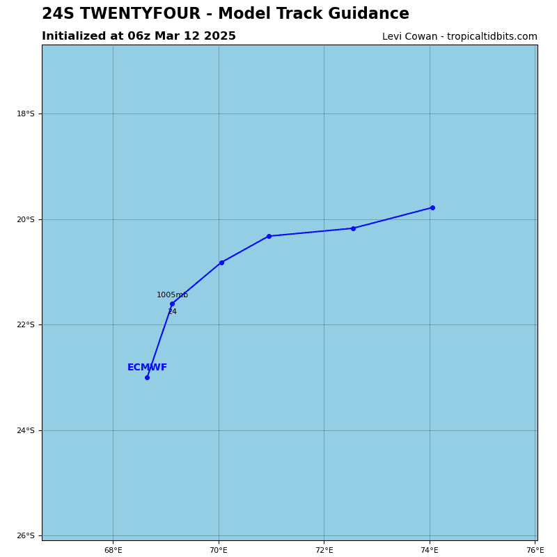
Tropical Cyclone 24S (Ialy)
According to the JTWC Warning number 8…sustained winds were 55 knots, with gusts to near 70 knots
Animated multi-spectral satellite imagery (msi) shows the system has maintained overall convective structure, wrap, and a pinhole eye. The msi loop also shows low level stratocumulus cloud lines wrapping in counter-clockwise toward the center.
Analysis indicates a marginally favorable environment with warm sea surface temperatures and moderate outflow offset by moderate to strong vertical wind shear and cold dry air intrusion at the low levels.
TC Ialy will track more northwestward as a secondary ridge to the west over Africa assumes steering. The environment will become more unstable as ridge and the cold dry air intrusion increase leading to a gradual erosion and eventual dissipation by 48 hours.
South Indian Ocean
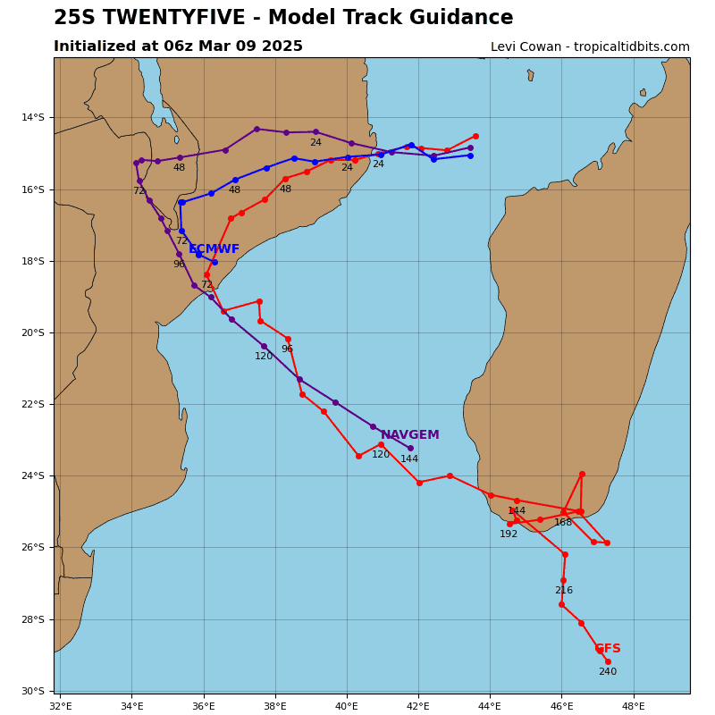
Tropical Cyclone 25S
According to the JTWC Warning number 1…sustained winds were 35 knots, with gusts to near 45 knots
