
")
Current Snapshot
For all the latest updates visit: DisasterAWARE
k
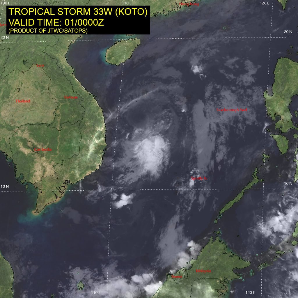
33W_010000sair
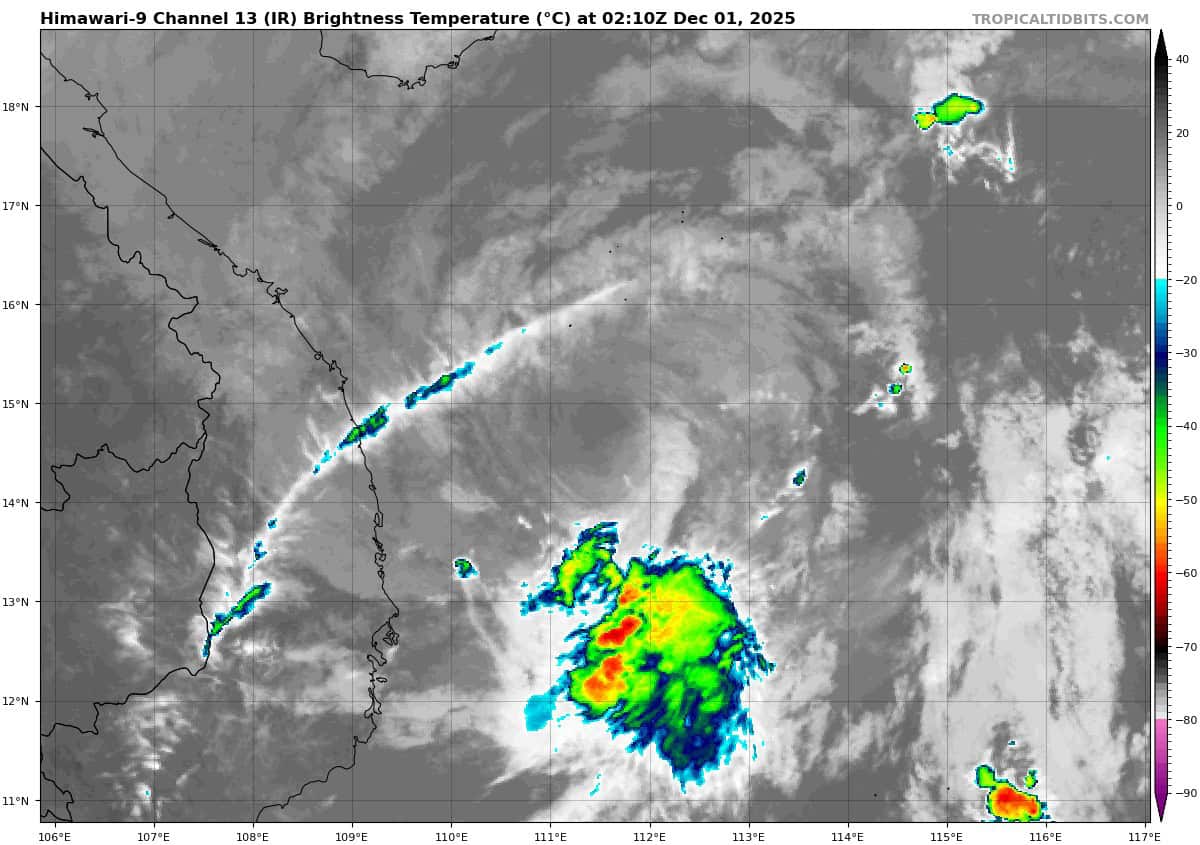
himawari9_ir_33W_202512010210_lat14.7-lon111.6
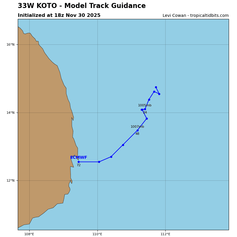
33W_tracks_latest
By PDC’s Senior Weather
Specialist Glenn James

The Pacific Disaster Center’s (PDC Global) Friday, November 28, 2025, Tropical Cyclone Activity Report…for the Pacific Ocean, the Indian Ocean, and adjacent Seas
Current Tropical Cyclones:
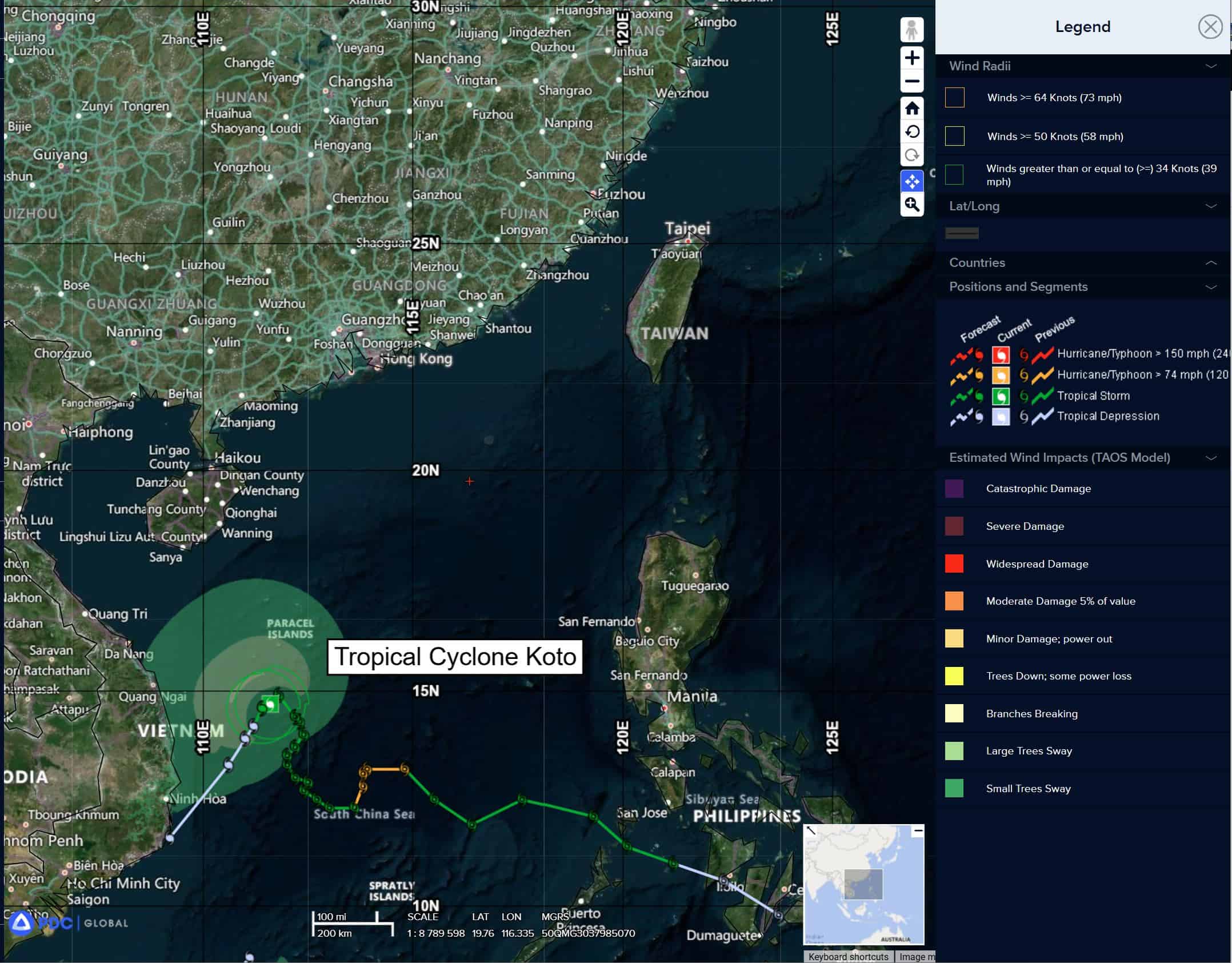
Tropical Cyclone 33W (Koto)…is located 206 NM east-southeast of Da Nang, Vietnan
Northeast Pacific Ocean: There are no Tropical Cyclones
Tropical cyclone formation is not expected during the next 7 days.
Central Pacific Ocean: There are no Tropical Cyclones
Tropical cyclone formation is not expected during the next 7 days.
Western Pacific, Indian Ocean, and adjacent Seas:
Western Pacific
Tropical Cyclone 33W (Koto)
According to the JTWC warning number 26, sustained winds were 35 knots, with gusts to near 45 knots
Animated multi-spectral satellite imagery (msi) depicts a fully exposed and shallow low level circulation center (llcc) and isolated weak convection located along a convergent feeder band well to the southeast. Water vapor imagery, a 302325z ssmis 91ghz microwave image and high-resolution model cross-sections confirm the presence of a layer of very dry mid-level air pushing in over top of the shallow vortex from the northwest.
Outflow aloft is weak to non-existent due to the lack of convection and the shallowness of the vortex, which looks to be restricted to below 600mb.
The environment continues to deteriorate as the wedge of dry air expands vertically and
continues to envelope TS 33W, while ssts remain marginal at best, hovering around 25-26c.
TS 33W has been relatively quasi-stationary over the past six hours, with an overall drift towards the southwest. The system is still stuck in a weak steering pattern, while the overall pattern is similar through the entire column (deep-layer ridging over the Philippine Sea and over southern Myanmar) the ridge pattern is much weaker in the lower-levels.
With this in mind, TS 33W will continue to drift slowly towards the southwest over the next 12-24 hours, before eventually picking up some speed after 24 hours as it the ridge builds over Indochina. The system is likely to skirt the coast of southeastern Vietnam, but it still forecast to remain offshore in this forecast.
As additional dry air moves in from the northwest and the system moves over even cooler waters, TS 33W stands no chance of re-intensifying. But it will take some time to spin down and dissipate, like to stair-step downwards in intensity through the forecast period. The forecast calls for dissipation at 72 hours, but in reality, the system will more than likely weaken below 25 knots by 60 hours and potentially as early as 48 hours.