
")
Current Snapshot
For all the latest updates visit: DisasterAWARE
epac
1800x1080eee
koto
33W_271200sair
himawari9_ir_33W_202511271410_lat12.8-lon113.8
33W_tracks_latest
ditwah
05B_271200sair
meteosat9_ir_05B_202511271421_lat7.6-lon81.7
05B_tracks_latest
By PDC’s Senior Weather
Specialist Glenn James

The Pacific Disaster Center’s (PDC Global) Thursday, November 27, 2025, Tropical Cyclone Activity Report…for the Pacific Ocean, the Indian Ocean, and adjacent Seas
Current Tropical Cyclones:
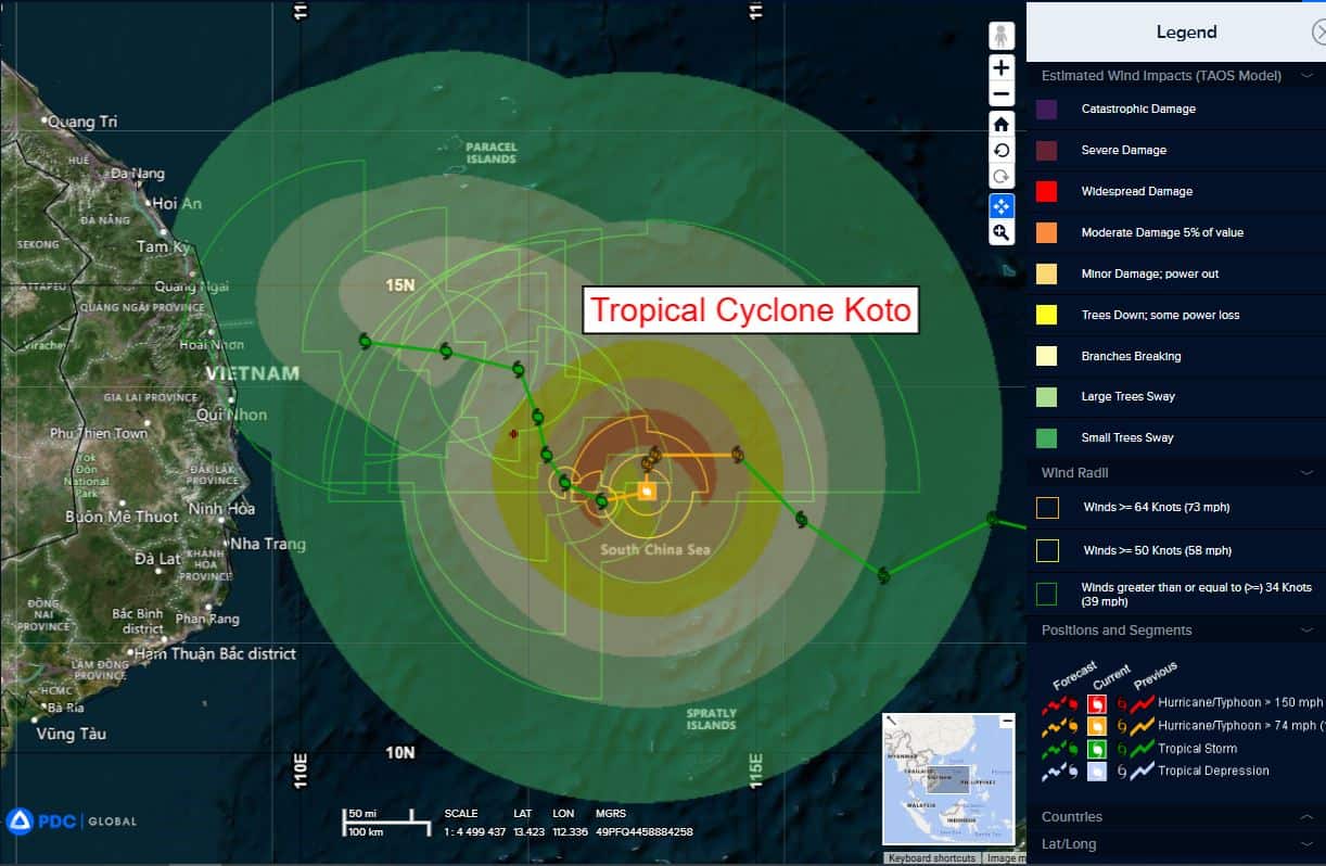
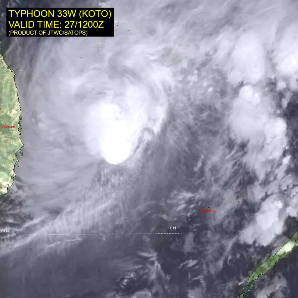
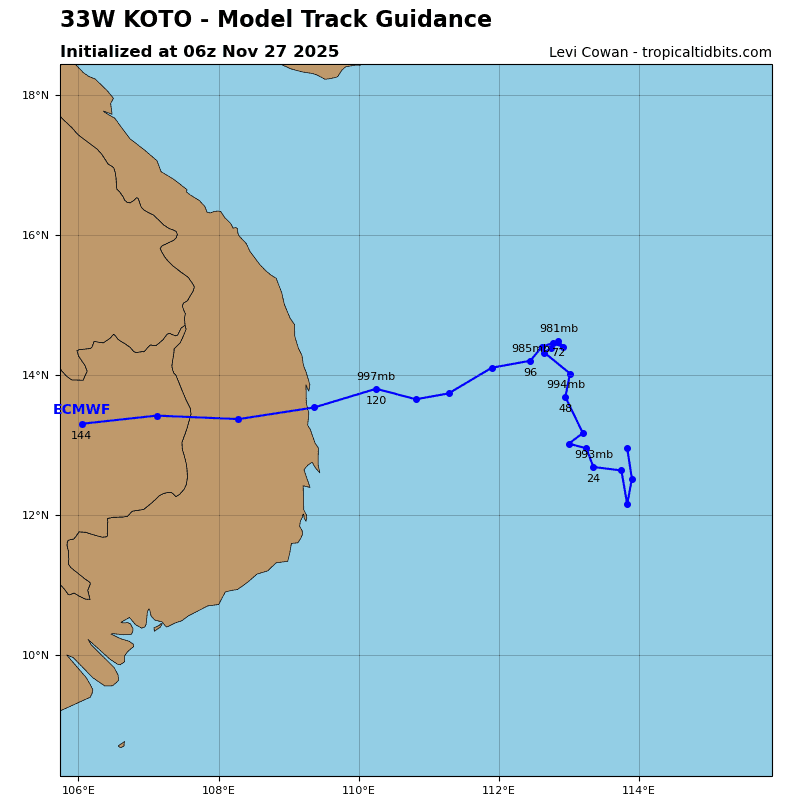
Tropical Cyclone 33W (Koto)…is located 352 NM southeast of Da Nang, Vietnam
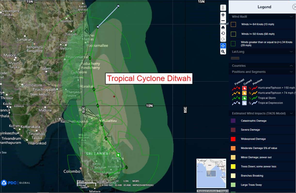
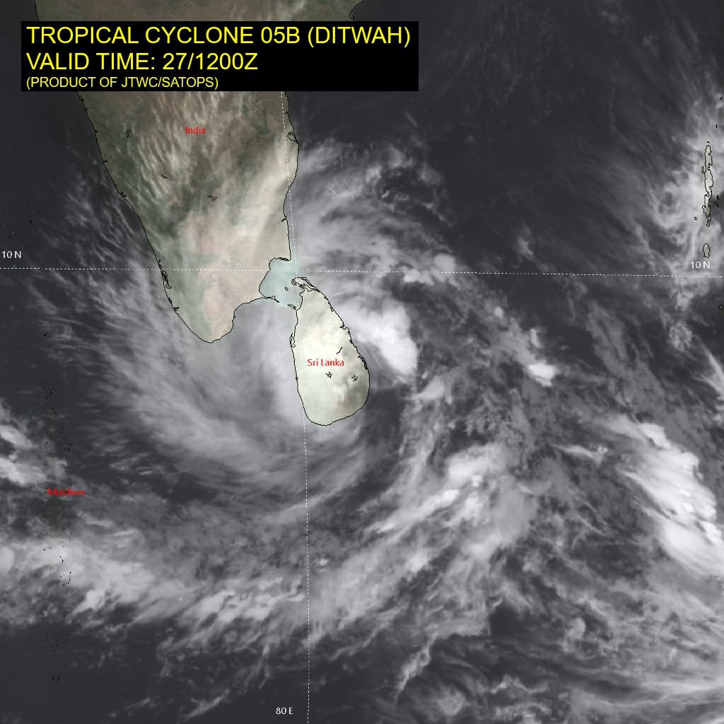
Tropical Cyclone 05B (Ditwah)…is located approximately 966 NM south-southwest of Kolkata, India
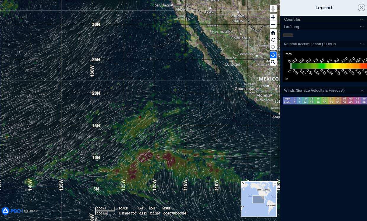
Northeast Pacific Ocean: There are no Tropical Cyclones
Tropical cyclone formation is not expected during the next 7 days.
Central Pacific Ocean: There are no Tropical Cyclones
Tropical cyclone formation is not expected during the next 7 days.
Western Pacific, Indian Ocean, and adjacent Seas:
Western Pacific
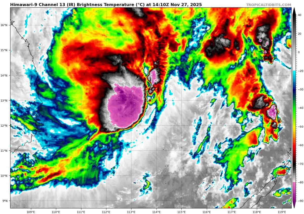
Tropical Cyclone 33W (Koto)
According to the JTWC warning number 14, sustained winds were 55 knots, with gusts to near 70 knots
Despite robust westward and poleward outflow, typhoon 33W is
struggling to maintain its convective core. Animated enhanced infrared satellite imagery depicts an asymmetric central dense overcast (cdo), with a tight thermal gradient along the eastern edge of the cdo associated with the high (25-30 knots) southeasterly vertical wind shear (vws).
microwave image, which shows shallow banding wrapping into a weak low-level circulation center (llcc) positioned on the eastern edge of the dwindling core convection.
North Indian Ocean
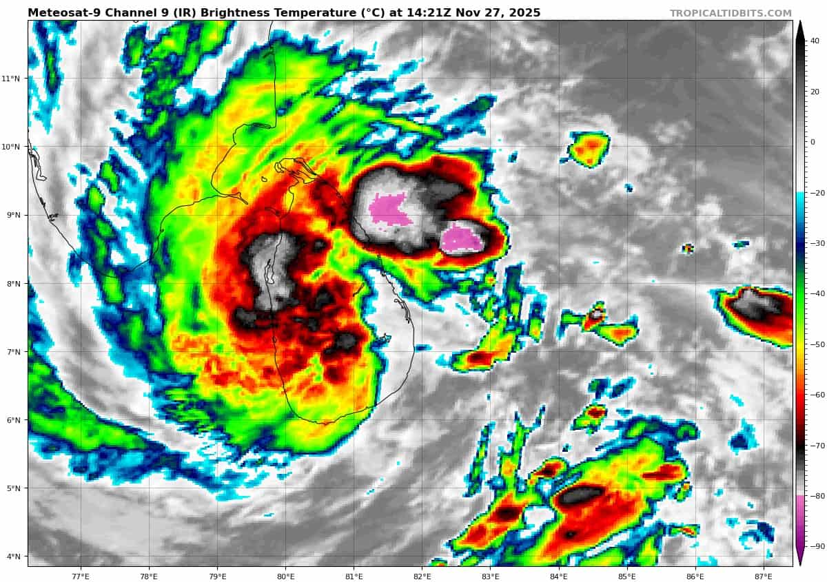
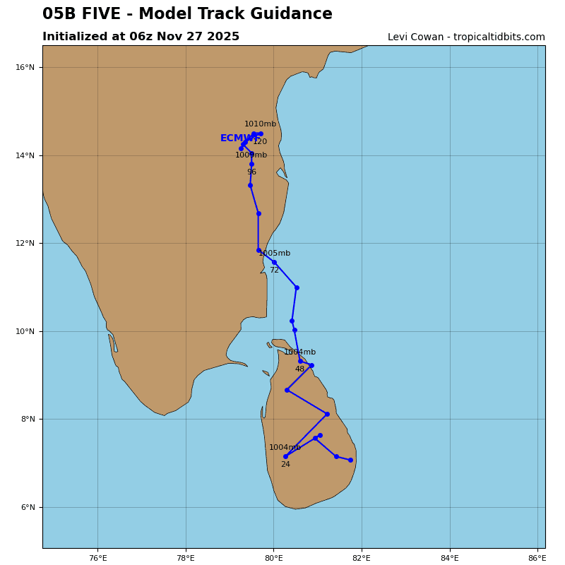
Tropical Cyclone 05B (Ditwah)
According to the JTWC warning number 5, sustained winds were 35 knots, with gusts to near 45 knots
Animated enhanced infrared (eir) satellite imagery depicts a broad low-level circulation, with deep convective banding over the northern and western quadrants wrapping into a ragged, defined low-level circulation center (llcc). A 271047z ssmis 37ghz microwave image shows convective banding wrapping around the northern semicircle, with a broad, weak llcc.
Environmental conditions are marginally favorable, with moderate radial outflow, low vertical wind shear offset by frictional effects.
Tropical cyclone 05B is forecast to track slowly poleward along the western periphery of the low-level str building to the east and northeast. After 96 hours, TC 05B is expected to turn northeast as it rounds the northwest periphery of the low-level str toward a break in the str.
Due to the track along the coast of Sri Lanka and just east of southeastern India, the system will intensify slowly through 48 hours. After 48 hours, upper-level conditions will degrade, with increasing southerlies and strong (25-30 knots) vertical wind shear associated with a deep upper-level trough digging into the Arabian Sea and India. The system should dissipate near 96 hours under strong southwesterly upper-level flow.
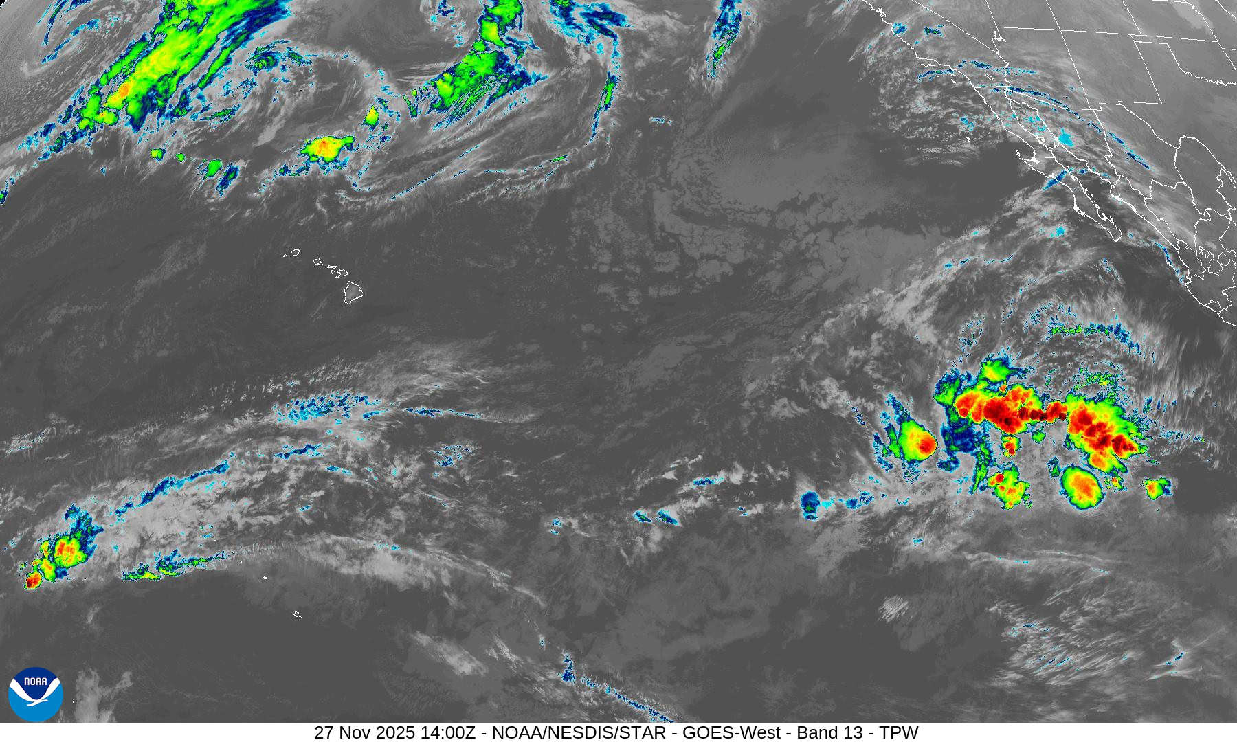
>>> There’s an area of disturbed weather being referred to as the remnants of 04B, which is located approximately 202 NM northwest of Singapore
Animated enhanced multi-spectral satellite (msi) imagery depicts 04B slowly reconsolidating as its crossing the Malay Peninsula towards the South China Sea but still appears very broad and disorganized, obscured by flaring convection that is being sheared to the west in the upper levels.
Environmental analysis for the western side of the South China
Sea reveals a marginally favorable environment with warm (27-28 c) sea surface temperatures, low to moderate (15-20 kts) vertical wind shear, and duel channel outflow in the upper levels getting shifted to the west by wind shear.
Deterministic models have improved over the last 24 hours with all models picking up on the circulation within 24 hours but they show the system will quickly deteriorate within 48 hours as it attempts to transit eastward. Ensembles tell a similar story with gfs revealing very minimal potential with this system as it transits
over land eventually reaching the South China Sea, and ecmwf ensemble liking the system more, but all members disappear after 48 hours.
Maximum sustained surface winds are estimated at 23 to 27 knots.
The potential for the development of a significant tropical cyclone within the next 24 hours is low.