
")
Current Snapshot
For all the latest updates visit: DisasterAWARE
epac
1800x1080e
koto
33W_261200sair
33W_tracks_latest
senyar
04B_261200sair
04B_tracks_latest
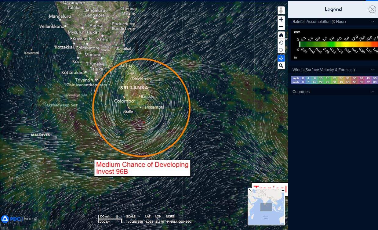
96b
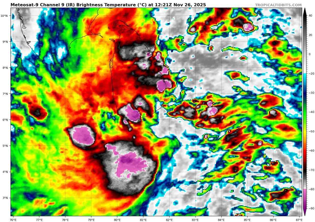
meteosat9_ir_96B_202511261221_lat6.3-lon81.5
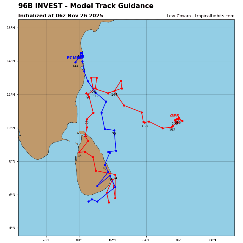
96B_tracks_latest
By PDC’s Senior Weather
Specialist Glenn James

The Pacific Disaster Center’s (PDC Global) Wednesday, November 26, 2025, Tropical Cyclone Activity Report…for the Pacific Ocean, the Indian Ocean, and adjacent Seas
Current Tropical Cyclones:
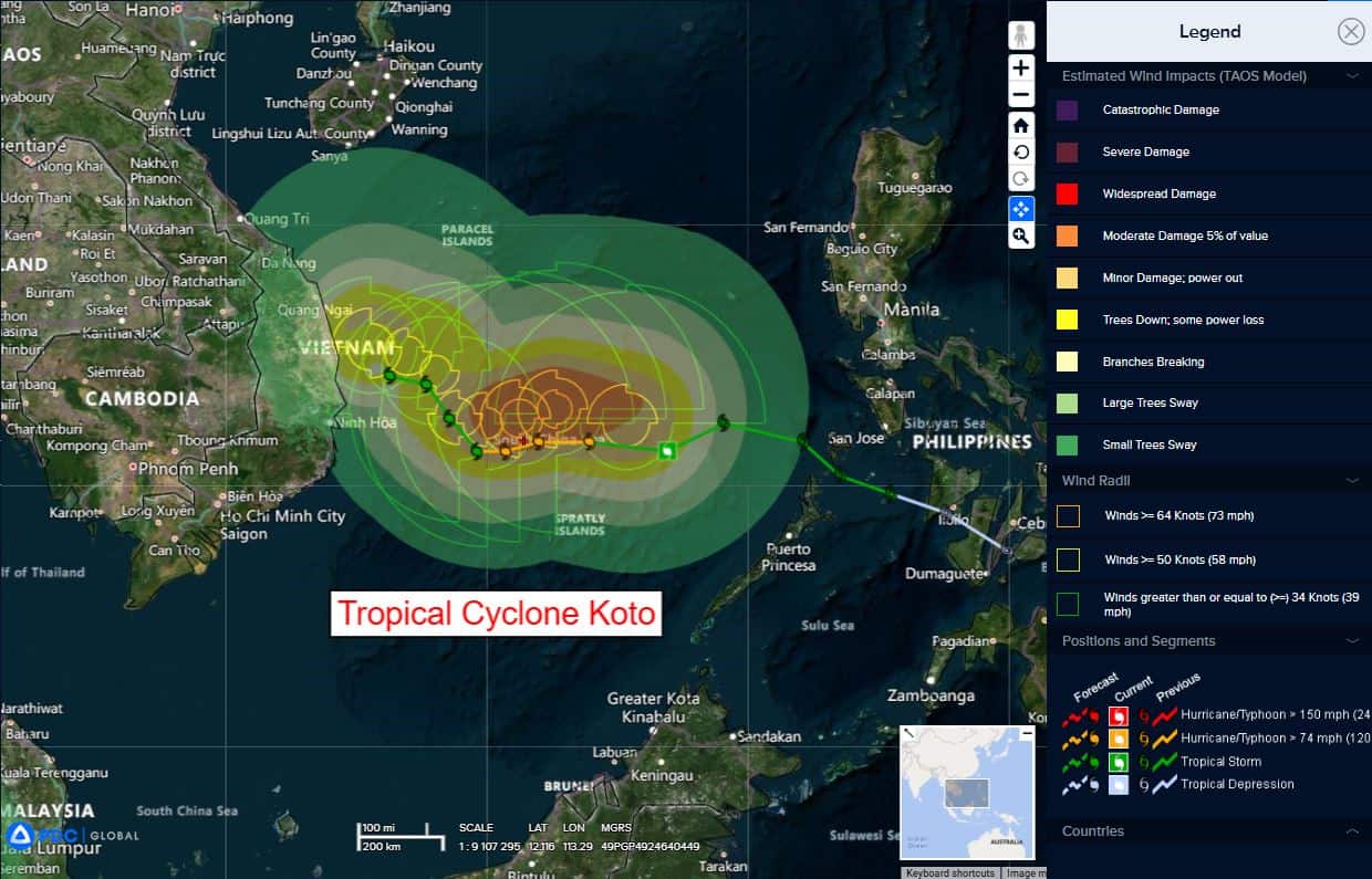
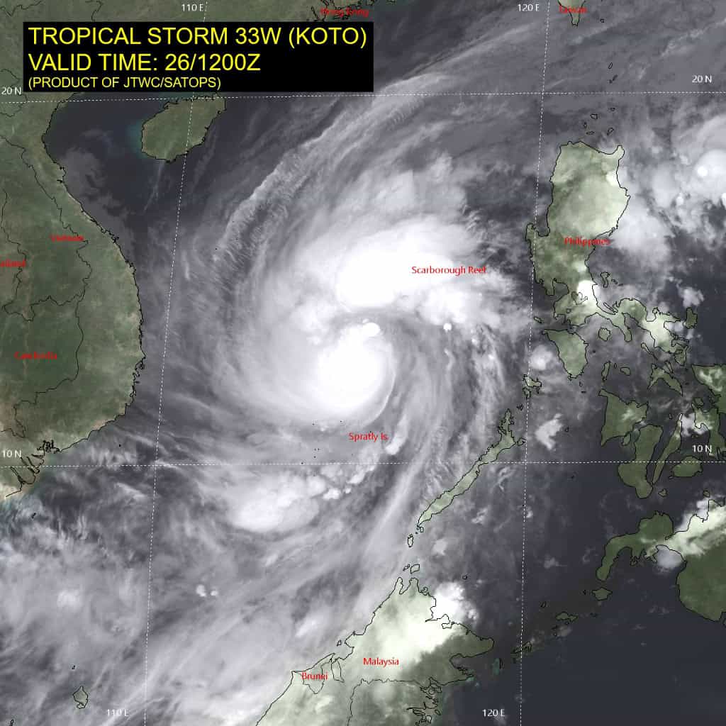
Tropical Cyclone 33W (Koto)…is located 366 NM east-southeast of Da Nang, Vietnam
Tropical Cyclone 04B (Senyar)…is located approximately 572 NM southwest of Ho Chi Minh City, Vietnam – Final Warning
Tropical Cyclone 05B…is located approximately 1046 NM south-southwest of Kolkata, India
Northeast Pacific Ocean: There are no Tropical Cyclones
Tropical cyclone formation is not expected during the next 7 days.
Central Pacific Ocean: There are no Tropical Cyclones
Tropical cyclone formation is not expected during the next 7 days.
Western Pacific, Indian Ocean, and adjacent Seas:
Western Pacific
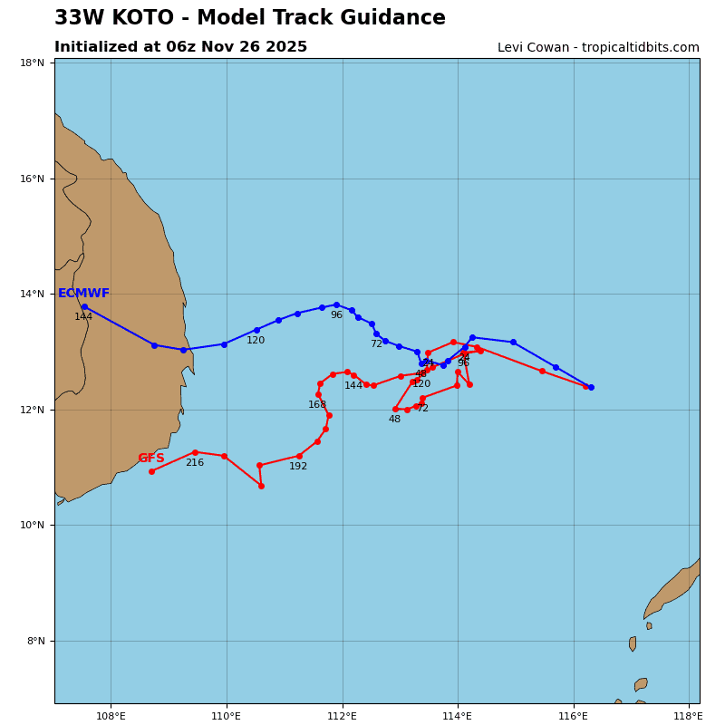
Tropical Cyclone 33W (Koto)
According to the JTWC warning number 10, sustained winds were 80 knots, with gusts to near 100 knots
Animated multispectral satellite imagery (msi) depicts tropical storm 33W (Koto) with vigorous bursts of deep convection over the center and prominent convective banding along the northern and southern peripheries. As the system continues to merge with the northeasterly surge, gale-force wind radii are rapidly expanding, particularly within the northern semicircle. A timely 260558z gmi 37 ghz microwave image revealed a defined microwave eye feature, allowing the initial position to be placed with high confidence.
Environmental analysis indicates that 33W is in a favorable environment characterized by strong poleward and equatorward
outflow aloft, low (5-10 kts) vertical wind shear, and warm (28-29
c) sea surface temperatures.
33W is forecast to track generally westward through 48 hours with steadily decreasing track speeds as the system tracks further into an area of weak steering influence. After 48 hours, a slow northwestward movement is forecast through 96 hours as
ridging over the northern Philippines builds back in to the east of the vortex. After 96 huors, ridging over southeast Asia will become the primary steering mechanism, causing 33W to track westward toward the coast of Vietnam through 120 hours.
Regarding intensity, 33W is forecast to intensify through 24 hours to a peak of around 70 kts as the environment remains relatively favorable. However, near 24 hours, shear begins to quickly increase to around 25-30 kts from the south. This shear, along with dry air entrainment associated with the northeasterly surge, will cause 33W to weaken through 72 hours. After 72 hours, shear and dry air are expected to lessen as the surge begins to retreat, allowing 33W to gradually redevelop as it approaches the coast of Vietnam.
North Indian Ocean
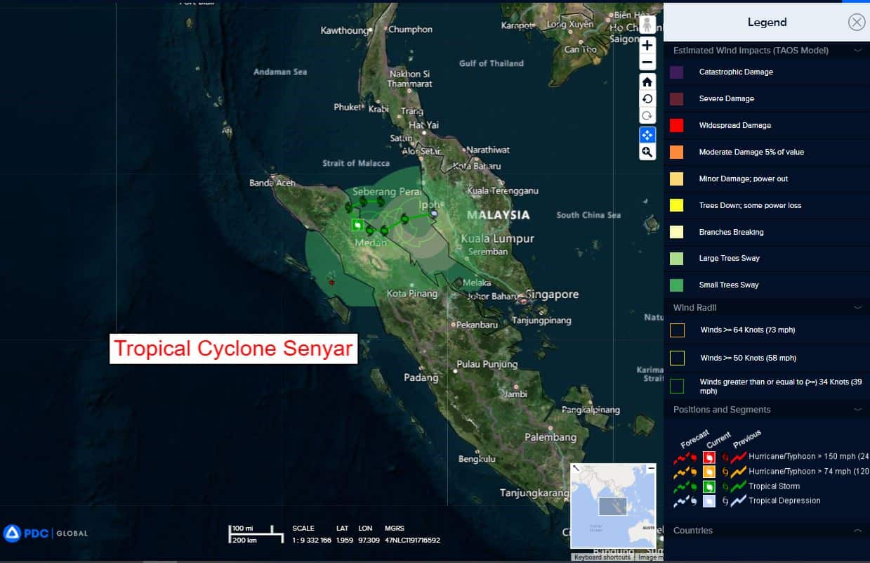
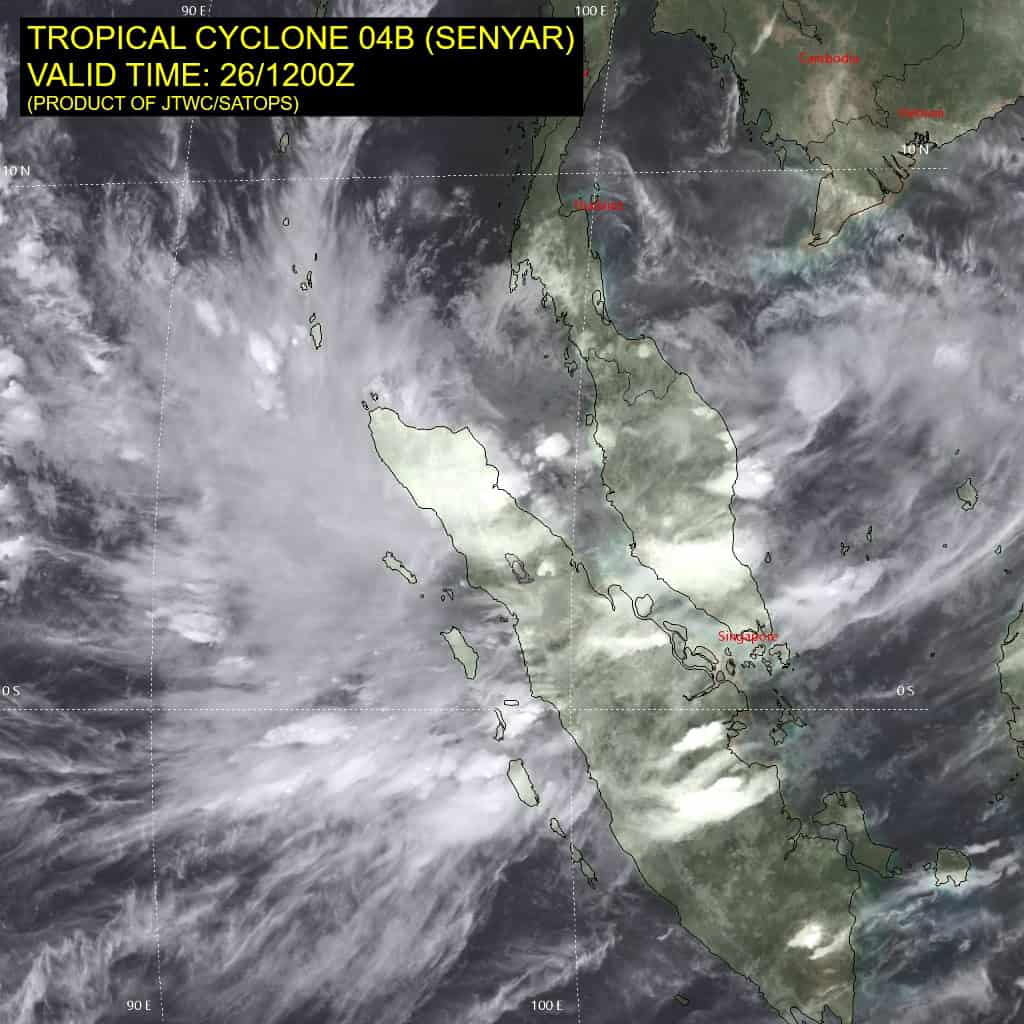
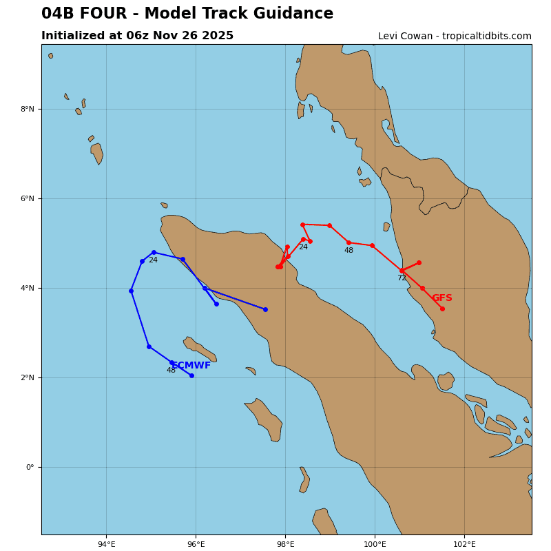
Tropical Cyclone 04B (Senyar) – Final Warning
According to the JTWC warning number 7, sustained winds were 25 knots, with gusts to near 35 knots
end of the forecast period.
Tropical Cyclone 05B
According to the JTWC warning number 1, sustained winds were 35 knots, with gusts to near 45 knots