
")
Current Snapshot
For all the latest updates visit: DisasterAWARE
kk
33W_011200sair
himawari9_ir_33W_202512011520_lat14.6-lon111.5
33W_tracks_latest
By PDC’s Senior Weather
Specialist Glenn James

The Pacific Disaster Center’s (PDC Global) Monday, December 1, 2025, Tropical Cyclone Activity Report…for the Pacific Ocean, the Indian Ocean, and adjacent Seas
Current Tropical Cyclones:
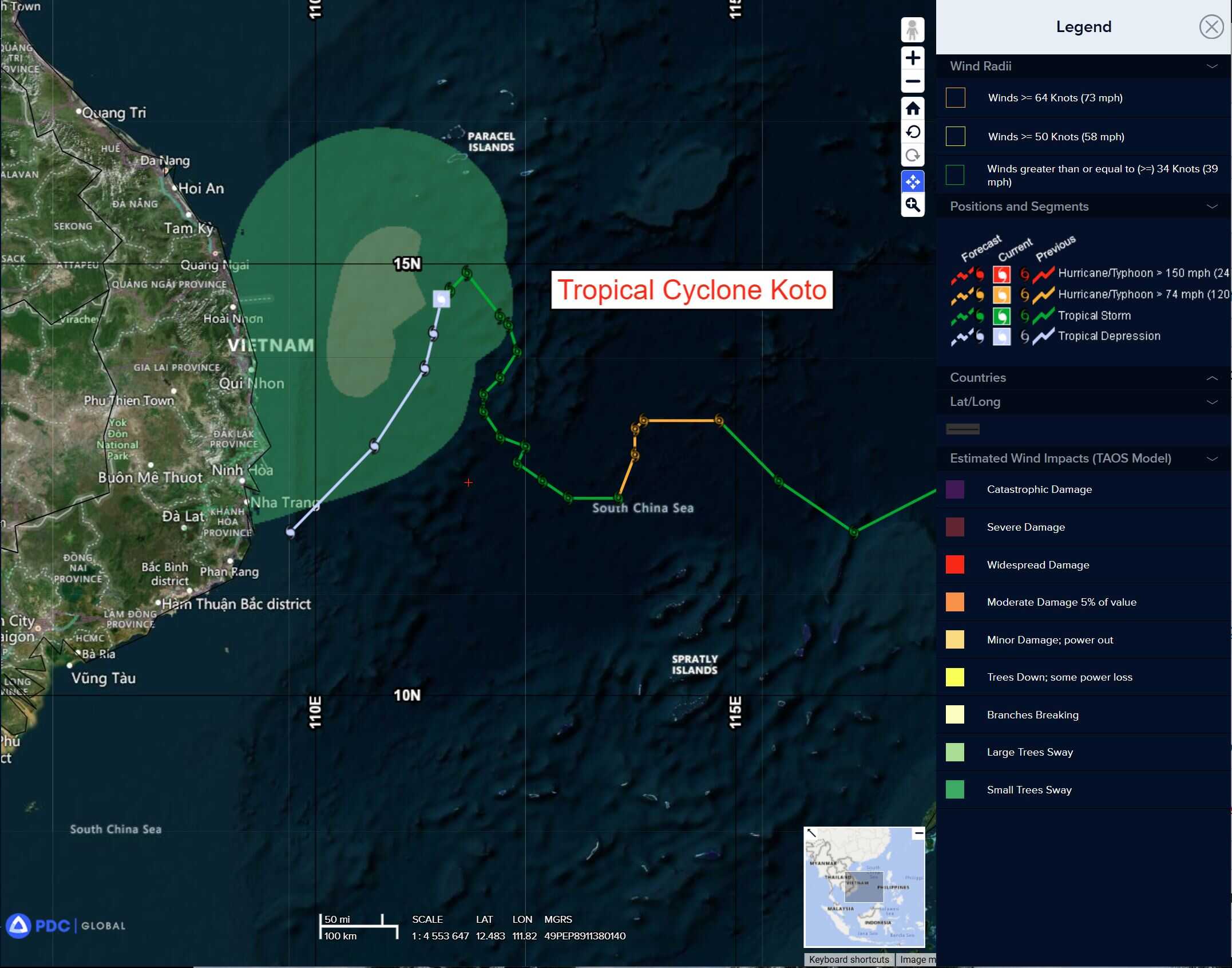
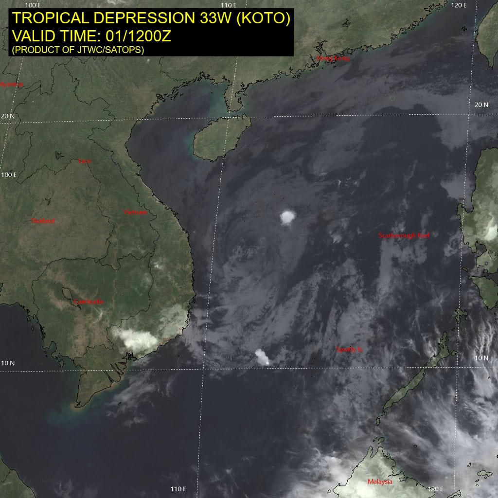
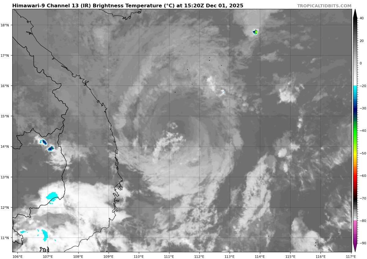
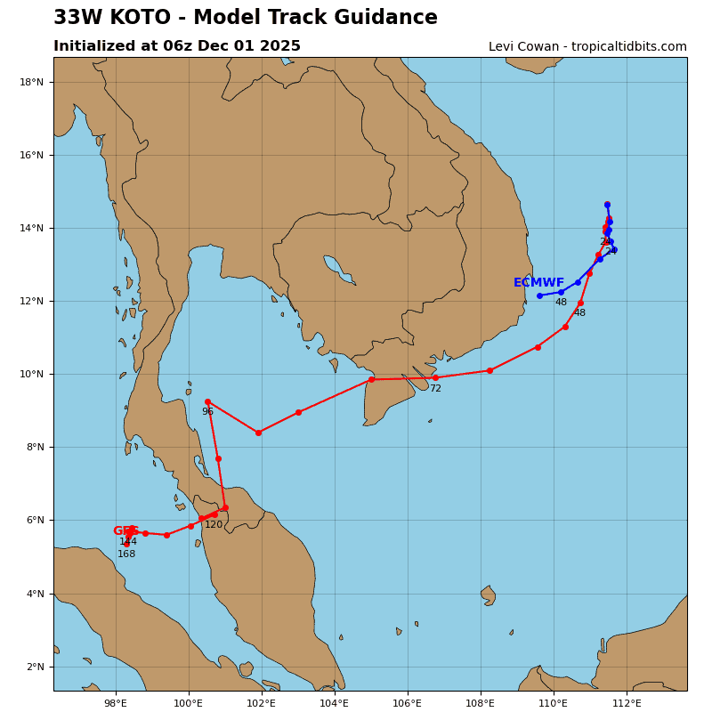
Tropical Cyclone 33W (Koto)…is located 221 NM east-southeast of Da Nang, Vietnam – Final Warning
Northeast Pacific Ocean: There are no Tropical Cyclones
The last regularly scheduled Tropical Cyclone Activity Report of the 2025 eastern North Pacific Hurricane Season has been issued. Routine issuance of this section of the PDC product will resume on May 15, 2026. During the off-season, Special Tropical Weather Outlooks will be issued as conditions warrant by the NHC.
Central Pacific Ocean: There are no Tropical Cyclones
The 2025 central North Pacific hurricane season has ended. As such, the final routine Tropical Cyclone Activity Report for the 2025 season has been issued. Routine issuance of this section of the PDC product will resume on June 1, 2026. During the off-season, Special Tropical Weather Outlooks will be issued as conditions warrant by the CPHC.
Western Pacific, Indian Ocean, and adjacent Seas:
Western Pacific
Tropical Cyclone 33W (Koto) – Final Warning
According to the JTWC warning number 30, sustained winds were 25 knots, with gusts to near 35 knots
Tropical depression 33W (Koto) continues to track south-southwestward after a significant slowing of movement and a slight shift to the east. Convective activity around the circulation has ceased.
Moderate vertical wind shear (15-20 kts), dry air entrainment, and cooler sea surface temperatures (26 c to 27 c) have continued to degrade the system with max wind speeds forecast to drop to 20 kts within 12 hours.
>>> There’s an area of disturbed weather being referred to as Invest 93W which is located approximately 172 NM north of Yap
Animated enhanced infrared satellite imagery (eir) depicts a poorly organized low level circulation center (llcc).
Environmental analysis for the area indicates favorable conditions for development with low vertical wind shear (10-15 kts), warm sea surface temperatures (30-31 c), and good poleward outflow aloft.
Global deterministic and ensemble models are in good agreement that 93W will continue westward.
Maximum sustained surface winds are estimated at 13 to 18 knots.
The potential for the development of a significant tropical cyclone within the next 24 hours is low.