
")
Current Snapshot
For all the latest updates visit: DisasterAWARE
1800x1080eeee
06P
06P_051200sair
goes18_ir_06P_202512051445_lat-16.0-lon-148.0
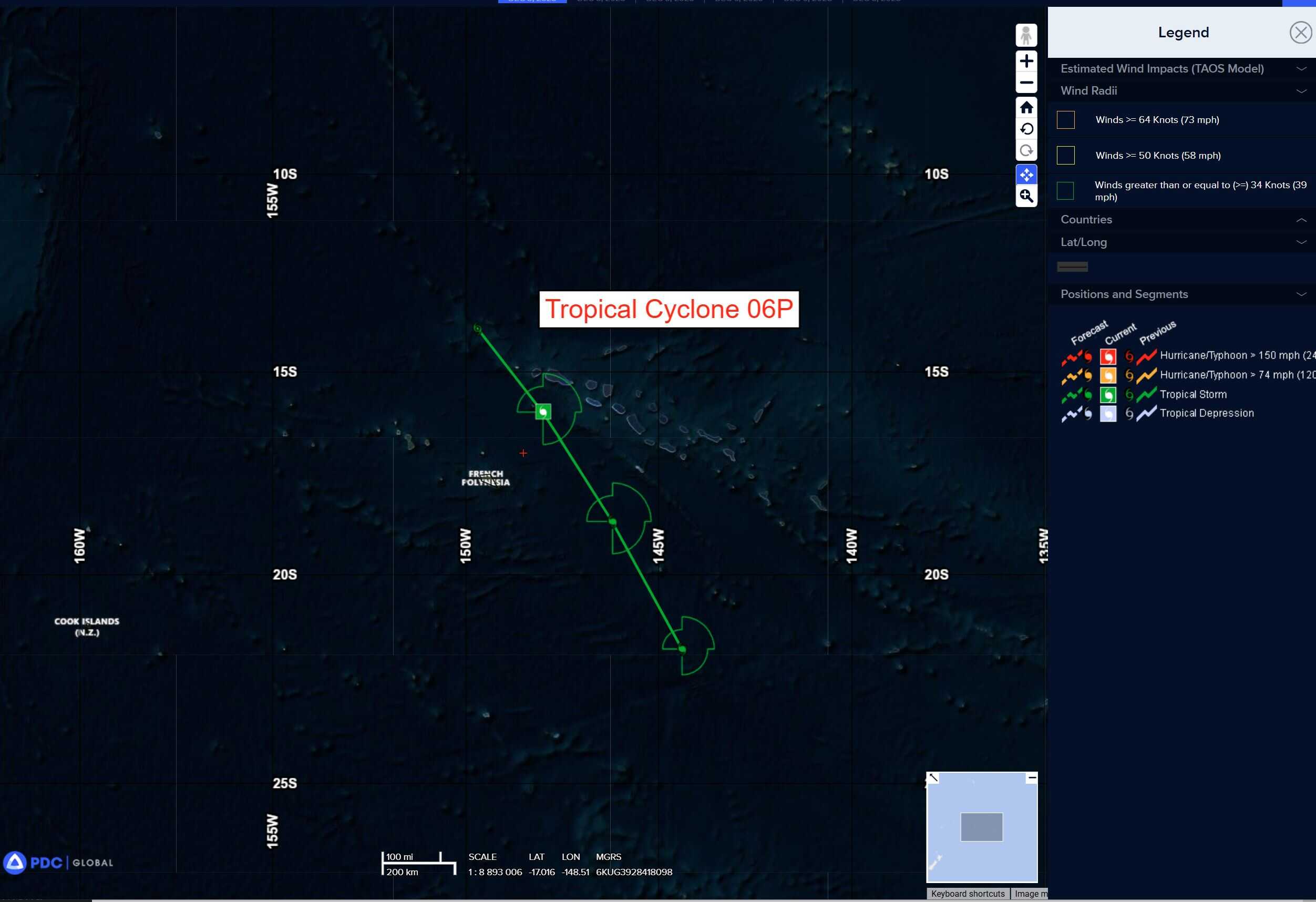
06P_tracks_latest
himawari9_ir_93W_202512051430_lat11.6-lon126.4

93W_tracks_latest
By PDC’s Senior Weather
Specialist Glenn James

The Pacific Disaster Center’s (PDC Global) Friday, December 5, 2025, Tropical Cyclone Activity Report…for the Pacific Ocean, the Indian Ocean, and adjacent Seas
Current Tropical Cyclones:
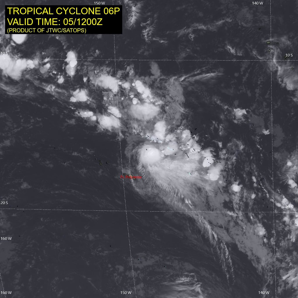
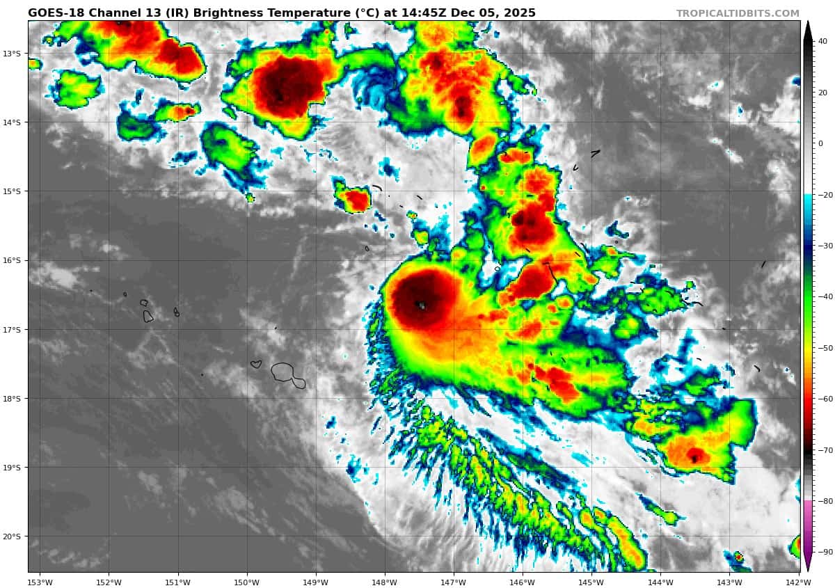
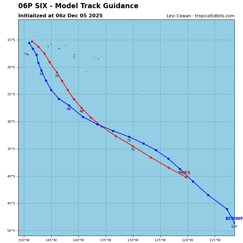
Tropical Cyclone 06P is located approximately 165 NM east-southeast of Papeete, Tahiti – Final Warning
Northeast Pacific Ocean: There are no Tropical Cyclones
The last regularly scheduled Tropical Cyclone Activity Report of the 2025 eastern North Pacific Hurricane Season has been issued. Routine issuance of this section of the PDC product will resume on May 15, 2026. During the off-season, Special Tropical Weather Outlooks will be issued as conditions warrant by the NHC.
Central Pacific Ocean: There are no Tropical Cyclones
The 2025 central North Pacific hurricane season has ended. As such, the final routine Tropical Cyclone Activity Report for the 2025 season has been issued. Routine issuance of this section of the PDC product will resume on June 1, 2026. During the off-season, Special Tropical Weather Outlooks will be issued as conditions warrant by the CPHC.
Western Pacific, Indian Ocean, and adjacent Seas:
Southwestern Pacific
Tropical Cyclone 06P – Final Warning
Western Pacific
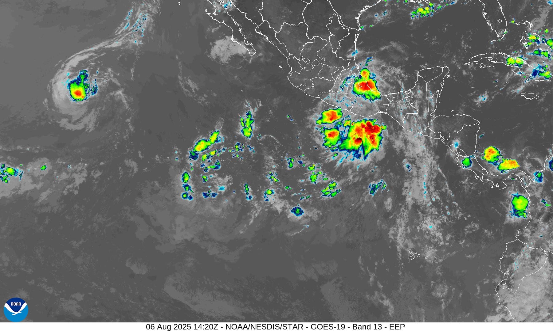
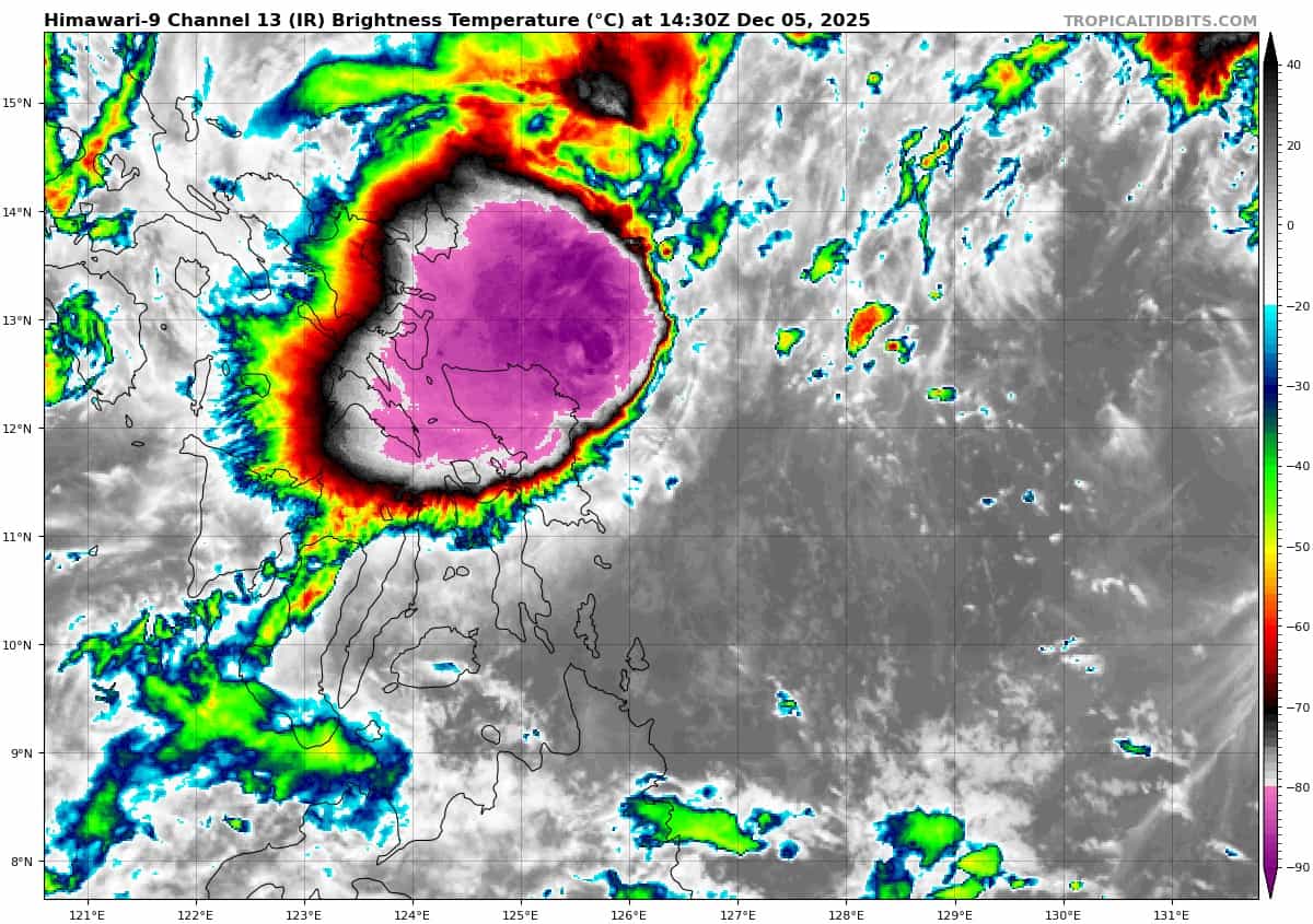
>>> There’s an area of disturbed weather being referred to as Invest 93W which is located approximately 156 NM east-southeast of Legazpi
Animated enhanced infrared satellite imagery (eir) depicts deep convection building near the consolidating low level circulation center (llcc). a 051346z ascat reveals 15-20 knot winds starting to consolidate along the western periphery.
Environmental analysis for the area indicates marginally favorable environment with high vertical wind shear (20-30 kts), warm sea surface temperatures (29-30 c), and good poleward outflow aloft.
Global deterministic models are in good agreement that 93W will move west over the Philippines. Global ensemble models are in good agreement that 93W will move west over the Philippines, with ecens showing a higher intensity between the two models.
Maximum sustained surface winds are estimated at 18 to 23 knots.
The potential for the development of a significant tropical cyclone within the next 24 hours is high.