
")
Current Snapshot
For all the latest updates visit: DisasterAWARE

1800×1080
melissa 1
close
GOES19-CAR-13-1000×1000
261136_earliest_reasonable_toa_34
261136INTQPF_sm
13L_tracks_latest
By PDC’s Senior Weather
Specialist Glenn James

The Pacific Disaster Center’s (PDC Global) Sunday, October 26, 2025, Tropical Cyclone Activity Report…for the Atlantic Ocean, the Caribbean Sea, and the Gulf of America
Current Tropical Cyclones:
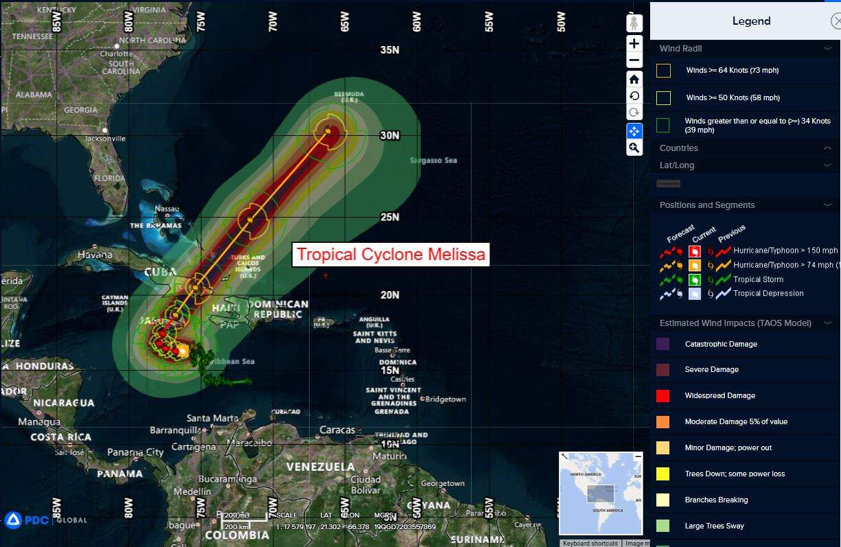
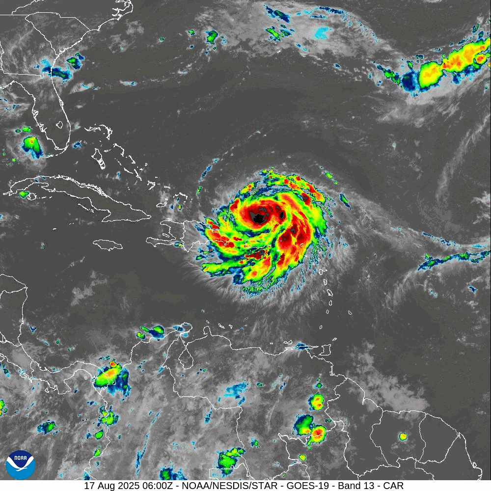
Tropical Cyclone Melissa…is located about 310 miles south-southwest of Guantanamo, Cuba
Atlantic Ocean: There are no active tropical cyclones
Tropical cyclone formation is not expected during the next 7-days.
Caribbean Sea:
Tropical Cyclone Melissa
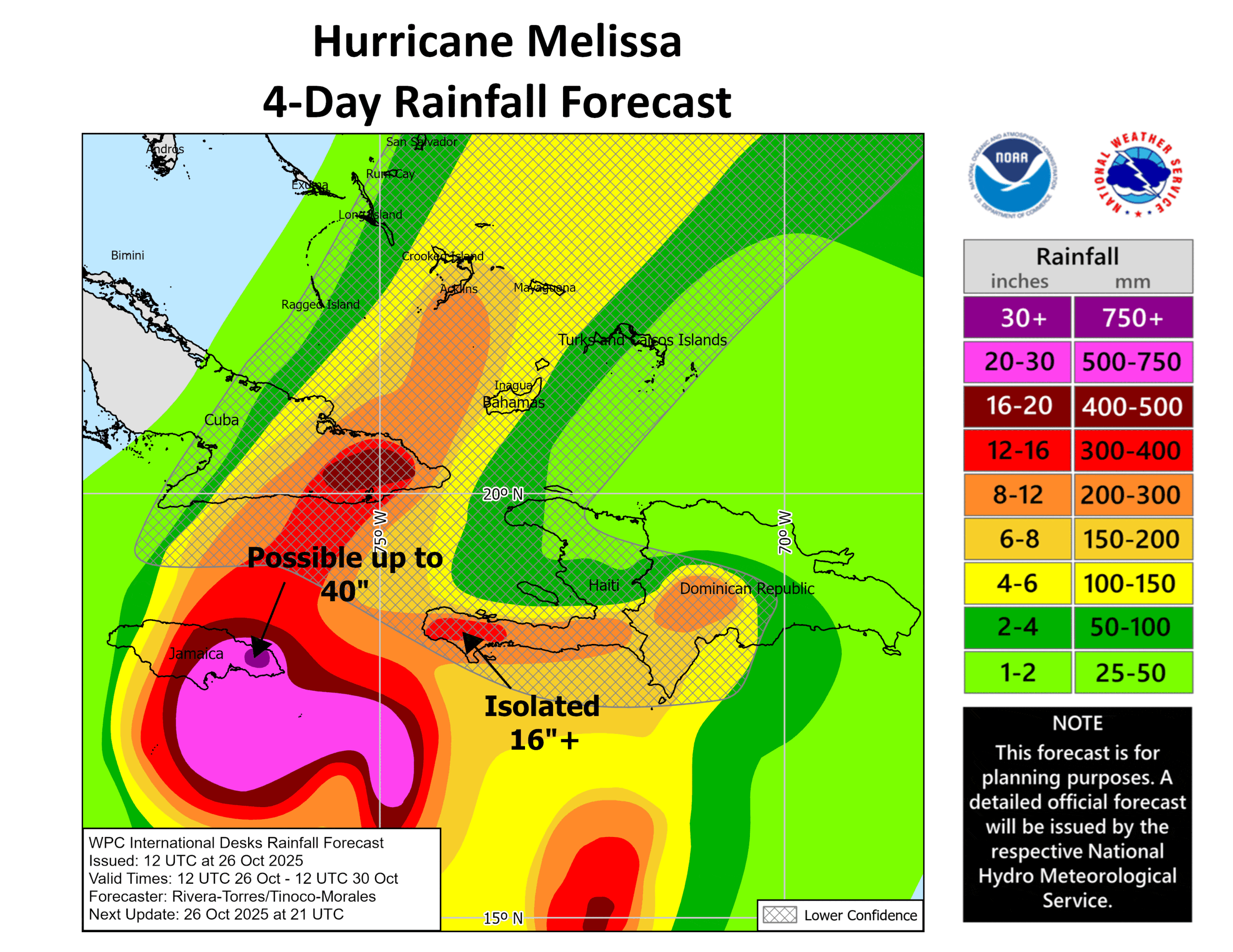
MELISSA LIKELY TO CAUSE LIFE-THREATENING AND CATASTROPHIC FLASH FLOODING AND LANDSLIDES IN PORTIONS OF JAMAICA AND SOUTHERN HISPANIOLA …HURRICANE CONDITIONS EXPECTED TO BEGIN BY LATE TOMORROW IN JAMAICA
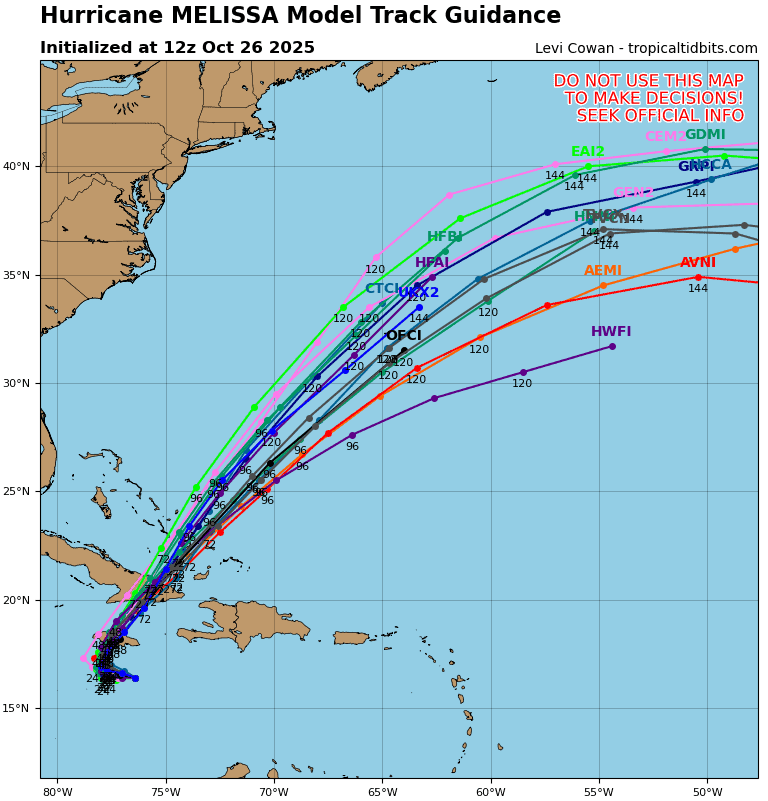
According to the NHC advisory number 23
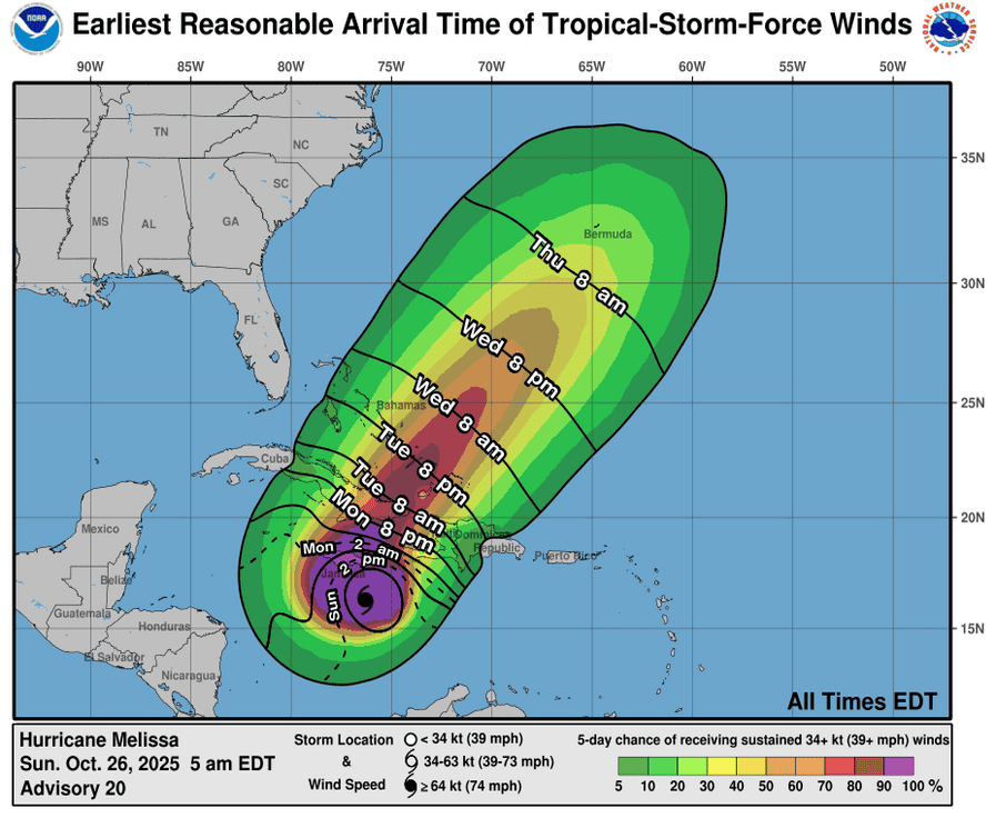
Melissa is moving toward the west near 5 mph (7 km/h). A slow westward motion is expected overnight, followed by a turn to the north and northeast on Monday and Tuesday. On the forecast track, the core of Melissa is expected to move near or over Jamaica on Tuesday, across southeastern Cuba Tuesday night, and across the southeastern Bahamas on Wednesday.
Maximum sustained winds are near 145 mph (230 km/h) with higher gusts. Melissa is a category 4 hurricane on the Saffir-Simpson Hurricane Wind Scale. Additional intensification is forecast over the next day or so, followed by fluctuations in intensity. Melissa is expected to be a powerful major hurricane when making landfall in Jamaica.
Hurricane-force winds extend outward up to 30 miles (45 km) from the center and tropical-storm-force winds extend outward up to 195 miles (315 km). The estimated minimum central pressure is 933 mb (27.55 inches).
HAZARDS AFFECTING LAND
WIND: Tropical storm conditions are likely occurring in Jamaica, with hurricane conditions expected by Monday. Tropical storm conditions are expected in the warning area in Haiti today. The potential for hurricane conditions in the watch area in Haiti have diminished for today, but there is still a possibility of hurricane conditions occurring there on Tuesday. Hurricane conditions are possible in the watch area in eastern Cuba on Tuesday into Wednesday.
RAINFALL: Melissa is expected to bring total rainfall of 15 to 30 inches to portions of southern Hispaniola and Jamaica into Wednesday, with local maxima of 40 inches possible. Additional heavy rainfall is likely beyond Wednesday; uncertainty at that time range precludes exact storm totals. Catastrophic flash flooding and landslides are probable across portions of southern Hispaniola and Jamaica. For eastern Cuba, total rainfall of 6 to 12 inches, with local amounts to 18 inches, are expected into Wednesday resulting in life-threatening flash flooding and landslides. Additional heavy rainfall is likely beyond Wednesday; uncertainty at that time range precludes exact storm totals.
SURF: Swells generated by Melissa are expected to affect portions of Hispaniola, Jamaica, eastern Cuba, and the Cayman Islands during the next several days. These swells are likely to cause life-threatening surf and rip current conditions.
STORM SURGE: Life-threatening storm surge is likely along the south coast of Jamaica late Monday through Tuesday morning. Peak storm surge heights could reach 9 to 13 feet above ground level, near and to the east of where the center of Melissa makes landfall. This storm surge will be accompanied by large and destructive waves. There is a potential for significant storm surge along the southeast coast of Cuba late Tuesday or Wednesday.
Gulf of America: There are no active tropical cyclones
Tropical cyclone formation is not expected during the next 7-days.